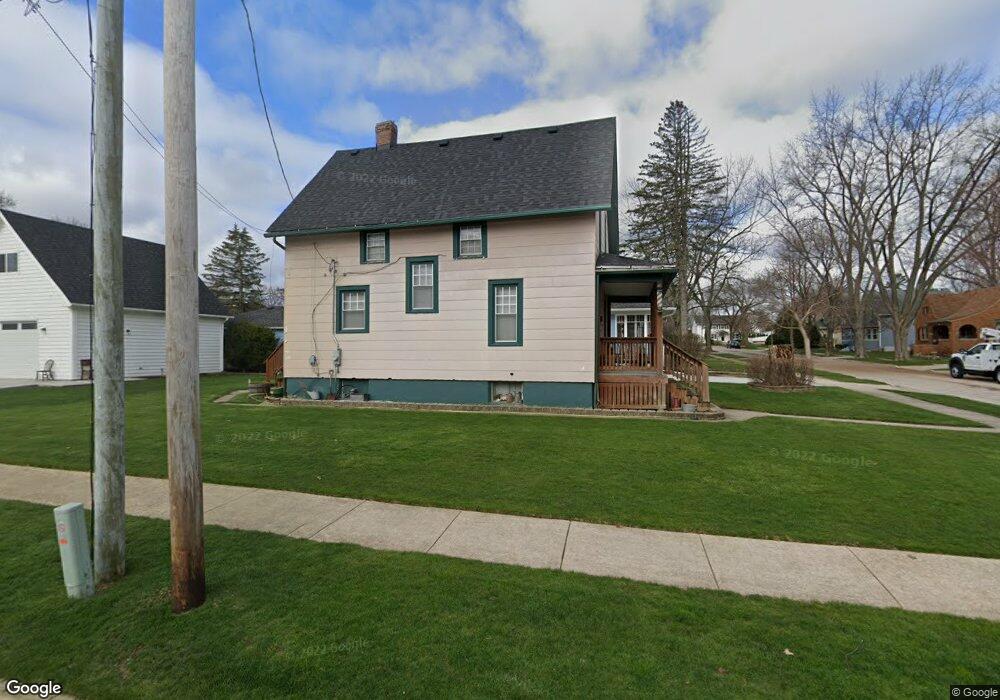
71 Browning Ave West Dundee, IL 60118
Estimated Value: $267,000 - $311,000
4
Beds
--
Bath
990
Sq Ft
$291/Sq Ft
Est. Value
About This Home
This home is located at 71 Browning Ave, West Dundee, IL 60118 and is currently estimated at $287,608, approximately $290 per square foot. 71 Browning Ave is a home located in Kane County with nearby schools including Dundee Highlands Elementary School, Dundee Middle School, and Dundee-Crown High School.
Ownership History
Date
Name
Owned For
Owner Type
Purchase Details
Closed on
May 29, 2003
Sold by
Nord Irma M
Bought by
Alters David M
Current Estimated Value
Home Financials for this Owner
Home Financials are based on the most recent Mortgage that was taken out on this home.
Original Mortgage
$166,250
Outstanding Balance
$66,672
Interest Rate
4.62%
Mortgage Type
Purchase Money Mortgage
Estimated Equity
$220,936
Create a Home Valuation Report for This Property
The Home Valuation Report is an in-depth analysis detailing your home's value as well as a comparison with similar homes in the area
Home Values in the Area
Average Home Value in this Area
Purchase History
| Date | Buyer | Sale Price | Title Company |
|---|---|---|---|
| Alters David M | $175,000 | -- |
Source: Public Records
Mortgage History
| Date | Status | Borrower | Loan Amount |
|---|---|---|---|
| Open | Alters David M | $166,250 |
Source: Public Records
Tax History Compared to Growth
Tax History
| Year | Tax Paid | Tax Assessment Tax Assessment Total Assessment is a certain percentage of the fair market value that is determined by local assessors to be the total taxable value of land and additions on the property. | Land | Improvement |
|---|---|---|---|---|
| 2024 | $6,288 | $85,147 | $18,868 | $66,279 |
| 2023 | $5,871 | $76,613 | $16,977 | $59,636 |
| 2022 | $5,103 | $63,921 | $16,977 | $46,944 |
| 2021 | $4,911 | $60,354 | $16,030 | $44,324 |
| 2020 | $4,313 | $58,997 | $15,670 | $43,327 |
| 2019 | $4,161 | $56,007 | $14,876 | $41,131 |
| 2018 | $3,933 | $52,382 | $14,581 | $37,801 |
| 2017 | $3,726 | $49,001 | $13,640 | $35,361 |
| 2016 | $3,787 | $42,790 | $13,207 | $29,583 |
| 2015 | -- | $43,801 | $17,765 | $26,036 |
| 2014 | -- | $42,591 | $17,274 | $25,317 |
| 2013 | -- | $43,895 | $17,803 | $26,092 |
Source: Public Records
Map
Nearby Homes
- Lot 1 View St
- 516 S 1st St
- 505 S 3rd St
- 93 Liberty St
- 112 Liberty St
- 560 S 5th St
- 512 Lisa Rd
- 0000 Strom Dr
- 436 Barrington Ave
- 709 Timothy Ct Unit 171
- 7 King William St
- 519 Oak Dr
- 152 King Ave
- 4 Summit St
- 849 Hemlock Dr
- 1042 Chateau Bluff Ln
- 510 N Van Buren St
- 432 Illinois St
- 152 Aberdeen Dr
- 1 S Lincoln Ave