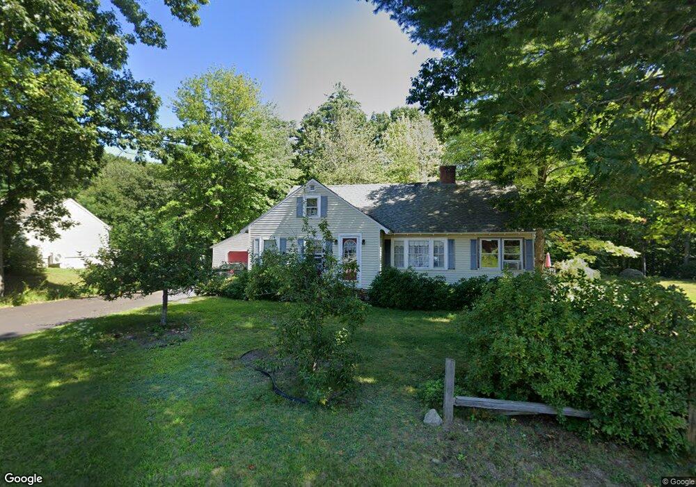
71 Cottonwood Ave Laconia, NH 03246
Estimated Value: $480,000 - $558,000
4
Beds
2
Baths
2,214
Sq Ft
$232/Sq Ft
Est. Value
About This Home
This home is located at 71 Cottonwood Ave, Laconia, NH 03246 and is currently estimated at $514,585, approximately $232 per square foot. 71 Cottonwood Ave is a home located in Belknap County with nearby schools including Laconia Middle School, Laconia High School, and Holy Trinity Catholic School.
Ownership History
Date
Name
Owned For
Owner Type
Purchase Details
Closed on
Feb 22, 2022
Sold by
Arsenault James E and Arsenault Beth R
Bought by
J & B Arsenault Ft
Current Estimated Value
Purchase Details
Closed on
Apr 1, 1994
Bought by
Arsenault James E and Arsenault Beth R
Create a Home Valuation Report for This Property
The Home Valuation Report is an in-depth analysis detailing your home's value as well as a comparison with similar homes in the area
Home Values in the Area
Average Home Value in this Area
Purchase History
| Date | Buyer | Sale Price | Title Company |
|---|---|---|---|
| J & B Arsenault Ft | -- | None Available | |
| Arsenault James E | $117,500 | -- |
Source: Public Records
Mortgage History
| Date | Status | Borrower | Loan Amount |
|---|---|---|---|
| Previous Owner | Arsenault James E | $107,900 | |
| Previous Owner | Arsenault James E | $125,000 |
Source: Public Records
Tax History Compared to Growth
Tax History
| Year | Tax Paid | Tax Assessment Tax Assessment Total Assessment is a certain percentage of the fair market value that is determined by local assessors to be the total taxable value of land and additions on the property. | Land | Improvement |
|---|---|---|---|---|
| 2024 | $6,961 | $510,700 | $171,200 | $339,500 |
| 2023 | $6,592 | $473,900 | $157,500 | $316,400 |
| 2022 | $6,037 | $406,500 | $133,600 | $272,900 |
| 2021 | $6,033 | $319,900 | $73,600 | $246,300 |
| 2020 | $6,093 | $309,000 | $62,700 | $246,300 |
| 2019 | $6,249 | $303,500 | $57,200 | $246,300 |
| 2018 | $6,203 | $297,500 | $55,600 | $241,900 |
| 2017 | $6,000 | $285,300 | $54,500 | $230,800 |
| 2016 | $5,841 | $263,100 | $54,500 | $208,600 |
| 2015 | $6,156 | $277,300 | $57,600 | $219,700 |
| 2014 | $6,259 | $279,400 | $57,600 | $221,800 |
| 2013 | $6,101 | $276,300 | $54,500 | $221,800 |
Source: Public Records
Map
Nearby Homes
- 102 Woodland Ave
- 74 Morrill St
- 468 Union Ave
- 162 Morrill St
- 0 Sanborn St Unit 8 5059863
- 29 Strafford St
- 96 Clinton St
- 239 Gilford Ave
- 122 Valley St
- 7 Countryside Dr
- Lot 1 Winter St
- 7 Riverside Ct
- 84 Spring St
- 30 Messer St
- 24 Mcgrath St
- 17 Arch St
- 6 Colonial Dr
- 44 Highland St
- 17 Rowell St
- 75 Stark St Unit 3
- 79 Cottonwood Ave
- 59 Cottonwood Ave
- 70 Cottonwood Ave
- 64 Cottonwood Ave
- 80 Cottonwood Ave
- 49 Cottonwood Ave
- 56 Cottonwood Ave
- 48 Cottonwood Ave
- 25 McGuinness Ct
- 29 McGuinness Ct
- 33 Cottonwood Ave
- 30 Cottonwood Ave
- 23 Cottonwood Ave
- 109 Pinecrest Dr
- 20 McGuinness Ct
- 22 Cottonwood Ave
- 17 Cottonwood Ave
- 115 Pinecrest Dr
- 97 Pinecrest Dr
- 6 McGuinness Ct