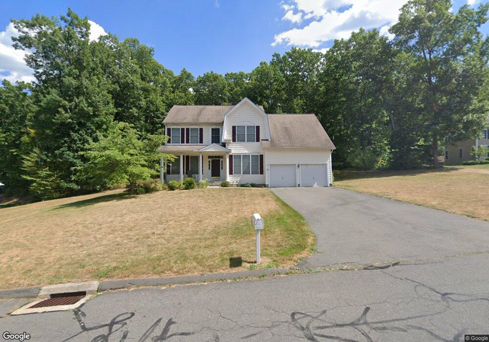
71 Dartmouth Dr Canton, CT 06019
Estimated Value: $636,000 - $991,000
4
Beds
3
Baths
2,524
Sq Ft
$292/Sq Ft
Est. Value
About This Home
This home is located at 71 Dartmouth Dr, Canton, CT 06019 and is currently estimated at $736,481, approximately $291 per square foot. 71 Dartmouth Dr is a home located in Hartford County with nearby schools including Cherry Brook Primary School, Canton Intermediate School, and Canton Middle School.
Ownership History
Date
Name
Owned For
Owner Type
Purchase Details
Closed on
Jun 7, 2004
Sold by
Baker Res Lp
Bought by
Donovan Gregory M and Donovan Ngoc-Diep T
Current Estimated Value
Home Financials for this Owner
Home Financials are based on the most recent Mortgage that was taken out on this home.
Original Mortgage
$260,000
Interest Rate
5.94%
Create a Home Valuation Report for This Property
The Home Valuation Report is an in-depth analysis detailing your home's value as well as a comparison with similar homes in the area
Home Values in the Area
Average Home Value in this Area
Purchase History
| Date | Buyer | Sale Price | Title Company |
|---|---|---|---|
| Donovan Gregory M | $394,060 | -- | |
| Donovan Gregory M | $394,060 | -- |
Source: Public Records
Mortgage History
| Date | Status | Borrower | Loan Amount |
|---|---|---|---|
| Open | Donovan Gregory M | $356,250 | |
| Closed | Donovan Gregory M | $113,500 | |
| Closed | Donovan Gregory M | $260,000 |
Source: Public Records
Tax History Compared to Growth
Tax History
| Year | Tax Paid | Tax Assessment Tax Assessment Total Assessment is a certain percentage of the fair market value that is determined by local assessors to be the total taxable value of land and additions on the property. | Land | Improvement |
|---|---|---|---|---|
| 2025 | $11,711 | $349,580 | $85,970 | $263,610 |
| 2024 | $11,938 | $349,580 | $85,970 | $263,610 |
| 2023 | $9,931 | $280,780 | $83,690 | $197,090 |
| 2022 | $9,459 | $280,780 | $83,690 | $197,090 |
| 2021 | $9,328 | $280,780 | $83,690 | $197,090 |
| 2020 | $9,151 | $280,780 | $83,690 | $197,090 |
| 2019 | $8,993 | $280,780 | $83,690 | $197,090 |
| 2018 | $9,425 | $307,010 | $87,500 | $219,510 |
| 2017 | $9,361 | $307,010 | $87,500 | $219,510 |
| 2016 | $9,137 | $307,010 | $87,500 | $219,510 |
| 2015 | $8,962 | $307,010 | $87,500 | $219,510 |
| 2014 | $8,768 | $307,010 | $87,500 | $219,510 |
Source: Public Records
Map
Nearby Homes
- 3 Bridle Path
- 20 Bart Dr
- 20 Found Land Way
- 85 Dowd Ave Unit 89
- 141 Dowd Ave
- 9 Maple Ave
- 48 Weatherstone
- 40 E Hill Rd
- 58 Weatherstone
- 61 Weatherstone
- 50 E Hill Rd Unit 4A
- 31 Stockbridge Dr
- 41 Applegate Ln
- 31 Applegate Ln Unit 31
- 49 Applegate Ln Unit 49
- 54 Secret Lake Rd
- 96 Dyer Ave
- 67 Torrington Ave Unit 69
- 18 Sunset Trail
- 12 Verville Rd
- 63 Dartmouth Dr
- 75 Dartmouth Dr
- 55 Dartmouth Dr Unit 57
- 84 Ellsworth Ln
- 80 Dartmouth Dr
- 62 Dartmouth Dr Unit 64
- 78 Ellsworth Ln
- 70 Dartmouth Dr
- 43 Dartmouth Dr
- 76 Dartmouth Dr
- 54 Dartmouth Dr
- 79 Ellsworth Ln
- 10 Cobb Rd
- 74 Ellsworth Ln
- 39 Dartmouth Dr Unit 55
- 48 Dartmouth Dr Unit 66
- 42 Dartmouth Dr
- 60 Bart Dr
- 75 Ellsworth Ln
- 23 Livingston Rd