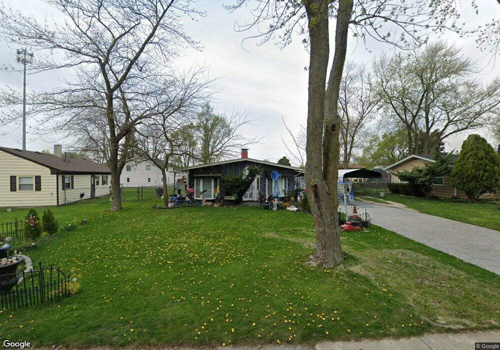
71 Hampton Rd Montgomery, IL 60538
Boulder Hill NeighborhoodEstimated Value: $264,000 - $303,000
3
Beds
1
Bath
1,534
Sq Ft
$187/Sq Ft
Est. Value
About This Home
This home is located at 71 Hampton Rd, Montgomery, IL 60538 and is currently estimated at $286,376, approximately $186 per square foot. 71 Hampton Rd is a home located in Kendall County with nearby schools including Boulder Hill Elementary School, Thompson Jr. High School, and Oswego High School.
Ownership History
Date
Name
Owned For
Owner Type
Purchase Details
Closed on
Dec 27, 2001
Sold by
Shelton Robin M
Bought by
Perry Patricia A
Current Estimated Value
Home Financials for this Owner
Home Financials are based on the most recent Mortgage that was taken out on this home.
Original Mortgage
$85,850
Outstanding Balance
$35,157
Interest Rate
7.07%
Estimated Equity
$251,219
Purchase Details
Closed on
Aug 1, 1995
Bought by
Shelton Stephen G and Shelton Robin
Purchase Details
Closed on
Dec 1, 1989
Bought by
Old 2Nd Natl Bk Tr 3037
Create a Home Valuation Report for This Property
The Home Valuation Report is an in-depth analysis detailing your home's value as well as a comparison with similar homes in the area
Home Values in the Area
Average Home Value in this Area
Purchase History
| Date | Buyer | Sale Price | Title Company |
|---|---|---|---|
| Perry Patricia A | $101,000 | Ticor Title Insurance | |
| Shelton Stephen G | $89,500 | -- | |
| Old 2Nd Natl Bk Tr 3037 | $86,500 | -- |
Source: Public Records
Mortgage History
| Date | Status | Borrower | Loan Amount |
|---|---|---|---|
| Open | Perry Patricia A | $85,850 | |
| Closed | Old 2Nd Natl Bk Tr 3037 | -- |
Source: Public Records
Tax History
| Year | Tax Paid | Tax Assessment Tax Assessment Total Assessment is a certain percentage of the fair market value that is determined by local assessors to be the total taxable value of land and additions on the property. | Land | Improvement |
|---|---|---|---|---|
| 2024 | $3,873 | $85,135 | $22,453 | $62,682 |
| 2023 | $4,346 | $77,396 | $20,412 | $56,984 |
| 2022 | $4,346 | $71,006 | $18,727 | $52,279 |
| 2021 | $4,505 | $66,361 | $17,502 | $48,859 |
| 2020 | $4,549 | $63,809 | $16,829 | $46,980 |
| 2019 | $5,095 | $59,930 | $16,829 | $43,101 |
| 2018 | $4,791 | $54,685 | $15,356 | $39,329 |
| 2017 | $4,483 | $50,401 | $14,153 | $36,248 |
| 2016 | $2,062 | $46,239 | $12,984 | $33,255 |
| 2015 | $1,979 | $42,814 | $12,022 | $30,792 |
| 2014 | -- | $41,168 | $11,560 | $29,608 |
| 2013 | -- | $43,334 | $12,168 | $31,166 |
Source: Public Records
Map
Nearby Homes
- 86 Circle Dr E
- 20 Durango Rd
- 19 Wyndham Dr Unit 10
- 28 Seneca Dr
- 16 Spring Garden Dr
- 22 Guilford Rd
- 109 Old Post Rd
- 117 Boulder Hill Pass Unit 117
- 119 Garden Dr
- 27 Winrock Rd
- 4 Ingleshire Rd
- 9 Cebold Dr
- 74 Paddock St
- 521 Waterford Dr
- 122 Longbeach Rd
- 510 Waterford Dr
- 225 Mondovi Dr
- 215 Fernwood Rd
- 135 Chesterfield Dr
- 310 Fairwind Ct
- 69 Hampton Rd
- 5 Saugatuck Rd
- 184 Boulder Hill Pass
- 186 Boulder Hill Pass
- 182 Boulder Hill Pass
- 67 Hampton Rd
- 70 Hampton Rd
- 9 Saugatuck Rd
- 180 Boulder Hill Pass
- 68 Hampton Rd
- 65 Hampton Rd
- 6 Saugatuck Rd
- 4 Saugatuck Rd
- 8 Saugatuck Rd
- 66 Hampton Rd
- 190 Boulder Hill Pass
- 178 Boulder Hill Pass
- 10 Saugatuck Rd
- 63 Hampton Rd Unit 7
- 99 Circle Dr E Unit 7
Your Personal Tour Guide
Ask me questions while you tour the home.