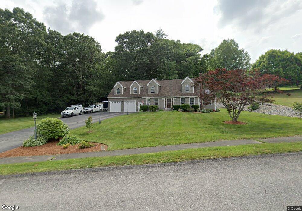
71 Hanson Rd Charlton, MA 01507
Estimated Value: $595,902 - $698,000
3
Beds
4
Baths
2,307
Sq Ft
$275/Sq Ft
Est. Value
About This Home
This home is located at 71 Hanson Rd, Charlton, MA 01507 and is currently estimated at $634,976, approximately $275 per square foot. 71 Hanson Rd is a home located in Worcester County with nearby schools including Shepherd Hill Regional High School.
Ownership History
Date
Name
Owned For
Owner Type
Purchase Details
Closed on
Jan 15, 2013
Sold by
True Gary S and True Melinda M
Bought by
True Gary S
Current Estimated Value
Purchase Details
Closed on
Jun 29, 1998
Sold by
Franchi Robert and Franchi Korine
Bought by
True Gary S and True Melinda M
Home Financials for this Owner
Home Financials are based on the most recent Mortgage that was taken out on this home.
Original Mortgage
$110,000
Interest Rate
7.09%
Mortgage Type
Purchase Money Mortgage
Purchase Details
Closed on
Feb 10, 1993
Sold by
Preston Homes Inc
Bought by
Franchi Robert and Davis Korine
Home Financials for this Owner
Home Financials are based on the most recent Mortgage that was taken out on this home.
Original Mortgage
$128,950
Interest Rate
8.13%
Mortgage Type
Purchase Money Mortgage
Create a Home Valuation Report for This Property
The Home Valuation Report is an in-depth analysis detailing your home's value as well as a comparison with similar homes in the area
Home Values in the Area
Average Home Value in this Area
Purchase History
| Date | Buyer | Sale Price | Title Company |
|---|---|---|---|
| True Gary S | -- | -- | |
| True Gary S | -- | -- | |
| True Gary S | $159,900 | -- | |
| True Gary S | $159,900 | -- | |
| Franchi Robert | $139,200 | -- |
Source: Public Records
Mortgage History
| Date | Status | Borrower | Loan Amount |
|---|---|---|---|
| Previous Owner | Franchi Robert | $101,200 | |
| Previous Owner | Franchi Robert | $110,000 | |
| Previous Owner | Franchi Robert | $128,950 |
Source: Public Records
Tax History
| Year | Tax Paid | Tax Assessment Tax Assessment Total Assessment is a certain percentage of the fair market value that is determined by local assessors to be the total taxable value of land and additions on the property. | Land | Improvement |
|---|---|---|---|---|
| 2025 | $6,100 | $548,100 | $82,800 | $465,300 |
| 2024 | $5,923 | $522,300 | $82,800 | $439,500 |
| 2023 | $5,689 | $467,500 | $80,000 | $387,500 |
| 2022 | $5,284 | $397,600 | $74,500 | $323,100 |
| 2021 | $5,045 | $336,100 | $71,800 | $264,300 |
| 2020 | $4,980 | $333,300 | $69,000 | $264,300 |
| 2019 | $4,923 | $333,300 | $69,000 | $264,300 |
| 2018 | $4,344 | $321,800 | $69,000 | $252,800 |
| 2017 | $4,198 | $297,700 | $69,000 | $228,700 |
| 2016 | $4,102 | $297,700 | $69,000 | $228,700 |
| 2015 | $3,995 | $297,700 | $69,000 | $228,700 |
| 2014 | $3,771 | $297,900 | $70,700 | $227,200 |
Source: Public Records
Map
Nearby Homes
- 40 Carroll Hill Rd
- 0 Hammond Hill Rd
- 0 Oxbow Rd
- 4 N Meadow Ln
- 7 Hycrest Rd
- 8 Hycrest Rd
- 34 Northside Rd
- 8 Northside Rd
- 30 Bond Rd
- 25 N Main St Unit A
- Lot 2 Gould Rd
- Lot 1 Gould Rd
- Lot 3 Gould Rd
- Lot 9 Gould Rd
- Lot 4 Gould Rd
- Lot 5 Gould Rd
- 9 L Stevens Rd Unit B
- 9 L Stevens Rd Unit A
- 7 L Stevens Rd Unit B
- Lot 8 Coughlin Rd
Your Personal Tour Guide
Ask me questions while you tour the home.