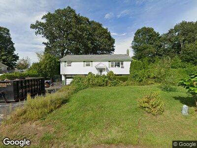
71 Horan Way Stoughton, MA 02072
Estimated Value: $561,000 - $629,000
3
Beds
1
Bath
1,889
Sq Ft
$312/Sq Ft
Est. Value
About This Home
This home is located at 71 Horan Way, Stoughton, MA 02072 and is currently estimated at $589,562, approximately $312 per square foot. 71 Horan Way is a home located in Norfolk County with nearby schools including Wilkins Elementary School, O'Donnell Middle School, and Stoughton High School.
Ownership History
Date
Name
Owned For
Owner Type
Purchase Details
Closed on
Nov 3, 2022
Sold by
Herrmann Ft 2012 and Herrmann
Bought by
Herrmann Robert G and Herrmann William H
Current Estimated Value
Purchase Details
Closed on
Jun 12, 2013
Sold by
Herrmann Irma E
Bought by
Herrmann Ft and Herrmann
Purchase Details
Closed on
Dec 1, 1964
Bought by
Herrmann Ft
Create a Home Valuation Report for This Property
The Home Valuation Report is an in-depth analysis detailing your home's value as well as a comparison with similar homes in the area
Home Values in the Area
Average Home Value in this Area
Purchase History
| Date | Buyer | Sale Price | Title Company |
|---|---|---|---|
| Herrmann Robert G | -- | None Available | |
| Herrmann Robert G | -- | None Available | |
| Herrmann Ft | -- | -- | |
| Herrmann Ft | -- | -- | |
| Herrmann Ft | -- | -- |
Source: Public Records
Mortgage History
| Date | Status | Borrower | Loan Amount |
|---|---|---|---|
| Open | Edmonds Tyler | $516,000 | |
| Closed | Edmonds Tyler | $516,000 |
Source: Public Records
Tax History Compared to Growth
Tax History
| Year | Tax Paid | Tax Assessment Tax Assessment Total Assessment is a certain percentage of the fair market value that is determined by local assessors to be the total taxable value of land and additions on the property. | Land | Improvement |
|---|---|---|---|---|
| 2025 | $6,490 | $524,200 | $222,900 | $301,300 |
| 2024 | $6,290 | $494,100 | $203,600 | $290,500 |
| 2023 | $6,019 | $444,200 | $186,000 | $258,200 |
| 2022 | $5,917 | $410,600 | $179,000 | $231,600 |
| 2021 | $5,418 | $358,800 | $158,000 | $200,800 |
| 2020 | $5,216 | $350,300 | $158,000 | $192,300 |
| 2019 | $5,272 | $343,700 | $158,000 | $185,700 |
| 2018 | $4,656 | $314,400 | $150,900 | $163,500 |
| 2017 | $4,457 | $307,600 | $149,200 | $158,400 |
| 2016 | $4,234 | $282,800 | $135,100 | $147,700 |
| 2015 | $4,173 | $275,800 | $128,100 | $147,700 |
| 2014 | $4,066 | $258,300 | $117,600 | $140,700 |
Source: Public Records
Map
Nearby Homes
- 56 Station St
- 545 Pearl St
- 350 Cushing St
- 62 Ralph Mann Dr
- 141 Shaw Farm Rd Unit 141
- 464 Canton St
- 54 Will Dr Unit 87
- 43 Will Dr Unit 30
- 45 Will Dr Unit 97
- 64 Thomas St
- 16 Rosewood Dr Unit 18-04
- 8 Cottonwood Dr
- 15 Greenbrook Dr
- 1049 Pleasant St
- 79 Greenbrook Dr
- 52 Adams St
- 248 Greenbrook Dr
- 71 Rosewood Dr
- 197 Greenbrook Dr Unit 197
- 228 Greenbrook Dr