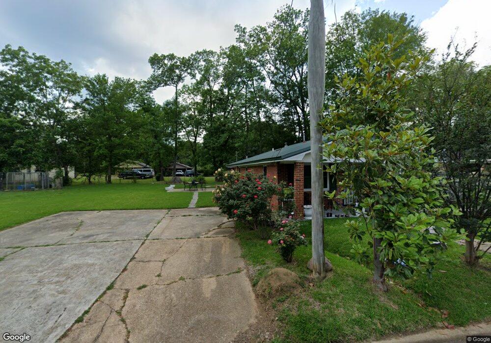
71 Lowe St West Point, MS 39773
Estimated Value: $93,950 - $144,000
3
Beds
--
Bath
1,193
Sq Ft
$93/Sq Ft
Est. Value
About This Home
This home is located at 71 Lowe St, West Point, MS 39773 and is currently estimated at $110,988, approximately $93 per square foot. 71 Lowe St is a home with nearby schools including East Side Elementary School, West Clay Elementary School, and Church Hill Elementary School.
Create a Home Valuation Report for This Property
The Home Valuation Report is an in-depth analysis detailing your home's value as well as a comparison with similar homes in the area
Tax History
| Year | Tax Paid | Tax Assessment Tax Assessment Total Assessment is a certain percentage of the fair market value that is determined by local assessors to be the total taxable value of land and additions on the property. | Land | Improvement |
|---|---|---|---|---|
| 2025 | $1,004 | $5,296 | $700 | $4,596 |
| 2024 | $1,004 | $7,944 | $1,050 | $6,894 |
| 2023 | $1,004 | $6,711 | $1,050 | $5,661 |
| 2022 | $374 | $6,711 | $1,050 | $5,661 |
| 2021 | $0 | $4,439 | $700 | $3,739 |
| 2020 | $327 | $4,439 | $700 | $3,739 |
| 2019 | $327 | $4,439 | $700 | $3,739 |
| 2018 | $0 | $4,439 | $700 | $3,739 |
| 2017 | $0 | $4,439 | $700 | $3,739 |
| 2016 | $327 | $6,658 | $1,050 | $5,608 |
| 2015 | $301 | $6,004 | $1,050 | $4,954 |
| 2014 | $287 | $6,004 | $1,050 | $4,954 |
| 2013 | $287 | $4,003 | $700 | $3,303 |
Source: Public Records
Map
Nearby Homes
- 218 Lewellen St
- 530 E Morrow St
- 237 Guyton Cir
- 123 Cottrell St
- 7642 Highway 45 Alternate N
- 761 E Morrow St
- 0 Kennedy Dr
- 26788 E Main St
- 13 Cul de Sac St
- 0 Us Hwy 45a Unit 4033641
- 0 Us Hwy 45a Unit 22-3720
- 26852 E Main St
- 49 Barksdale Dr
- 27045 E Main St
- 26596 E Main St
- 0 Mississippi 50
- 184 Tournament St
- 551 E Westbrook St
- 399 Lone Oak Dr
- 228 S Division St
Your Personal Tour Guide
Ask me questions while you tour the home.