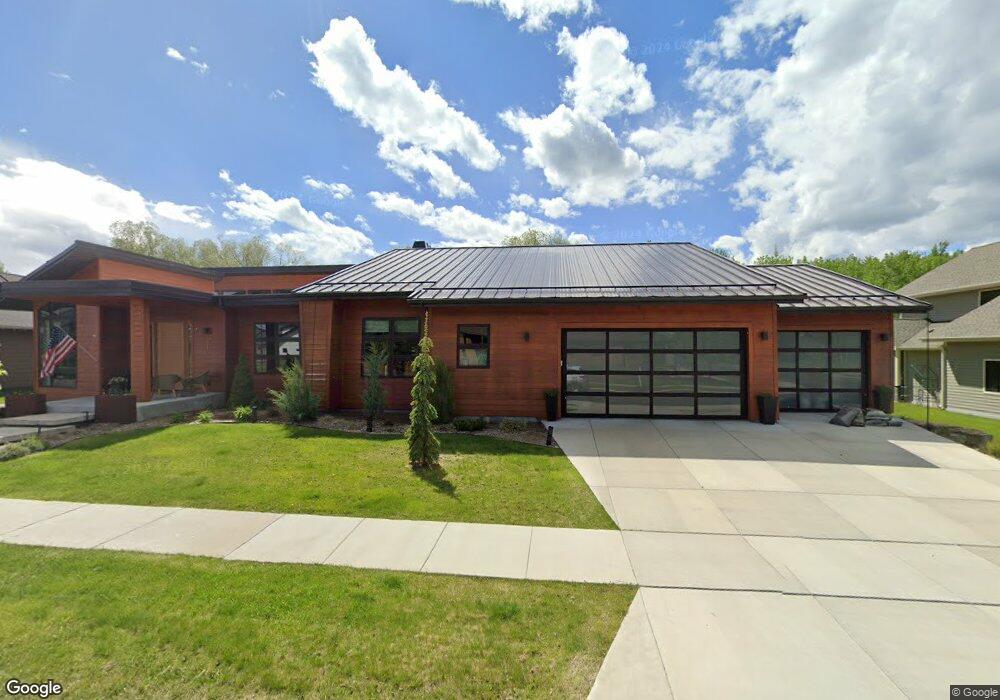
71 Mathew Bird Cir Bozeman, MT 59715
South Bozeman NeighborhoodEstimated Value: $1,417,000 - $1,683,000
3
Beds
4
Baths
3,436
Sq Ft
$451/Sq Ft
Est. Value
About This Home
This home is located at 71 Mathew Bird Cir, Bozeman, MT 59715 and is currently estimated at $1,548,136, approximately $450 per square foot. 71 Mathew Bird Cir is a home with nearby schools including Morning Star School, Sacajawea Middle School, and Bozeman High School.
Ownership History
Date
Name
Owned For
Owner Type
Purchase Details
Closed on
Aug 26, 2025
Sold by
Burgard Christopher J and Burgard Sandra L
Bought by
Burgard Living Trust and Burgard
Current Estimated Value
Purchase Details
Closed on
Jul 31, 2018
Sold by
Ebbighausen Homes Inc
Bought by
Burgard Christopher J and Burgard Sandra L
Home Financials for this Owner
Home Financials are based on the most recent Mortgage that was taken out on this home.
Original Mortgage
$400,000
Interest Rate
4.5%
Mortgage Type
New Conventional
Purchase Details
Closed on
Nov 11, 2014
Sold by
Stommel Peter William and Stommel Suzan Lynn
Bought by
Ebbighausen Homes Inc
Create a Home Valuation Report for This Property
The Home Valuation Report is an in-depth analysis detailing your home's value as well as a comparison with similar homes in the area
Home Values in the Area
Average Home Value in this Area
Purchase History
| Date | Buyer | Sale Price | Title Company |
|---|---|---|---|
| Burgard Living Trust | -- | None Listed On Document | |
| Burgard Christopher J | -- | Security Title Co | |
| Ebbighausen Homes Inc | -- | American Land Title Company |
Source: Public Records
Mortgage History
| Date | Status | Borrower | Loan Amount |
|---|---|---|---|
| Previous Owner | Burgard Christopher J | $400,000 |
Source: Public Records
Tax History Compared to Growth
Tax History
| Year | Tax Paid | Tax Assessment Tax Assessment Total Assessment is a certain percentage of the fair market value that is determined by local assessors to be the total taxable value of land and additions on the property. | Land | Improvement |
|---|---|---|---|---|
| 2025 | $8,869 | $1,602,300 | $0 | $0 |
| 2024 | $9,967 | $1,497,300 | $0 | $0 |
| 2023 | $9,635 | $1,497,300 | $0 | $0 |
| 2022 | $7,876 | $1,027,100 | $0 | $0 |
| 2021 | $8,691 | $1,027,100 | $0 | $0 |
| 2020 | $7,188 | $842,100 | $0 | $0 |
| 2019 | $7,352 | $842,100 | $0 | $0 |
| 2018 | $2,789 | $295,666 | $0 | $0 |
| 2017 | $1,698 | $182,176 | $0 | $0 |
| 2016 | $1,309 | $138,934 | $0 | $0 |
| 2015 | $1,310 | $138,934 | $0 | $0 |
| 2014 | $1,122 | $70,081 | $0 | $0 |
Source: Public Records
Map
Nearby Homes
- 102 Nostalgia Ln
- Lot 129 Graf St
- 210 W Graf St
- 502 Cambridge Dr
- 518 Oxford Dr
- 462 Cornell Dr
- 1621 Cambridge Dr
- 1617 Cambridge Dr
- 1613 Cambridge Dr
- 1609 Cambridge Dr
- 1525 Cambridge Dr
- 1517 Cambridge Dr
- 3609 Fieldstone Dr W
- 2516 Spring Creek Dr
- 3214 Hillcrest Dr
- 2702 Langohr Ave
- 2818 Westridge Dr
- 515 W Arnold St
- 4314 Graf St
- 504 Morrow St
- 69 Mathew Bird Cir
- 105 Mathew Bird Cir
- 91 Mathew Bird Cir
- 184 Nash Creek Ln
- LOT 109 Mathew Bird
- 55 Mathew Bird Cir
- 127 Mathew Bird Cir
- 166 Nash Creek Ln
- 195 Nash Creek Ln
- 124 Nash Creek Ln
- 43 Mathew Bird Cir
- 153 Nash Creek Ln
- TBD Meadow Creek Subdivision
- 29 Mathew Bird Cir
- 143 Mathew Bird Cir
- 198 Nostalgia Ln
- 106 Silverwood Dr
- 137 Nash Creek Ln
- 102 Silverwood Dr
- 105 Silverwood Dr