
Seller's Agent in 2026
Jeffrey Wagner
Lamacchia Realty, Inc.
(508) 479-0668
3 in this area
166 Total Sales
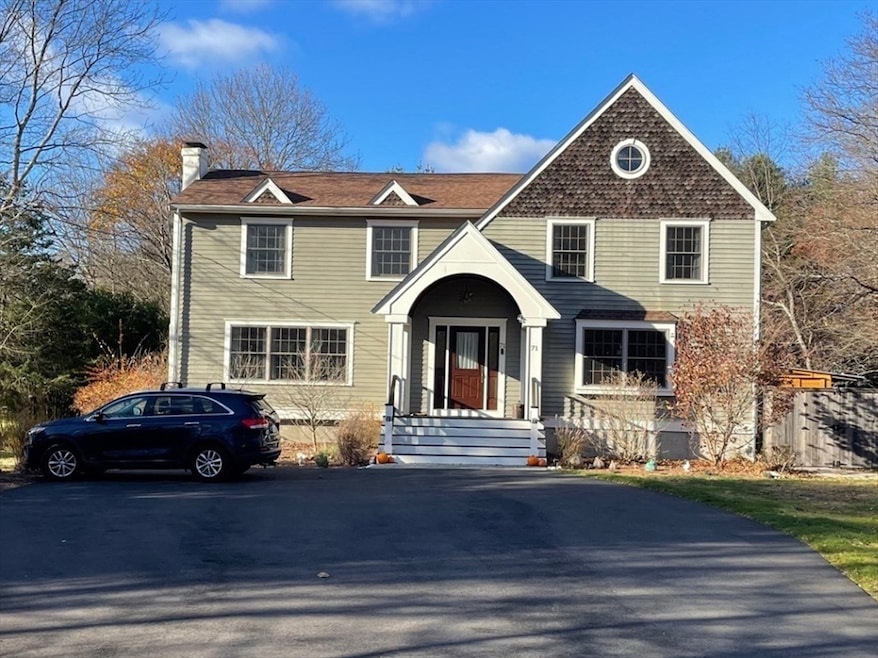
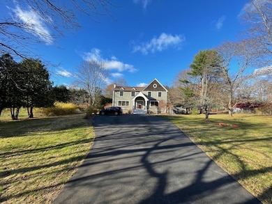
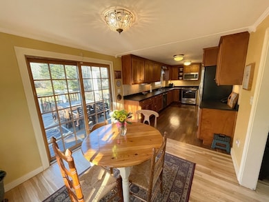
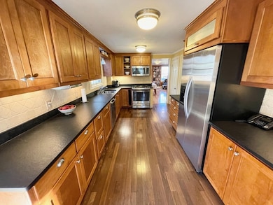
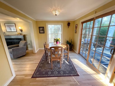
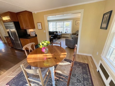
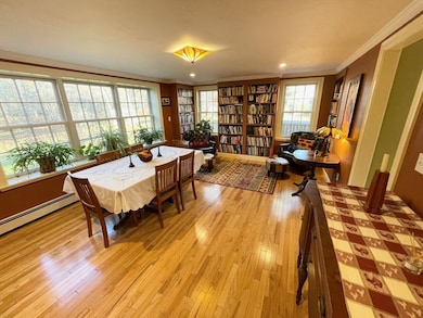
Welcome to this warm & inviting 4-bedroom, 2.5-bath Colonial set on a level 1.15-acre lot. Offering 2,302 sq ft of well-designed living space, this home blends classic charm w/ modern updates & HW floors. Large mahogany front porch as you enter w/ Spanish tiled mudroom, light filed living room w/ fireplace. Kitchen has birch cabinets, granite countertops & SS appliances. Large dining room also doubles as library area w/ built-in bookcases & storage. The home features a large partially finished basement w/ office / family area & also providing abundant storage & laundry. Upstairs has primary bedroom suite w/ vaulted ceiling, marble tiled bathroom, walk-in closet, dressing rm & 3 additional bedrooms. Step outside to a private, expansive backyard complete w/ large deck, patio, firepit, outdoor shower & large shed. Near lake, park & Cottage St School district. Recent updates include roof (2016), paved driveway (2024 & a furnace/heat pump system (2020).
| Date | Type | Sale Price | Title Company |
|---|---|---|---|
| Quit Claim Deed | $930,000 | -- | |
| Quit Claim Deed | -- | None Available | |
| Deed | $385,000 | -- |
| Date | Status | Loan Amount | Loan Type |
|---|---|---|---|
| Open | $744,000 | New Conventional | |
| Previous Owner | $273,000 | Purchase Money Mortgage |
| Date | Event | Price | List to Sale | Price per Sq Ft |
|---|---|---|---|---|
| 01/06/2026 01/06/26 | Sold | $930,000 | +3.4% | $404 / Sq Ft |
| 11/21/2025 11/21/25 | Pending | -- | -- | -- |
| 11/19/2025 11/19/25 | For Sale | $899,000 | -- | $391 / Sq Ft |
| Year | Tax Paid | Tax Assessment Tax Assessment Total Assessment is a certain percentage of the fair market value that is determined by local assessors to be the total taxable value of land and additions on the property. | Land | Improvement |
|---|---|---|---|---|
| 2025 | $13,645 | $780,600 | $476,500 | $304,100 |
| 2024 | $13,094 | $744,800 | $437,200 | $307,600 |
| 2023 | $12,840 | $690,700 | $408,800 | $281,900 |
| 2022 | $12,042 | $609,700 | $340,600 | $269,100 |
| 2021 | $11,903 | $582,600 | $321,200 | $261,400 |
| 2020 | $10,515 | $553,400 | $292,000 | $261,400 |
| 2019 | $10,091 | $519,900 | $258,500 | $261,400 |
| 2018 | $9,972 | $514,800 | $253,400 | $261,400 |
| 2017 | $8,015 | $408,500 | $215,700 | $192,800 |
| 2016 | $7,350 | $365,500 | $215,700 | $149,800 |
| 2015 | $6,445 | $317,500 | $181,100 | $136,400 |
| 2014 | $6,634 | $322,800 | $197,300 | $125,500 |
Seller's Agent in 2026
Jeffrey Wagner
Lamacchia Realty, Inc.
(508) 479-0668
3 in this area
166 Total Sales
Buyer's Agent in 2026
Anne Kennedy
Coldwell Banker Realty - Newton
(617) 549-1832
3 in this area
104 Total Sales
Source: MLS Property Information Network (MLS PIN)
MLS Number: 73456276
APN: SHAR-000052-000012-000001
Disclaimer: Certain information contained herein is derived from information provided by parties other than Homes.com. All information provided is deemed reliable, but is not guaranteed to be accurate and should be independently verified.
![]() The property listing data and information, or the Images, set forth herein were provided to MLS Property Information Network, Inc. from third party sources, including sellers, lessors and public records, and were compiled by MLS Property Information Network, Inc. The property listing data and information, and the Images, are for the personal, non-commercial use of consumers having a good faith interest in purchasing or leasing listed properties of the type displayed to them and may not be used for any purpose other than to identify prospective properties which such consumers may have a good faith interest in purchasing or leasing. MLS Property Information Network, Inc. and its subscribers disclaim any and all representations and warranties as to the accuracy of the property listing data and information, or as to the accuracy of any of the Images, set forth herein.
The property listing data and information, or the Images, set forth herein were provided to MLS Property Information Network, Inc. from third party sources, including sellers, lessors and public records, and were compiled by MLS Property Information Network, Inc. The property listing data and information, and the Images, are for the personal, non-commercial use of consumers having a good faith interest in purchasing or leasing listed properties of the type displayed to them and may not be used for any purpose other than to identify prospective properties which such consumers may have a good faith interest in purchasing or leasing. MLS Property Information Network, Inc. and its subscribers disclaim any and all representations and warranties as to the accuracy of the property listing data and information, or as to the accuracy of any of the Images, set forth herein.
Ask me questions while you tour the home.