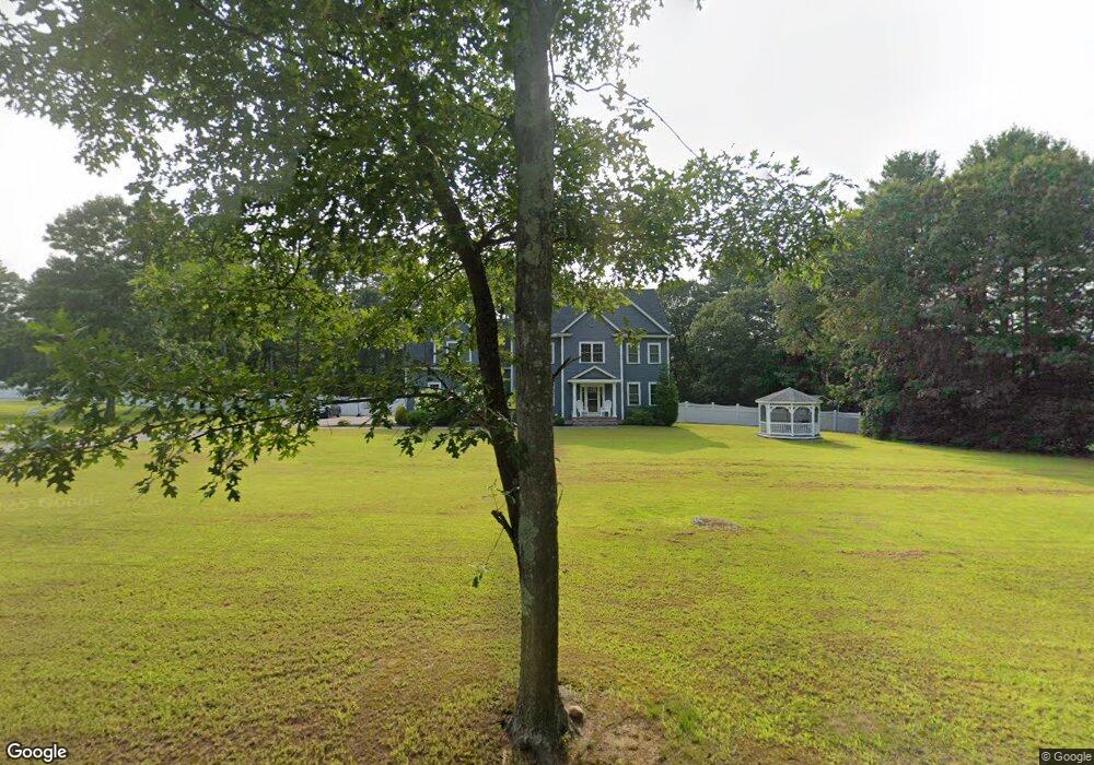
71 Myrtle St Norfolk, MA 02056
Estimated Value: $1,073,000 - $1,280,000
4
Beds
3
Baths
3,300
Sq Ft
$355/Sq Ft
Est. Value
About This Home
This home is located at 71 Myrtle St, Norfolk, MA 02056 and is currently estimated at $1,171,341, approximately $354 per square foot. 71 Myrtle St is a home located in Norfolk County with nearby schools including H. Olive Day School, Freeman-Kennedy School, and Woodside Montessori Academy.
Ownership History
Date
Name
Owned For
Owner Type
Purchase Details
Closed on
Aug 23, 2024
Sold by
Richards-Farnsworth Ann E and Richards-Farnsworth L
Bought by
Laurie A R-Farnsworth Lt and Richard-Farnsworth
Current Estimated Value
Purchase Details
Closed on
Feb 26, 2020
Sold by
Pelcon Development T
Bought by
Farnsworth Anne E and Farnsworth Laurie A
Home Financials for this Owner
Home Financials are based on the most recent Mortgage that was taken out on this home.
Original Mortgage
$599,920
Interest Rate
3.6%
Mortgage Type
New Conventional
Create a Home Valuation Report for This Property
The Home Valuation Report is an in-depth analysis detailing your home's value as well as a comparison with similar homes in the area
Home Values in the Area
Average Home Value in this Area
Purchase History
| Date | Buyer | Sale Price | Title Company |
|---|---|---|---|
| Laurie A R-Farnsworth Lt | -- | None Available | |
| Laurie A R-Farnsworth Lt | -- | None Available | |
| Farnsworth Anne E | $749,900 | None Available |
Source: Public Records
Mortgage History
| Date | Status | Borrower | Loan Amount |
|---|---|---|---|
| Previous Owner | Farnsworth Anne E | $599,920 |
Source: Public Records
Tax History Compared to Growth
Tax History
| Year | Tax Paid | Tax Assessment Tax Assessment Total Assessment is a certain percentage of the fair market value that is determined by local assessors to be the total taxable value of land and additions on the property. | Land | Improvement |
|---|---|---|---|---|
| 2025 | $16,949 | $1,061,300 | $231,300 | $830,000 |
| 2024 | $16,149 | $1,037,200 | $242,800 | $794,400 |
| 2023 | $15,412 | $939,200 | $242,800 | $696,400 |
| 2022 | $14,416 | $792,100 | $227,400 | $564,700 |
| 2021 | $13,897 | $772,500 | $220,800 | $551,700 |
| 2020 | $10,205 | $547,500 | $201,100 | $346,400 |
| 2019 | $4,594 | $251,200 | $251,200 | $0 |
Source: Public Records
Map
Nearby Homes
- 12 Ariana Ln
- 41 Myrtle St
- 98 Myrtle St
- 99 Leland Rd
- 292 Main St
- 10 Silver Fox Rd
- 48 River Rd
- 10 Populatic Street Extension
- 0 Toils End Rd
- 312 Eagles Nest Way Unit 312
- 29 Wildwood Rd Unit 29
- 33 Daniels St
- 10 Medway St
- 1 Granite Dr
- 18 Keeney Pond Rd
- 16 Keeney Pond Rd
- 7 Keeney Pond Rd
- 70 Daniels St
- 6 Trailside Way
- 11 Waites Crossing