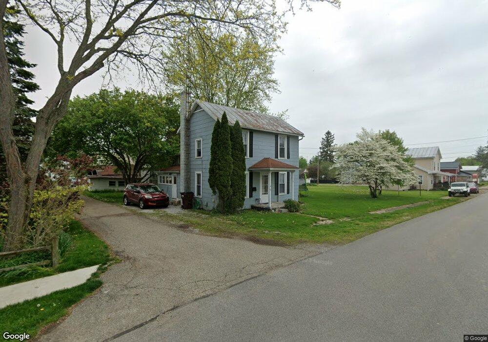
71 S Chestnut St Fredericktown, OH 43019
Estimated Value: $146,000 - $202,334
3
Beds
2
Baths
1,344
Sq Ft
$130/Sq Ft
Est. Value
About This Home
This home is located at 71 S Chestnut St, Fredericktown, OH 43019 and is currently estimated at $175,334, approximately $130 per square foot. 71 S Chestnut St is a home located in Knox County with nearby schools including Fredericktown Elementary School, Fredericktown Middle School, and Fredericktown High School.
Ownership History
Date
Name
Owned For
Owner Type
Purchase Details
Closed on
Nov 30, 2005
Sold by
Halterman John D and Halterman Amanda J
Bought by
Boggs Aaron M and Boggs Elizabeth A
Current Estimated Value
Home Financials for this Owner
Home Financials are based on the most recent Mortgage that was taken out on this home.
Original Mortgage
$66,600
Interest Rate
5.73%
Mortgage Type
New Conventional
Purchase Details
Closed on
Nov 8, 1995
Sold by
Hoeflich Hazel A
Bought by
Halterman John D and Halterman Amanda
Create a Home Valuation Report for This Property
The Home Valuation Report is an in-depth analysis detailing your home's value as well as a comparison with similar homes in the area
Home Values in the Area
Average Home Value in this Area
Purchase History
We collect this data history from publicly available records. To have your information removed, we recommend requesting removal directly through your county’s website.
| Date | Buyer | Sale Price | Title Company |
|---|---|---|---|
| Boggs Aaron M | $55,500 | None Available | |
| Halterman John D | $50,000 | -- |
Source: Public Records
Mortgage History
We collect this data history from publicly available records. To have your information removed, we recommend requesting removal directly through your county’s website.
| Date | Status | Borrower | Loan Amount |
|---|---|---|---|
| Closed | Boggs Aaron M | $66,600 |
Source: Public Records
Tax History
| Year | Tax Paid | Tax Assessment Tax Assessment Total Assessment is a certain percentage of the fair market value that is determined by local assessors to be the total taxable value of land and additions on the property. | Land | Improvement |
|---|---|---|---|---|
| 2025 | $1,508 | $36,930 | $10,630 | $26,300 |
| 2024 | $1,508 | $36,930 | $10,630 | $26,300 |
| 2023 | $1,513 | $36,930 | $10,630 | $26,300 |
| 2022 | $1,195 | $25,470 | $7,330 | $18,140 |
| 2021 | $1,195 | $25,470 | $7,330 | $18,140 |
| 2020 | $1,177 | $25,470 | $7,330 | $18,140 |
| 2019 | $1,219 | $25,060 | $7,920 | $17,140 |
| 2018 | $1,219 | $25,060 | $7,920 | $17,140 |
| 2017 | $1,202 | $25,060 | $7,920 | $17,140 |
| 2016 | $1,120 | $23,200 | $7,330 | $15,870 |
| 2015 | $1,051 | $23,200 | $7,330 | $15,870 |
| 2014 | $1,053 | $23,200 | $7,330 | $15,870 |
| 2013 | $1,148 | $23,820 | $6,890 | $16,930 |
Source: Public Records
Map
Nearby Homes
- 18 W 2nd St
- 122 W Sandusky St
- 48 Struble Cir
- 6 Adena Ct
- 48 Colony Dr
- 53 Zent Ave
- 116 Struble Cir
- 27 Colony Dr
- 17597 Spillway Dr
- 17597 Spillway Rd
- 9596 Woodridge Cir
- 9583 Woodridge Cir
- 11810 Woodview Ln
- 12019 Woodview Ln
- 10367 Quaker Rd
- 13891 Armentrout Rd
- 0 Crooked Street Land Split 2
- 0 Crooked St
- 13739 Old Mansfield Rd
- 13399 Old Mansfield Rd
- 87 S Chestnut St
- 55 S Chestnut St
- 72 S Chestnut St
- 76 S Chestnut St
- 56 S Chestnut St
- 76 S Mulberry St
- 86 S Chestnut St
- 23 W 5th St
- 89 S Chestnut St
- 89 S Chestnut St
- 89 S Chestnut St
- 21 W 5th St
- 53 W 5th St
- 88 S Chestnut St
- 92 S Mulberry St
- 75 S Main St
- 67 S Main St
- 59 S Main St
- 79 S Main St
- 47 S Chestnut St
Your Personal Tour Guide
Ask me questions while you tour the home.