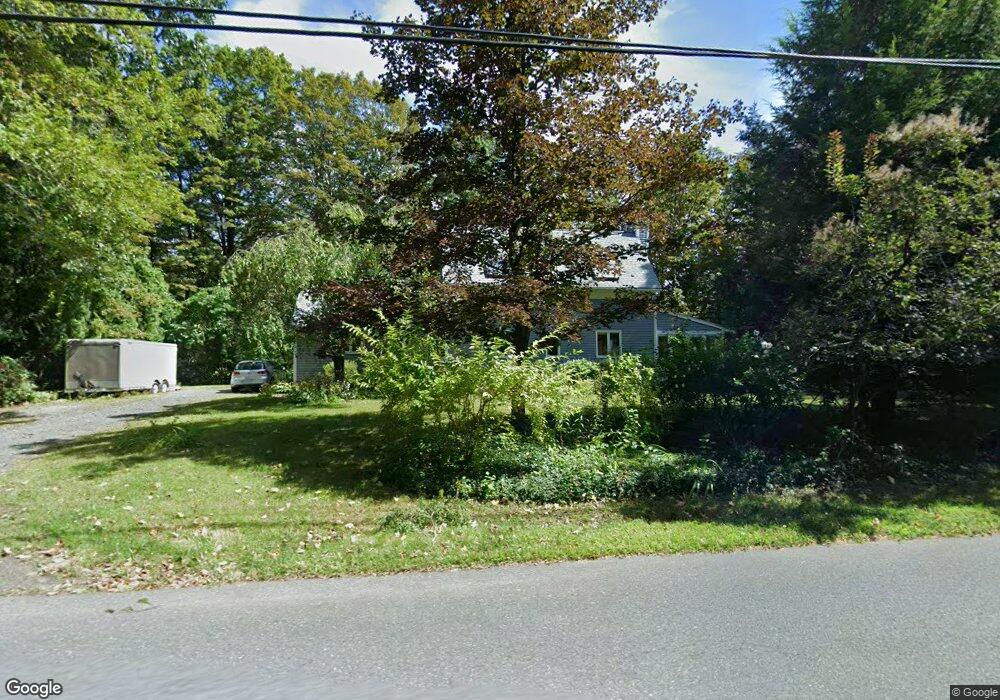
71 Sylvester Rd Florence, MA 01062
Florence NeighborhoodEstimated Value: $467,292 - $508,000
2
Beds
2
Baths
1,491
Sq Ft
$323/Sq Ft
Est. Value
About This Home
This home is located at 71 Sylvester Rd, Florence, MA 01062 and is currently estimated at $481,323, approximately $322 per square foot. 71 Sylvester Rd is a home located in Hampshire County with nearby schools including Northampton High School and The Williston Northampton School.
Ownership History
Date
Name
Owned For
Owner Type
Purchase Details
Closed on
Jun 1, 2006
Sold by
Kamel Mordechai and Weinberger Sara
Bought by
Aronson Robert W
Current Estimated Value
Purchase Details
Closed on
Apr 25, 2003
Sold by
Avedon Myra J and Frances Jean E
Bought by
Kamel Mordechai and Weinberger Sara
Home Financials for this Owner
Home Financials are based on the most recent Mortgage that was taken out on this home.
Original Mortgage
$221,000
Interest Rate
5.64%
Mortgage Type
Purchase Money Mortgage
Purchase Details
Closed on
Aug 4, 1998
Sold by
Brink Toby
Bought by
Avedon Myra J and Frances Jean E
Home Financials for this Owner
Home Financials are based on the most recent Mortgage that was taken out on this home.
Original Mortgage
$100,000
Interest Rate
6.92%
Mortgage Type
Purchase Money Mortgage
Purchase Details
Closed on
Sep 28, 1993
Sold by
Grigg Susan
Bought by
Hartt Toby
Create a Home Valuation Report for This Property
The Home Valuation Report is an in-depth analysis detailing your home's value as well as a comparison with similar homes in the area
Home Values in the Area
Average Home Value in this Area
Purchase History
| Date | Buyer | Sale Price | Title Company |
|---|---|---|---|
| Aronson Robert W | $333,800 | -- | |
| Kamel Mordechai | $321,000 | -- | |
| Avedon Myra J | $135,750 | -- | |
| Hartt Toby | $135,000 | -- |
Source: Public Records
Mortgage History
| Date | Status | Borrower | Loan Amount |
|---|---|---|---|
| Previous Owner | Hartt Toby | $48,000 | |
| Previous Owner | Hartt Toby | $221,000 | |
| Previous Owner | Hartt Toby | $46,000 | |
| Previous Owner | Hartt Toby | $100,000 |
Source: Public Records
Tax History
| Year | Tax Paid | Tax Assessment Tax Assessment Total Assessment is a certain percentage of the fair market value that is determined by local assessors to be the total taxable value of land and additions on the property. | Land | Improvement |
|---|---|---|---|---|
| 2025 | $5,651 | $405,700 | $103,100 | $302,600 |
| 2024 | $5,845 | $384,800 | $98,900 | $285,900 |
| 2023 | $4,993 | $315,200 | $89,400 | $225,800 |
| 2022 | $5,115 | $285,900 | $84,300 | $201,600 |
| 2021 | $4,530 | $260,800 | $80,800 | $180,000 |
| 2020 | $4,381 | $260,800 | $80,800 | $180,000 |
| 2019 | $4,435 | $255,300 | $83,400 | $171,900 |
| 2018 | $4,359 | $255,800 | $83,400 | $172,400 |
| 2017 | $4,269 | $255,800 | $83,400 | $172,400 |
| 2016 | $4,134 | $255,800 | $83,400 | $172,400 |
| 2015 | $4,489 | $284,100 | $98,700 | $185,400 |
| 2014 | $4,372 | $284,100 | $98,700 | $185,400 |
Source: Public Records
Map
Nearby Homes
- 0 W Farms Rd
- 404 Sylvester Rd
- 892 Westhampton Rd
- 832 Westhampton Rd
- 20-11 Sylvester Rd
- 723 Lot B Ryan Rd
- 1260 Westhampton Rd
- 296 Ryan Rd Unit A
- 296 Ryan Rd
- 296 Ryan Rd Unit B
- 751 Park Hill Rd
- 815 Burts Pit Rd
- 42 Clark St
- 98 Park Hill Rd
- 36 Torrey St
- 697 Florence Rd
- 635 Florence Rd
- 1 Ashley Cir
- 18 Nicols Way Unit 18
- 967 Florence Rd
- 83 Sylvester Rd
- 59 Sylvester Rd
- 64 Sylvester Rd
- 51 Sylvester Rd
- 54 Sylvester Rd
- 95 Sylvester Rd
- 26 Sylvester Rd
- 125 Sylvester Rd
- 88 Sylvester Rd
- 2 Turkey Hill Rd
- 31 Sylvester Rd
- 24 Turkey Hill Rd
- 6 Sylvester Rd
- 33 Sylvester Rd
- 11 Turkey Hill Rd
- 73 Turkey Hill Rd
- 2 Sylvester Rd
- 138 Sylvester Rd
- 1 Turkey Hill Rd
- 0 Sylvester Rd Unit 14121422
Your Personal Tour Guide
Ask me questions while you tour the home.