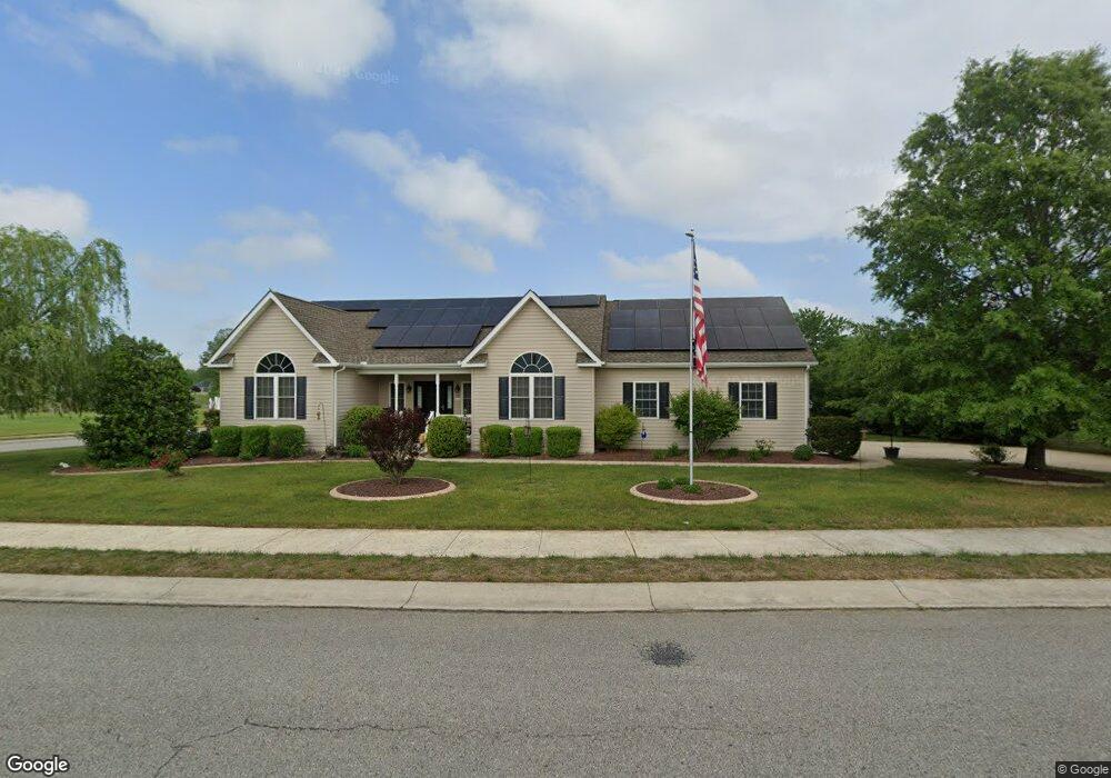
71 Weatherstone Ln Unit PALLAD Felton, DE 19943
Estimated Value: $372,000 - $435,000
3
Beds
2
Baths
1,827
Sq Ft
$226/Sq Ft
Est. Value
About This Home
This home is located at 71 Weatherstone Ln Unit PALLAD, Felton, DE 19943 and is currently estimated at $412,467, approximately $225 per square foot. 71 Weatherstone Ln Unit PALLAD is a home located in Kent County with nearby schools including Lake Forest East Elementary School, Lake Forest Central Elementary School, and W.T. Chipman Middle School.
Ownership History
Date
Name
Owned For
Owner Type
Purchase Details
Closed on
Sep 28, 2012
Sold by
Mccloskey Farm Llc
Bought by
Dennis Troy G and Dennis Sandra L
Current Estimated Value
Home Financials for this Owner
Home Financials are based on the most recent Mortgage that was taken out on this home.
Original Mortgage
$189,900
Outstanding Balance
$132,425
Interest Rate
3.66%
Mortgage Type
VA
Estimated Equity
$280,042
Create a Home Valuation Report for This Property
The Home Valuation Report is an in-depth analysis detailing your home's value as well as a comparison with similar homes in the area
Home Values in the Area
Average Home Value in this Area
Purchase History
| Date | Buyer | Sale Price | Title Company |
|---|---|---|---|
| Dennis Troy G | $189,900 | None Available |
Source: Public Records
Mortgage History
| Date | Status | Borrower | Loan Amount |
|---|---|---|---|
| Open | Dennis Troy G | $189,900 |
Source: Public Records
Tax History Compared to Growth
Tax History
| Year | Tax Paid | Tax Assessment Tax Assessment Total Assessment is a certain percentage of the fair market value that is determined by local assessors to be the total taxable value of land and additions on the property. | Land | Improvement |
|---|---|---|---|---|
| 2025 | $1,810 | $359,400 | $94,500 | $264,900 |
| 2024 | $1,810 | $359,400 | $94,500 | $264,900 |
| 2023 | $1,643 | $49,300 | $6,500 | $42,800 |
| 2022 | $1,455 | $49,300 | $6,500 | $42,800 |
| 2021 | $1,433 | $49,300 | $6,500 | $42,800 |
| 2020 | $1,471 | $49,300 | $6,500 | $42,800 |
| 2019 | $1,491 | $49,300 | $6,500 | $42,800 |
| 2018 | $1,460 | $49,300 | $6,500 | $42,800 |
| 2017 | $1,527 | $49,300 | $0 | $0 |
| 2016 | $1,372 | $49,300 | $0 | $0 |
| 2015 | -- | $49,300 | $0 | $0 |
| 2014 | -- | $49,300 | $0 | $0 |
Source: Public Records
Map
Nearby Homes
- 2 Weatherstone Ln
- 910 Weatherstone Ln
- 167 Spring Dale Ln
- 196 Elm Crest Ln
- 150 Elm Crest Ln
- 25 Farmhouse Trail
- 4217 Midstate Rd
- 3674 Andrews Lake Rd
- 438 Aston Villa Dr
- 156 Pratts Branch Rd
- 144 Pratts Branch Rd
- 106 Pine Needle Dr
- 311 Otter Way
- 145 Front St
- 02 Obsidian Dr
- 07 Obsidian Dr
- 06 Obsidian Dr
- Lot 7 Waterside Dr
- 05 Obsidian Dr
- 03 Obsidian Dr
- 71 Weatherstone Ln
- 83 Weatherstone Ln
- 85 Weatherstone Ln
- 87 Weatherstone Ln Unit PALLAD
- 95 Weatherstone Ln
- 64 Airtson Ct
- 86 Weatherstone Ln
- 86 Weatherstone Ln Unit PRINCE
- 99 Weatherstone Ln
- 86 Weatherstone Lane Princet
- 78 Weatherstone Ln
- 80 Weatherstone Ln
- 62 Weatherstone Ln
- 88 Weatherstone Ln
- 96 Weatherstone Ln
- 43 Airtson Ct
- 4 Weatherstone Ln
- 6 Weatherstone Ln
- 5 Weatherstone Ln
- 3 Weatherstone Ln