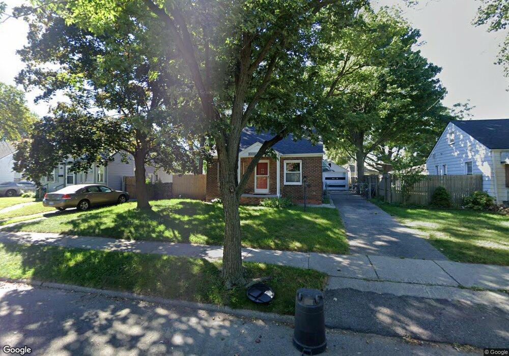
710 E Chesterfield St Ferndale, MI 48220
Estimated Value: $178,000 - $219,000
2
Beds
1
Bath
775
Sq Ft
$262/Sq Ft
Est. Value
About This Home
This home is located at 710 E Chesterfield St, Ferndale, MI 48220 and is currently estimated at $203,221, approximately $262 per square foot. 710 E Chesterfield St is a home located in Oakland County with nearby schools including Ferndale Lower Elementary Campus, Ferndale Upper Elementary Campus, and Ferndale Middle School.
Ownership History
Date
Name
Owned For
Owner Type
Purchase Details
Closed on
Jun 29, 2004
Sold by
Stark Gertrude
Bought by
Feys Jacqueline M
Current Estimated Value
Home Financials for this Owner
Home Financials are based on the most recent Mortgage that was taken out on this home.
Original Mortgage
$11,300
Outstanding Balance
$5,741
Interest Rate
6.37%
Mortgage Type
Credit Line Revolving
Estimated Equity
$197,480
Create a Home Valuation Report for This Property
The Home Valuation Report is an in-depth analysis detailing your home's value as well as a comparison with similar homes in the area
Home Values in the Area
Average Home Value in this Area
Purchase History
| Date | Buyer | Sale Price | Title Company |
|---|---|---|---|
| Feys Jacqueline M | $113,000 | Metropolitan Title Company |
Source: Public Records
Mortgage History
| Date | Status | Borrower | Loan Amount |
|---|---|---|---|
| Open | Feys Jacqueline M | $11,300 | |
| Open | Feys Jacqueline M | $90,400 |
Source: Public Records
Tax History Compared to Growth
Tax History
| Year | Tax Paid | Tax Assessment Tax Assessment Total Assessment is a certain percentage of the fair market value that is determined by local assessors to be the total taxable value of land and additions on the property. | Land | Improvement |
|---|---|---|---|---|
| 2024 | $2,071 | $88,240 | $0 | $0 |
| 2023 | $2,008 | $84,950 | $0 | $0 |
| 2022 | $2,013 | $77,200 | $0 | $0 |
| 2021 | $2,025 | $69,820 | $0 | $0 |
| 2020 | $1,922 | $61,090 | $0 | $0 |
| 2019 | $1,951 | $49,680 | $0 | $0 |
| 2018 | $1,958 | $40,200 | $0 | $0 |
| 2017 | $1,933 | $38,100 | $0 | $0 |
| 2016 | $1,906 | $36,530 | $0 | $0 |
| 2015 | -- | $34,230 | $0 | $0 |
| 2014 | -- | $30,740 | $0 | $0 |
| 2011 | -- | $42,540 | $0 | $0 |
Source: Public Records
Map
Nearby Homes
- 541 E Bennett Ave
- 615 E Webster St
- 565 E Webster St
- 631 Spencer St
- 454 Hilton Rd
- 440 Jewell St
- 342 Spencer St
- 00 Channing St
- 301 Spencer St
- 261 E Webster St
- 634 Channing St
- 230 E Webster St
- 250 Spencer St
- 259 Spencer St
- 420 Silman St
- 354 Silman St
- 388 Channing St
- 168 W Bennett
- 364 Channing St
- 601 Alameda St
- 730 E Chesterfield St
- 750 E Chesterfield St
- 691 E Bennette St
- 770 E Chesterfield St
- 705 E Bennett Ave
- 711 E Bennett Ave
- 705 E Bennette St
- 680 E Chesterfield St
- 691 E Bennett Ave
- 751 E Bennett Ave
- 691 E Chesterfield St
- 733 E Chesterfield St
- 713 E Chesterfield St
- 751 E Chesterfield St
- 658 E Chesterfield St
- 771 E Chesterfield St
- 679 E Chesterfield St
- 809 E Bennette St
- 638 E Chesterfield St
- 659 E Chesterfield St