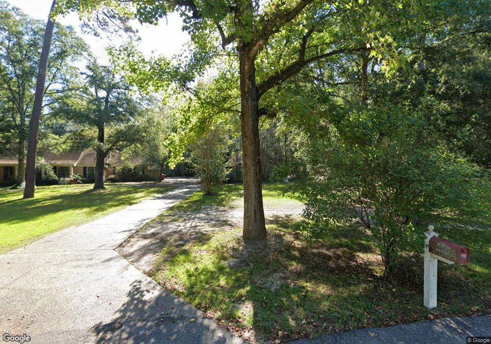
710 Idlewild Dr Picayune, MS 39466
Estimated Value: $269,000 - $304,000
4
Beds
4
Baths
3,069
Sq Ft
$93/Sq Ft
Est. Value
About This Home
This home is located at 710 Idlewild Dr, Picayune, MS 39466 and is currently estimated at $285,290, approximately $92 per square foot. 710 Idlewild Dr is a home located in Pearl River County with nearby schools including West Side Elementary School, Picayune Junior High School, and Picayune Memorial High School.
Ownership History
Date
Name
Owned For
Owner Type
Purchase Details
Closed on
May 23, 2022
Sold by
Edwards Billie G and Edwards Evelyn W
Bought by
Gordon David
Current Estimated Value
Home Financials for this Owner
Home Financials are based on the most recent Mortgage that was taken out on this home.
Original Mortgage
$119,247
Outstanding Balance
$42,718
Interest Rate
4.44%
Mortgage Type
Construction
Estimated Equity
$242,572
Purchase Details
Closed on
May 13, 2014
Sold by
Hal Mark Hal Mark and Schrock Pam Gill
Bought by
Schrock Hal Mark and Schrock Pam Gill
Create a Home Valuation Report for This Property
The Home Valuation Report is an in-depth analysis detailing your home's value as well as a comparison with similar homes in the area
Purchase History
| Date | Buyer | Sale Price | Title Company |
|---|---|---|---|
| Gordon David | $149,058 | Attorney Only | |
| Schrock Hal Mark | -- | -- |
Source: Public Records
Mortgage History
| Date | Status | Borrower | Loan Amount |
|---|---|---|---|
| Open | Gordon David | $119,247 |
Source: Public Records
Tax History Compared to Growth
Tax History
| Year | Tax Paid | Tax Assessment Tax Assessment Total Assessment is a certain percentage of the fair market value that is determined by local assessors to be the total taxable value of land and additions on the property. | Land | Improvement |
|---|---|---|---|---|
| 2024 | $3,479 | $20,561 | $0 | $0 |
| 2023 | $3,321 | $17,021 | $0 | $0 |
| 2022 | $4,060 | $16,946 | $0 | $0 |
| 2021 | $631 | $11,302 | $0 | $0 |
| 2020 | $588 | $11,302 | $0 | $0 |
| 2019 | $766 | $12,457 | $0 | $0 |
| 2018 | $1,630 | $12,458 | $0 | $0 |
| 2017 | $1,889 | $13,707 | $0 | $0 |
| 2016 | $1,801 | $13,707 | $0 | $0 |
| 2015 | $1,814 | $13,467 | $0 | $0 |
| 2014 | $1,857 | $13,552 | $0 | $0 |
Source: Public Records
Map
Nearby Homes
- 700 Idlewild Dr
- 1301 Third Ave
- 605 Briarwood Ln
- 202 N Boley Dr
- TBD Bent Creek Lot 21
- NHN Bent Creek
- 1624 Fifth Ave
- 415 Fifth Ave
- 620 Williams Ave
- 319 Dozier St
- 1401 Formby Davis Ave
- 510 W Canal St
- 0 N Beech St
- 0 Bennett St
- 1018 Palestine Rd
- 1312 N Beech St
- NHN S Main St
- 10 W Canal St
- 9 W Canal St
- NHN Corner S Main and Elizabeth St
- NHN Idlewild Dr
- 800 Idlewild Dr
- 705 Idlewild Dr
- 701 Idlewild Dr
- 704 Idlewild Dr
- 826 Idlewild Dr
- 712 Idlewild Ln
- 714 Idlewild Ln
- 825 Idlewild Dr
- 722 Idlewild Ln
- 701 Idlewild Ln
- 711 Idlewild Ln
- 722 Idlewild Dr
- 606 Idlewild Dr
- 827 Idlewild Dr
- 713 Idlewild Ln
- 1110 Grice Ave
- 726 Stovall Ave
- 609 Idlewild Dr
- 721 Idlewild Ln
