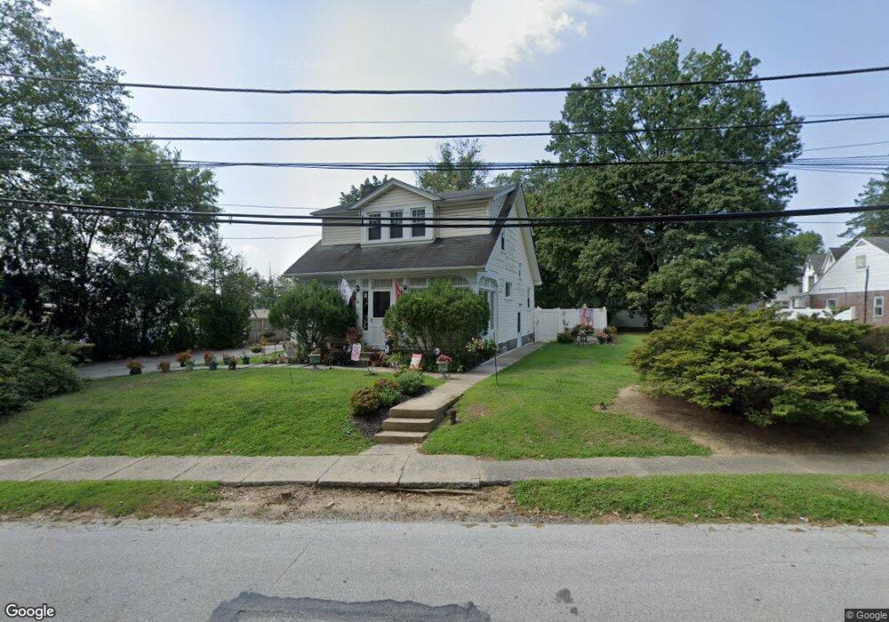
710 Lehann Cir Springfield, PA 19064
Estimated Value: $338,000 - $392,000
3
Beds
1
Bath
1,176
Sq Ft
$314/Sq Ft
Est. Value
About This Home
This home is located at 710 Lehann Cir, Springfield, PA 19064 and is currently estimated at $369,666, approximately $314 per square foot. 710 Lehann Cir is a home located in Delaware County with nearby schools including Springfield High School, St Francis Of Assisi School, and Holy Cross School.
Ownership History
Date
Name
Owned For
Owner Type
Purchase Details
Closed on
Mar 3, 2023
Sold by
Lesniak Coulston
Bought by
North Star Sp Lp
Current Estimated Value
Purchase Details
Closed on
Jun 11, 2004
Sold by
Odonnell Patricia A and Martino Eugene A
Bought by
Lesniak Stanley J and Vance Coulston H
Home Financials for this Owner
Home Financials are based on the most recent Mortgage that was taken out on this home.
Original Mortgage
$150,000
Interest Rate
6.32%
Mortgage Type
Purchase Money Mortgage
Purchase Details
Closed on
Jun 2, 2003
Sold by
Pierce Clifford M and Pierce Michele
Bought by
Odonnell Patricia A and Martino Eugene A
Home Financials for this Owner
Home Financials are based on the most recent Mortgage that was taken out on this home.
Original Mortgage
$166,250
Interest Rate
5.83%
Mortgage Type
Purchase Money Mortgage
Create a Home Valuation Report for This Property
The Home Valuation Report is an in-depth analysis detailing your home's value as well as a comparison with similar homes in the area
Home Values in the Area
Average Home Value in this Area
Purchase History
| Date | Buyer | Sale Price | Title Company |
|---|---|---|---|
| North Star Sp Lp | $300,000 | -- | |
| Lesniak Stanley J | $187,500 | -- | |
| Odonnell Patricia A | $175,000 | Commonwealth Land Title Insu |
Source: Public Records
Mortgage History
| Date | Status | Borrower | Loan Amount |
|---|---|---|---|
| Previous Owner | Lesniak Stanley J | $150,000 | |
| Previous Owner | Odonnell Patricia A | $166,250 |
Source: Public Records
Tax History Compared to Growth
Tax History
| Year | Tax Paid | Tax Assessment Tax Assessment Total Assessment is a certain percentage of the fair market value that is determined by local assessors to be the total taxable value of land and additions on the property. | Land | Improvement |
|---|---|---|---|---|
| 2025 | $6,158 | $219,080 | $107,660 | $111,420 |
| 2024 | $6,158 | $219,080 | $107,660 | $111,420 |
| 2023 | $5,929 | $219,080 | $107,660 | $111,420 |
| 2022 | $5,801 | $219,080 | $107,660 | $111,420 |
| 2021 | $8,984 | $219,080 | $107,660 | $111,420 |
| 2020 | $5,212 | $115,030 | $51,760 | $63,270 |
| 2019 | $5,090 | $115,030 | $51,760 | $63,270 |
| 2018 | $5,017 | $115,030 | $0 | $0 |
| 2017 | $4,901 | $115,030 | $0 | $0 |
| 2016 | $631 | $115,030 | $0 | $0 |
| 2015 | $631 | $115,030 | $0 | $0 |
| 2014 | $631 | $115,030 | $0 | $0 |
Source: Public Records
Map
Nearby Homes
- 243 Rambling Way
- 979 Edgewood Dr
- 1045 West Ave
- 332 Franklin Ave
- 240 Beechwood Rd
- 304 Providence Rd
- 268 Beechwood Rd
- 142 Rambling Way
- 225 Lynbrooke Rd
- 214 Lynbrooke Rd
- 624 Country Ln
- 251 Powell Rd
- 230 Ridgewood Rd
- 342 E Springfield Rd
- 306 School St
- 223 Harding Ave
- 306 E Springfield Rd
- 246 Pennington Ave
- 601 Country Ln
- 224 Ballymore Rd
- 700 Lehann Cir
- 509 Lehann Cir
- 511 Lehann Cir
- 515 Lehann Cir
- 518 Baltimore Pike
- 500-508 Baltimore Pike
- 517 Lehann Cir
- 711 Lehann Cir
- 715 Lehann Cir
- 530 Baltimore Pike
- 508 Baltimore Pike
- 723 Lehann Cir
- 443 Garden Rd
- 521 Lehann Cir
- 437 Garden Rd
- 504 Lehann Cir
- 523 Lehann Cir
- 500 Lehann Cir
- 532 Baltimore Pike
- 502 Lehann Cir