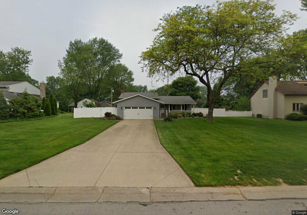
710 Lincoln St Amherst, OH 44001
Estimated Value: $296,000 - $323,000
4
Beds
2
Baths
1,876
Sq Ft
$164/Sq Ft
Est. Value
About This Home
This home is located at 710 Lincoln St, Amherst, OH 44001 and is currently estimated at $308,111, approximately $164 per square foot. 710 Lincoln St is a home located in Lorain County with nearby schools including Powers Elementary School, Walter G. Nord Middle School, and Amherst Junior High School.
Ownership History
Date
Name
Owned For
Owner Type
Purchase Details
Closed on
Feb 13, 2006
Sold by
Schrenkel John J and Schrenkel Diane
Bought by
Fox Craig E and Fox Heather L
Current Estimated Value
Home Financials for this Owner
Home Financials are based on the most recent Mortgage that was taken out on this home.
Original Mortgage
$175,400
Interest Rate
6.3%
Mortgage Type
Fannie Mae Freddie Mac
Purchase Details
Closed on
May 7, 2003
Sold by
Bradley Leroy R and Bradley Myrtle L
Bought by
Schrenkel John J and Schrenkel Diane
Home Financials for this Owner
Home Financials are based on the most recent Mortgage that was taken out on this home.
Original Mortgage
$100,000
Interest Rate
6.02%
Mortgage Type
Purchase Money Mortgage
Create a Home Valuation Report for This Property
The Home Valuation Report is an in-depth analysis detailing your home's value as well as a comparison with similar homes in the area
Home Values in the Area
Average Home Value in this Area
Purchase History
| Date | Buyer | Sale Price | Title Company |
|---|---|---|---|
| Fox Craig E | $194,900 | Sandstone Title Agency Ltd | |
| Schrenkel John J | $164,000 | Real Living Title Agency Ltd |
Source: Public Records
Mortgage History
| Date | Status | Borrower | Loan Amount |
|---|---|---|---|
| Closed | Fox Craig E | $175,400 | |
| Closed | Schrenkel John J | $100,000 |
Source: Public Records
Tax History Compared to Growth
Tax History
| Year | Tax Paid | Tax Assessment Tax Assessment Total Assessment is a certain percentage of the fair market value that is determined by local assessors to be the total taxable value of land and additions on the property. | Land | Improvement |
|---|---|---|---|---|
| 2024 | $3,493 | $86,345 | $16,594 | $69,752 |
| 2023 | $2,991 | $62,265 | $16,069 | $46,197 |
| 2022 | $2,868 | $62,265 | $16,069 | $46,197 |
| 2021 | $2,875 | $62,265 | $16,069 | $46,197 |
| 2020 | $2,388 | $46,040 | $13,170 | $32,870 |
| 2019 | $2,341 | $46,040 | $13,170 | $32,870 |
| 2018 | $2,353 | $46,040 | $13,170 | $32,870 |
| 2017 | $2,422 | $44,480 | $9,230 | $35,250 |
| 2016 | $2,441 | $44,480 | $9,230 | $35,250 |
| 2015 | $2,427 | $44,480 | $9,230 | $35,250 |
| 2014 | $2,506 | $45,710 | $9,480 | $36,230 |
| 2013 | $2,514 | $45,710 | $9,480 | $36,230 |
Source: Public Records
Map
Nearby Homes
- 117 Fall Lake Ln
- 707 Greenlawn Dr
- 47020 Cooper Foster Park Rd
- 726 Sunrise Dr
- 320 Pebble Creek Ct
- 1011 N Main St
- 369 Pebble Creek Ct
- 357 Pebble Creek Ct
- 0 Cooper Foster Park Rd Unit 5129838
- 394 Long St
- 825 Cleveland Ave
- 105 N Woodhill Dr
- 922 Sharondale Dr
- 1250 N Main St
- 110 Habant Dr
- 0 Stonebridge Dr
- 0 Rosecliff Dr
- 2176 Myla Way
- 2180 Myla Way
- 1280 Meadowview Ln
- 706 Lincoln St
- 714 Lincoln St
- 709 Oakhurst Dr
- 707 Oakhurst Dr
- 711 Oakhurst Dr
- 704 Lincoln St
- 716 Lincoln St
- 707 Lincoln St
- 705 Oakhurst Dr
- 711 Lincoln St
- 199 Shadylawn Dr
- 718 Lincoln St
- 713 Lincoln St
- 228 Greenlawn Dr
- 715 Oakhurst Dr
- 701 Lincoln St
- 712 Oakhurst Dr
- 703 Oakhurst Dr
- 714 Oakhurst Dr
- 706 Oakhurst Dr