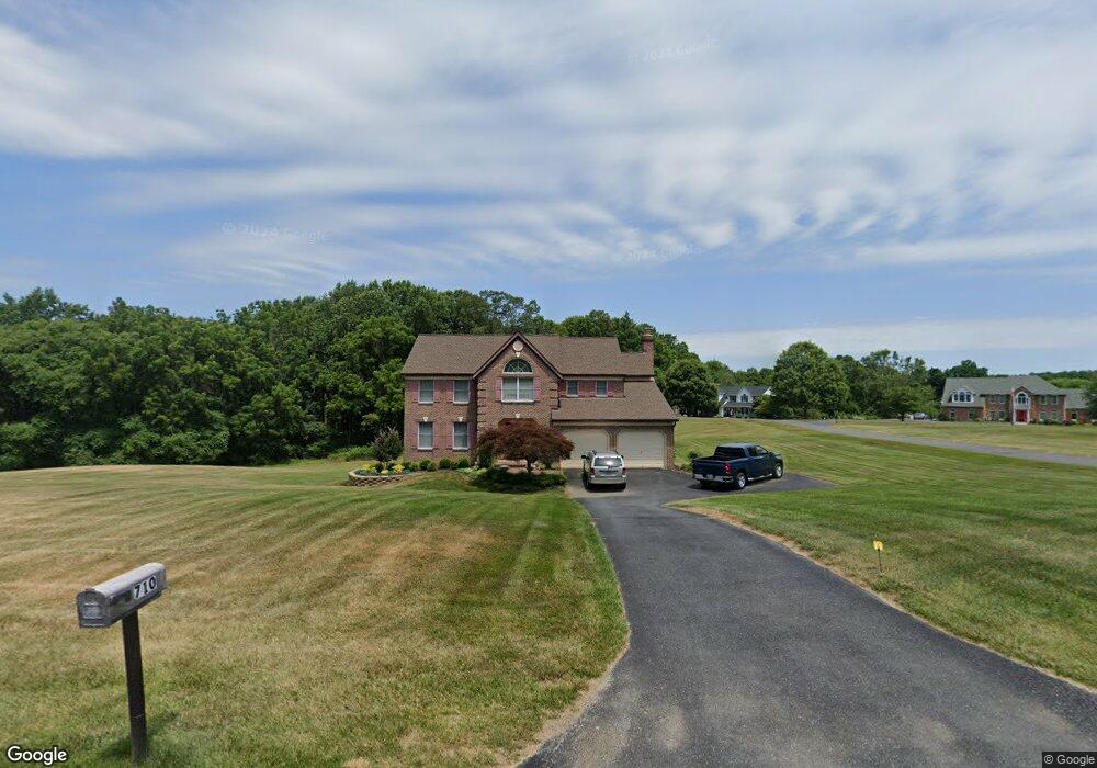
710 Pheasant Dr Forest Hill, MD 21050
Estimated Value: $681,252 - $785,000
Studio
4
Baths
2,796
Sq Ft
$264/Sq Ft
Est. Value
About This Home
This home is located at 710 Pheasant Dr, Forest Hill, MD 21050 and is currently estimated at $738,313, approximately $264 per square foot. 710 Pheasant Dr is a home located in Harford County with nearby schools including Forest Hill Elementary School, North Harford Middle School, and North Harford High School.
Ownership History
Date
Name
Owned For
Owner Type
Purchase Details
Closed on
Mar 18, 1991
Sold by
Stapf Charles Q & Sons Inc
Bought by
Williams Gregory P and Williams Germaine M
Current Estimated Value
Home Financials for this Owner
Home Financials are based on the most recent Mortgage that was taken out on this home.
Original Mortgage
$148,000
Interest Rate
9.5%
Purchase Details
Closed on
Dec 10, 1990
Sold by
Meadowlark Corporation
Bought by
Stapf Charles Q & Sons Inc
Purchase Details
Closed on
Aug 25, 1988
Sold by
Edwards Lester E
Bought by
Meadowlark Corporation
Create a Home Valuation Report for This Property
The Home Valuation Report is an in-depth analysis detailing your home's value as well as a comparison with similar homes in the area
Purchase History
| Date | Buyer | Sale Price | Title Company |
|---|---|---|---|
| Williams Gregory P | $220,000 | -- | |
| Stapf Charles Q & Sons Inc | $62,500 | -- | |
| Meadowlark Corporation | $750,000 | -- |
Source: Public Records
Mortgage History
| Date | Status | Borrower | Loan Amount |
|---|---|---|---|
| Closed | Williams Gregory P | $148,000 |
Source: Public Records
Tax History
| Year | Tax Paid | Tax Assessment Tax Assessment Total Assessment is a certain percentage of the fair market value that is determined by local assessors to be the total taxable value of land and additions on the property. | Land | Improvement |
|---|---|---|---|---|
| 2025 | $5,369 | $513,400 | $136,900 | $376,500 |
| 2024 | $5,082 | $487,067 | $0 | $0 |
| 2023 | $5,082 | $460,733 | $0 | $0 |
| 2022 | $4,735 | $434,400 | $136,900 | $297,500 |
| 2020 | $4,780 | $409,000 | $0 | $0 |
| 2019 | $4,633 | $396,300 | $141,900 | $254,400 |
| 2018 | $4,473 | $385,933 | $0 | $0 |
| 2017 | $4,355 | $396,300 | $0 | $0 |
| 2016 | -- | $365,200 | $0 | $0 |
| 2015 | $4,402 | $365,200 | $0 | $0 |
| 2014 | $4,402 | $365,200 | $0 | $0 |
Source: Public Records
Map
Nearby Homes
- 2948 Grier Nursery Rd
- 106 Bower Ln
- 209 Christopher Rd
- 2804 Rocks Rd
- 2433 Maxa Meadows Ln
- 2419 Edwards Manor Dr
- 2605 Ady Rd
- 2322 Rock Spring Rd
- 332 Ponfield Rd E
- 2229-A Ady Rd
- 2135 Mardic Dr
- 407 Shellbark Ct
- 2033 Mardic Dr
- 2027 Mardic Dr
- 3213 Sudath Ln
- 305 Esther Dr
- 310 Willrich Cir
- 313 Willrich Cir Unit E
- 311 Willrich Cir Unit G
- 2013 Columbine Ln
- 708 Pheasant Dr
- 720 Pheasant Dr
- 711 Pheasant Dr
- 713 Pheasant Dr
- 716 Pheasant Dr
- 718 Pheasant Dr
- 712 Pheasant Dr
- 706 Pheasant Dr
- 722 Pheasant Dr
- 714 Pheasant Dr
- 715 Pheasant Dr
- 704 Pheasant Dr
- 709 Pheasant Dr
- 707 Pheasant Dr
- 717 Pheasant Dr
- 721 Pheasant Dr
- 702 Pheasant Dr
- 723 Pyle Rd
- 724 Pheasant Dr
- 719 Pheasant Dr
Your Personal Tour Guide
Ask me questions while you tour the home.