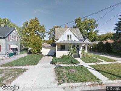
710 Sherman Ave W Fort Atkinson, WI 53538
Estimated Value: $189,679 - $229,000
--
Bed
--
Bath
--
Sq Ft
7,187
Sq Ft Lot
About This Home
This home is located at 710 Sherman Ave W, Fort Atkinson, WI 53538 and is currently estimated at $217,170. 710 Sherman Ave W is a home located in Jefferson County with nearby schools including Barrie Elementary School, Fort Atkinson Middle School, and Fort Atkinson High School.
Ownership History
Date
Name
Owned For
Owner Type
Purchase Details
Closed on
Sep 16, 2009
Sold by
Blomgren Lisa E
Bought by
Fort Community Cu
Current Estimated Value
Purchase Details
Closed on
Nov 13, 2006
Sold by
Splittgerber Charles A
Bought by
Blomgren Lisa
Home Financials for this Owner
Home Financials are based on the most recent Mortgage that was taken out on this home.
Original Mortgage
$96,000
Interest Rate
6.41%
Mortgage Type
Purchase Money Mortgage
Create a Home Valuation Report for This Property
The Home Valuation Report is an in-depth analysis detailing your home's value as well as a comparison with similar homes in the area
Home Values in the Area
Average Home Value in this Area
Purchase History
| Date | Buyer | Sale Price | Title Company |
|---|---|---|---|
| Fort Community Cu | -- | None Available | |
| Blomgren Lisa | -- | None Available |
Source: Public Records
Mortgage History
| Date | Status | Borrower | Loan Amount |
|---|---|---|---|
| Open | Baker Wesly D | $68,600 | |
| Previous Owner | Blomgren Lisa | $96,000 |
Source: Public Records
Tax History Compared to Growth
Tax History
| Year | Tax Paid | Tax Assessment Tax Assessment Total Assessment is a certain percentage of the fair market value that is determined by local assessors to be the total taxable value of land and additions on the property. | Land | Improvement |
|---|---|---|---|---|
| 2024 | $2,881 | $155,700 | $37,500 | $118,200 |
| 2023 | $2,533 | $155,700 | $37,500 | $118,200 |
| 2022 | $2,605 | $105,300 | $25,500 | $79,800 |
| 2021 | $2,291 | $105,300 | $25,500 | $79,800 |
| 2020 | $2,278 | $105,300 | $25,500 | $79,800 |
| 2019 | $2,169 | $105,300 | $25,500 | $79,800 |
| 2018 | $2,100 | $105,300 | $25,500 | $79,800 |
| 2017 | $2,081 | $105,300 | $25,500 | $79,800 |
| 2016 | $2,387 | $115,400 | $23,700 | $91,700 |
| 2015 | $2,512 | $115,400 | $23,700 | $91,700 |
| 2014 | $2,426 | $115,400 | $23,700 | $91,700 |
| 2013 | $2,489 | $115,400 | $23,700 | $91,700 |
Source: Public Records
Map
Nearby Homes
- 817 Van Buren St
- 351 Monroe St
- 916 Madison Ave
- 320 Grove St
- 1222 Sherman Ave W
- 521 Adams St
- 407 Janesville Ave
- 311 N Main St
- 401 S 5th St
- 716 Messmer St
- 100 Edward St Unit 6
- 102 Clarence St
- 101 N 4th St Unit 103
- 1313 Commonwealth Dr
- 233 S Water St E
- 617 Grant St
- 430 Whitewater Ave
- 613 Grove St
- 609 Grove St
- 622 Maple St
- 710 Sherman Ave W
- 203 Jackson St
- 718 Sherman Ave W
- 207 Jackson St
- 213 Jackson St
- 711 Sherman Ave W
- 722 Sherman Ave W
- 125 Jackson St
- 217 Jackson St
- 715 Sherman Ave W
- 208 Council St
- 212 Council St
- 726 Sherman Ave W
- 121 Jackson St
- 614 Sherman Ave W
- 221 Jackson St
- 709 Janette St Unit 711
- 713 Janette St
- 613 Barrie St
- 216 Council St