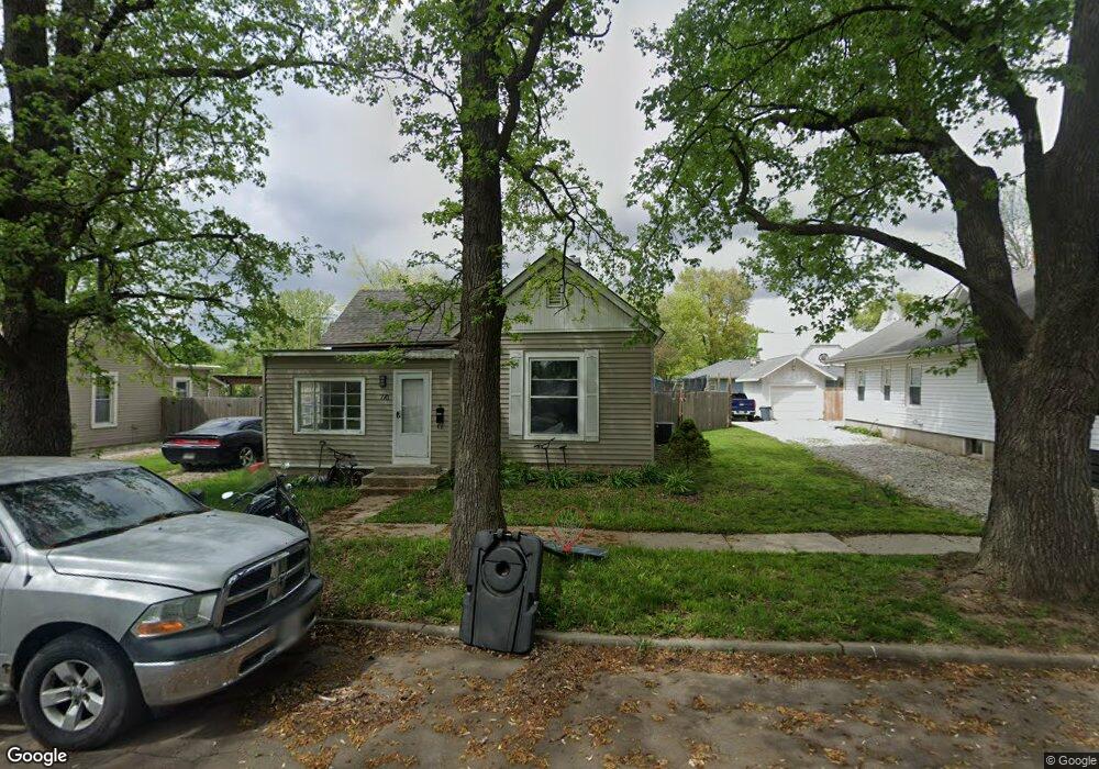
710 W Locust St Plattsburg, MO 64477
Estimated Value: $131,000 - $150,000
3
Beds
1
Bath
1,200
Sq Ft
$117/Sq Ft
Est. Value
About This Home
This home is located at 710 W Locust St, Plattsburg, MO 64477 and is currently estimated at $140,796, approximately $117 per square foot. 710 W Locust St is a home located in Clinton County with nearby schools including Ellis Elementary School, Clinton County R-III Middle School, and Plattsburg High School.
Ownership History
Date
Name
Owned For
Owner Type
Purchase Details
Closed on
Sep 13, 2022
Sold by
Turley Jennifer L and Turley Harold M
Bought by
Gilded Investments Llc
Current Estimated Value
Home Financials for this Owner
Home Financials are based on the most recent Mortgage that was taken out on this home.
Original Mortgage
$62,850
Outstanding Balance
$59,918
Interest Rate
4.99%
Mortgage Type
Credit Line Revolving
Estimated Equity
$80,878
Purchase Details
Closed on
Dec 1, 2008
Bought by
Turley Harold M and Turley Jennifer L
Create a Home Valuation Report for This Property
The Home Valuation Report is an in-depth analysis detailing your home's value as well as a comparison with similar homes in the area
Home Values in the Area
Average Home Value in this Area
Purchase History
| Date | Buyer | Sale Price | Title Company |
|---|---|---|---|
| Gilded Investments Llc | -- | Stewart Title | |
| Turley Harold M | -- | -- |
Source: Public Records
Mortgage History
| Date | Status | Borrower | Loan Amount |
|---|---|---|---|
| Open | Gilded Investments Llc | $62,850 |
Source: Public Records
Tax History Compared to Growth
Tax History
| Year | Tax Paid | Tax Assessment Tax Assessment Total Assessment is a certain percentage of the fair market value that is determined by local assessors to be the total taxable value of land and additions on the property. | Land | Improvement |
|---|---|---|---|---|
| 2023 | $462 | $5,905 | $732 | $5,173 |
| 2022 | $426 | $5,435 | $732 | $4,703 |
| 2021 | $422 | $5,435 | $732 | $4,703 |
| 2020 | $388 | $4,940 | $665 | $4,275 |
| 2019 | $384 | $4,940 | $665 | $4,275 |
| 2018 | $385 | $4,940 | $665 | $4,275 |
| 2017 | $383 | $4,940 | $665 | $4,275 |
| 2016 | $387 | $4,940 | $665 | $4,275 |
| 2013 | -- | $4,940 | $0 | $0 |
Source: Public Records
Map
Nearby Homes
- 604 W Broadway St
- 0 N 7th St
- 205 N Redbird Ln
- 0 Railroad St
- 0 Missouri 116
- 0 116 Hwy Unit 2216369
- 502 A&B 3rd St
- 411 N Main St
- 500 A&B S 3rd St
- 508 S 3rd St
- 110 Carter Dr
- 605 E Concord Dr
- 600 Gary St
- 0 NW Plotsky Ave
- 1306 Minuteman Dr
- 400 Patricia St
- 1507 W Concord Dr
- 1708 Bunker Hill Dr
- 1005 SW Shaver Rd
- 1133 NW Brethren Church Rd
- 708 W Locust St
- 712 W Locust St
- 702 W Locust St
- 703 W Maple St
- 705 W Maple St
- 705 W Maple St
- 705 W Maple St
- 703 W Locust St
- 700 W Locust St
- 713 W Locust St
- 200 N 8th St
- 206 N 8th St
- 701 W Maple St
- 701 W Locust St
- 104 N 8th St
- 610 W Locust St
- 708 W Broadway St
- 615 W Maple St
- 806 W Locust St
- 704 W Broadway St