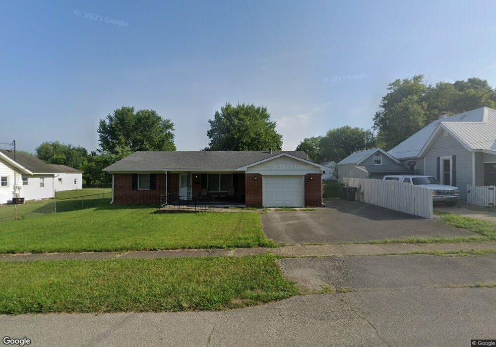
710 Walnut St Whiteland, IN 46184
Estimated Value: $221,000 - $262,000
2
Beds
2
Baths
1,428
Sq Ft
$167/Sq Ft
Est. Value
About This Home
This home is located at 710 Walnut St, Whiteland, IN 46184 and is currently estimated at $239,158, approximately $167 per square foot. 710 Walnut St is a home located in Johnson County with nearby schools including Whiteland Elementary School, Clark-Pleasant Middle School, and Whiteland Community High School.
Ownership History
Date
Name
Owned For
Owner Type
Purchase Details
Closed on
Nov 30, 2010
Sold by
Wiseman Marian A
Bought by
Harmon Micnael W
Current Estimated Value
Home Financials for this Owner
Home Financials are based on the most recent Mortgage that was taken out on this home.
Original Mortgage
$78,800
Outstanding Balance
$52,062
Interest Rate
4.22%
Mortgage Type
New Conventional
Estimated Equity
$187,096
Create a Home Valuation Report for This Property
The Home Valuation Report is an in-depth analysis detailing your home's value as well as a comparison with similar homes in the area
Home Values in the Area
Average Home Value in this Area
Purchase History
| Date | Buyer | Sale Price | Title Company |
|---|---|---|---|
| Harmon Micnael W | -- | None Available |
Source: Public Records
Mortgage History
| Date | Status | Borrower | Loan Amount |
|---|---|---|---|
| Open | Harmon Micnael W | $78,800 |
Source: Public Records
Tax History
| Year | Tax Paid | Tax Assessment Tax Assessment Total Assessment is a certain percentage of the fair market value that is determined by local assessors to be the total taxable value of land and additions on the property. | Land | Improvement |
|---|---|---|---|---|
| 2025 | $1,544 | $187,600 | $39,200 | $148,400 |
| 2024 | $1,544 | $162,300 | $39,200 | $123,100 |
| 2023 | $1,591 | $162,300 | $39,200 | $123,100 |
| 2022 | $1,589 | $154,100 | $31,800 | $122,300 |
| 2021 | $1,252 | $127,800 | $28,300 | $99,500 |
| 2020 | $1,076 | $114,400 | $17,500 | $96,900 |
| 2019 | $934 | $105,000 | $17,500 | $87,500 |
| 2018 | $990 | $103,400 | $13,400 | $90,000 |
| 2017 | $1,038 | $109,200 | $13,400 | $95,800 |
| 2016 | $1,091 | $109,200 | $13,400 | $95,800 |
| 2014 | $923 | $99,000 | $15,300 | $83,700 |
| 2013 | $923 | $98,700 | $15,300 | $83,400 |
Source: Public Records
Map
Nearby Homes
- 650 E Pearl St
- 230 Walker Dr
- 810 Pearl St
- 40 Wilkins St
- 50 Wilkins St
- 70 Wilkins St
- 0 N 200 (Honey Creek Rd ) W Unit MBR21845718
- 830 Saddlebrook Farms Blvd
- 60 Wilkins St
- 131 West St
- 930 Saddlebrook Farms Blvd
- 30 Benfield Dr
- 950 Saddlebrook Farms Blvd
- 120 Ames Dr
- 5503 N 125 E
- 801 Blaine Dr
- 131 Ames Dr
- 140 Ames Dr
- 197 Briar Hill Dr
- 150 Ames Dr
Your Personal Tour Guide
Ask me questions while you tour the home.