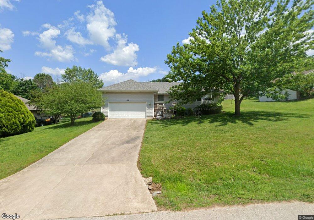
710 Watson St Willard, MO 65781
Estimated Value: $211,968 - $242,000
3
Beds
2
Baths
1,326
Sq Ft
$172/Sq Ft
Est. Value
About This Home
This home is located at 710 Watson St, Willard, MO 65781 and is currently estimated at $228,492, approximately $172 per square foot. 710 Watson St is a home located in Greene County with nearby schools including Willard North Elementary School and Willard Intermediate School North.
Create a Home Valuation Report for This Property
The Home Valuation Report is an in-depth analysis detailing your home's value as well as a comparison with similar homes in the area
Home Values in the Area
Average Home Value in this Area
Tax History
| Year | Tax Paid | Tax Assessment Tax Assessment Total Assessment is a certain percentage of the fair market value that is determined by local assessors to be the total taxable value of land and additions on the property. | Land | Improvement |
|---|---|---|---|---|
| 2025 | $1,426 | $23,660 | $5,700 | $17,960 |
| 2024 | $1,312 | $21,190 | $4,750 | $16,440 |
| 2023 | $1,308 | $21,190 | $4,750 | $16,440 |
| 2022 | $1,152 | $18,960 | $4,750 | $14,210 |
| 2021 | $1,150 | $18,960 | $4,750 | $14,210 |
| 2020 | $1,147 | $18,580 | $4,750 | $13,830 |
| 2019 | $1,141 | $18,580 | $4,750 | $13,830 |
| 2018 | $1,169 | $18,750 | $4,750 | $14,000 |
| 2017 | $1,160 | $17,630 | $4,750 | $12,880 |
| 2016 | $1,088 | $17,630 | $4,750 | $12,880 |
| 2015 | $1,078 | $17,630 | $4,750 | $12,880 |
| 2014 | $1,034 | $16,720 | $4,750 | $11,970 |
Source: Public Records
Map
Nearby Homes
- 708 S Main St
- 117 Ridgeview Dr
- 803 S State Highway Ab
- 000 Mark St
- 825 Pershing St
- 831 Pershing St
- 7400 W Farm Road 84
- 506 S Gauge St
- 716 Daniel Ln
- 305 Hughes Rd
- 308 Hughes Rd
- 408 Pine St
- 464 Baird Ct
- 466 Baird Ct
- 314 S Main St
- 823 Hoffman Hills Blvd
- 462 Baird Ct
- 479 S Summit Dr
- 461 Baird Ct
- 771 S Bent Tree Ave
Your Personal Tour Guide
Ask me questions while you tour the home.