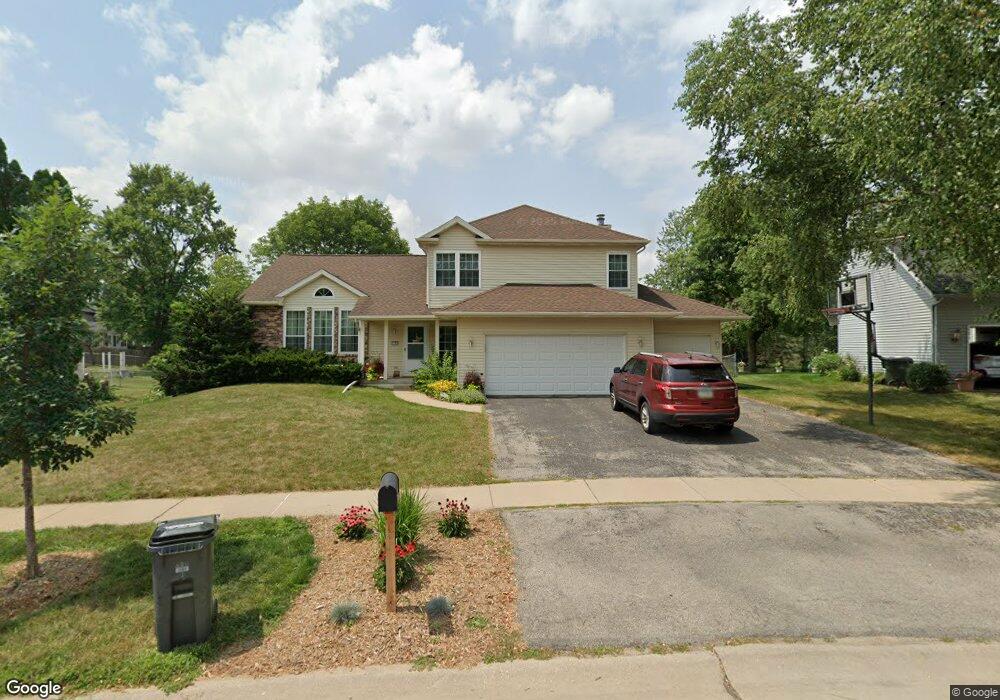
7101 Kent Dr NE Cedar Rapids, IA 52402
Estimated Value: $331,000 - $342,000
3
Beds
5
Baths
2,019
Sq Ft
$167/Sq Ft
Est. Value
About This Home
This home is located at 7101 Kent Dr NE, Cedar Rapids, IA 52402 and is currently estimated at $337,070, approximately $166 per square foot. 7101 Kent Dr NE is a home located in Linn County with nearby schools including Bowman Woods Elementary School, Oak Ridge School, and Linn-Mar High School.
Ownership History
Date
Name
Owned For
Owner Type
Purchase Details
Closed on
May 27, 2004
Sold by
Suri Diane Mcginnis and Suri David Allen
Bought by
Oehler Mark B and Oehler Lynn M
Current Estimated Value
Home Financials for this Owner
Home Financials are based on the most recent Mortgage that was taken out on this home.
Original Mortgage
$169,600
Outstanding Balance
$82,851
Interest Rate
5.99%
Mortgage Type
Unknown
Estimated Equity
$254,219
Create a Home Valuation Report for This Property
The Home Valuation Report is an in-depth analysis detailing your home's value as well as a comparison with similar homes in the area
Home Values in the Area
Average Home Value in this Area
Purchase History
| Date | Buyer | Sale Price | Title Company |
|---|---|---|---|
| Oehler Mark B | $211,500 | -- |
Source: Public Records
Mortgage History
| Date | Status | Borrower | Loan Amount |
|---|---|---|---|
| Open | Oehler Mark B | $169,600 |
Source: Public Records
Tax History Compared to Growth
Tax History
| Year | Tax Paid | Tax Assessment Tax Assessment Total Assessment is a certain percentage of the fair market value that is determined by local assessors to be the total taxable value of land and additions on the property. | Land | Improvement |
|---|---|---|---|---|
| 2025 | $5,706 | $308,900 | $71,300 | $237,600 |
| 2024 | $5,582 | $301,700 | $71,300 | $230,400 |
| 2023 | $5,582 | $301,700 | $71,300 | $230,400 |
| 2022 | $5,118 | $253,100 | $64,800 | $188,300 |
| 2021 | $5,076 | $240,100 | $60,500 | $179,600 |
| 2020 | $5,076 | $224,800 | $49,700 | $175,100 |
| 2019 | $4,786 | $214,500 | $49,700 | $164,800 |
| 2018 | $4,576 | $214,500 | $49,700 | $164,800 |
| 2017 | $4,666 | $212,100 | $49,700 | $162,400 |
| 2016 | $4,621 | $206,600 | $49,700 | $156,900 |
| 2015 | $4,507 | $201,288 | $30,234 | $171,054 |
| 2014 | $4,312 | $201,288 | $30,234 | $171,054 |
| 2013 | $4,164 | $201,288 | $30,234 | $171,054 |
Source: Public Records
Map
Nearby Homes
- 342 Cambridge Dr NE
- 7320 Hampshire Dr NE
- 6726 Bowman Ln NE
- 316 Sussex Dr NE
- 1151 Plumwood Ct NE
- 3310 Timber Ridge Ct
- 1000 Hampshire Cir
- 980 Hampshire Cir
- 960 Hampshire Cir
- 948 Hampshire Cir
- 916 Hampshire Cir
- 2140 Newcastle Rd
- 932 Prescott Ln
- 7415 Pin Tail Dr NE
- 884 Hampshire Cir
- 1150 Bedford Ct
- 862 Hampshire Cir
- 819 Hampshire Cir
- 820 Hampshire Cir
- 750 Hampshire Dr
- 7105 Kent Dr NE
- 358 Cambridge Dr NE
- 356 Cambridge Dr NE
- 360 Cambridge Dr NE
- 359 Willshire Ct NE
- 357 Willshire Ct NE
- 362 Cambridge Dr NE
- 7104 Kent Dr NE
- 346 Cambridge Dr NE
- 358 Willshire Ct NE
- 364 Cambridge Dr NE
- 7205 Hampshire Dr NE
- 7201 Hampshire Dr NE
- 7209 Hampshire Dr NE
- 7013 Kent Dr NE
- 357 Cambridge Dr NE
- 7213 Hampshire Dr NE
- 361 Willshire Ct NE
- 359 Cambridge Dr NE
- 340 Cambridge Dr NE