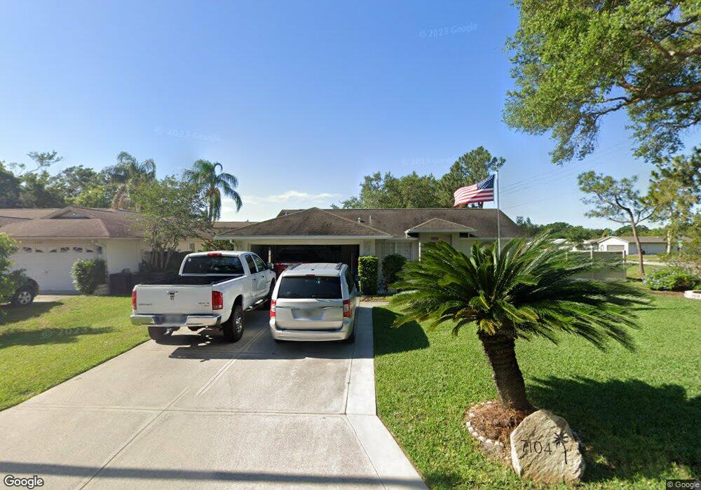
7104 Queen Palm Cir Sarasota, FL 34243
Estimated Value: $338,000 - $396,000
3
Beds
2
Baths
1,418
Sq Ft
$256/Sq Ft
Est. Value
About This Home
This home is located at 7104 Queen Palm Cir, Sarasota, FL 34243 and is currently estimated at $363,160, approximately $256 per square foot. 7104 Queen Palm Cir is a home located in Manatee County with nearby schools including Florine J. Abel Elementary School, Electa Lee Magnet Middle School, and Southeast High School.
Ownership History
Date
Name
Owned For
Owner Type
Purchase Details
Closed on
Jun 22, 2021
Sold by
Maki Frank A and Maki Susan A
Bought by
Maki Frank A and Maki Susan A
Current Estimated Value
Purchase Details
Closed on
Apr 3, 2000
Sold by
Mitchell Jacqueline A and Starr Jacqueline
Bought by
Maki Frank A and Maki Susan A
Home Financials for this Owner
Home Financials are based on the most recent Mortgage that was taken out on this home.
Original Mortgage
$104,000
Outstanding Balance
$35,912
Interest Rate
8.34%
Estimated Equity
$327,248
Purchase Details
Closed on
Oct 10, 1998
Sold by
Galt Starr Jacqueline and Galt Starr Charles
Bought by
Starr Jacqueline
Create a Home Valuation Report for This Property
The Home Valuation Report is an in-depth analysis detailing your home's value as well as a comparison with similar homes in the area
Home Values in the Area
Average Home Value in this Area
Purchase History
| Date | Buyer | Sale Price | Title Company |
|---|---|---|---|
| Maki Frank A | -- | Accommodation | |
| Maki Frank A | $130,000 | -- | |
| Starr Jacqueline | -- | -- |
Source: Public Records
Mortgage History
| Date | Status | Borrower | Loan Amount |
|---|---|---|---|
| Open | Maki Frank A | $104,000 |
Source: Public Records
Tax History Compared to Growth
Tax History
| Year | Tax Paid | Tax Assessment Tax Assessment Total Assessment is a certain percentage of the fair market value that is determined by local assessors to be the total taxable value of land and additions on the property. | Land | Improvement |
|---|---|---|---|---|
| 2025 | $4,216 | $282,269 | -- | -- |
| 2024 | $4,216 | $292,020 | $45,900 | $246,120 |
| 2023 | $4,116 | $295,932 | $45,900 | $250,032 |
| 2022 | $3,719 | $259,698 | $45,000 | $214,698 |
| 2021 | $3,079 | $192,794 | $45,000 | $147,794 |
| 2020 | $3,153 | $188,554 | $45,000 | $143,554 |
| 2019 | $3,039 | $179,926 | $40,000 | $139,926 |
| 2018 | $2,843 | $165,987 | $30,000 | $135,987 |
| 2017 | $2,724 | $175,002 | $0 | $0 |
| 2016 | $2,587 | $166,052 | $0 | $0 |
| 2015 | $2,111 | $144,448 | $0 | $0 |
| 2014 | $2,111 | $122,688 | $0 | $0 |
| 2013 | $1,919 | $109,543 | $24,050 | $85,493 |
Source: Public Records
Map
Nearby Homes
- 911 Wee Burn Place
- 7019 8th Ct E
- 813 Cypress Wood Ln
- 914 Plum Tree Ln
- 6860 Whitman Ct Unit 32B
- 927 Byron Ln Unit 13-B
- 7205 Alderwood Dr
- 1052 Longfellow Cir
- 940 Byron Ct Unit 17
- 1219 70th Dr E
- 1112 Longfellow Rd
- 1147 Longfellow Rd Unit 157C
- 1143 Longfellow Rd
- 1190 Longfellow Way Unit 135-C
- 530 Saint Andrews Dr
- 1125 Longfellow Way Unit 125B
- 1116 Danny Dr
- 7222 Meadowbrook Dr
- 1117 Angela Maria Rd
- 7304 Claries Dr
- 7106 Queen Palm Cir
- 907 Wee Burn Place
- 7105 Queen Palm Cir
- 903 Wee Burn Place
- 7107 Queen Palm Cir
- 7110 Queen Palm Cir
- 861 Wee Burn St
- 902 Wee Burn Place
- 7111 Queen Palm Cir
- 915 Wee Burn Place
- 857 Wee Burn St
- 7120 Pennsylvania Ave
- 7023 8th Ct E
- 7112 Queen Palm Cir
- 906 Wee Burn Place
- 906 Place
- 906 70th Dr E
- 7113 Queen Palm Cir
- 919 Wee Burn Place
- 858 Wee Burn St