Estimated Value: $449,000 - $711,000
4
Beds
4
Baths
2,831
Sq Ft
$191/Sq Ft
Est. Value
About This Home
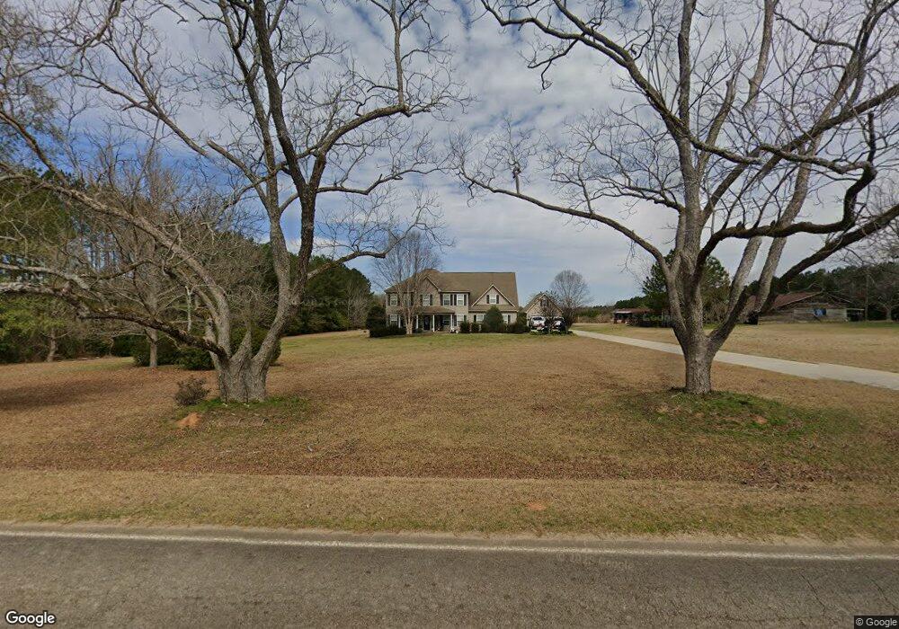
This home is located at 7109 Buckeye Rd, Perry, GA 31069 and is currently estimated at $540,894, approximately $191 per square foot. 7109 Buckeye Rd is a home located in Peach County with nearby schools including Kay Road Elementary School, Fort Valley Middle School, and Peach County High School.
Ownership History
Date
Name
Owned For
Owner Type
Purchase Details
Closed on
Feb 24, 2017
Sold by
Padgett Robert A
Bought by
Padgett Robert A and Padgett Christy S
Current Estimated Value
Home Financials for this Owner
Home Financials are based on the most recent Mortgage that was taken out on this home.
Original Mortgage
$214,489
Outstanding Balance
$178,260
Interest Rate
4.25%
Mortgage Type
FHA
Estimated Equity
$362,634
Purchase Details
Closed on
Dec 30, 2005
Sold by
Padgett Patsy V
Bought by
Padgett Robert A and Padgett Tiffany
Purchase Details
Closed on
Feb 24, 2004
Sold by
Padgett Henry A
Bought by
Padgett Robert Alan
Create a Home Valuation Report for This Property
The Home Valuation Report is an in-depth analysis detailing your home's value as well as a comparison with similar homes in the area
Purchase History
| Date | Buyer | Sale Price | Title Company |
|---|---|---|---|
| Padgett Robert A | -- | -- | |
| Padgett Robert A | -- | -- | |
| Padgett Robert A | -- | -- | |
| Padgett Robert Alan | -- | -- |
Source: Public Records
Mortgage History
| Date | Status | Borrower | Loan Amount |
|---|---|---|---|
| Open | Padgett Robert A | $214,489 |
Source: Public Records
Tax History
| Year | Tax Paid | Tax Assessment Tax Assessment Total Assessment is a certain percentage of the fair market value that is determined by local assessors to be the total taxable value of land and additions on the property. | Land | Improvement |
|---|---|---|---|---|
| 2025 | $4,238 | $158,720 | $15,080 | $143,640 |
| 2024 | $4,364 | $157,880 | $15,080 | $142,800 |
| 2023 | $3,628 | $129,200 | $10,040 | $119,160 |
| 2022 | $3,382 | $120,040 | $10,040 | $110,000 |
| 2021 | $2,917 | $88,880 | $10,040 | $78,840 |
| 2020 | $3,185 | $97,480 | $10,040 | $87,440 |
| 2019 | $3,101 | $94,320 | $10,040 | $84,280 |
| 2018 | $3,115 | $94,320 | $10,040 | $84,280 |
| 2017 | $3,130 | $94,320 | $10,040 | $84,280 |
| 2016 | $3,135 | $94,880 | $10,600 | $84,280 |
| 2015 | -- | $92,920 | $8,640 | $84,280 |
| 2014 | $3,082 | $92,920 | $8,640 | $84,280 |
| 2013 | -- | $92,920 | $8,640 | $84,280 |
Source: Public Records
Map
Nearby Homes
- 0 Todd Rd Unit 253674
- 309 Bermuda Ridge
- 105 Senimor Ct
- 108 Chimney Rock Rd
- 501 Longhorn Trail
- 204 Greylock Dr
- 103 Denali Dr
- 124 Lake Lillian Dr
- 624 Wantland Rd
- 2327 Us Hwy 41
- 0 Airport Rd Unit 250304
- 2XX Airport Rd
- 150 MacK Thompson Rd
- 502 Arons Ct
- 0 MacK Thompson Rd Unit 253661
- 149 MacK Thompson Road Common
- 105 Overton Dr
- 101 Overton Dr
- 104 Overton Dr
- 107 Waldorf Dr
- 7199 Buckeye Rd
- 7221 Buckeye Rd
- 7287 Buckeye Rd
- 6914 Buckeye Rd
- 7314 Buckeye Rd
- 6836 Buckeye Rd
- 6851 Buckeye Rd
- 6793 Buckeye Rd
- 6887 Buckeye Rd
- 7409 Buckeye Rd
- 7137 Buckeye Rd
- 0 Buckeye Rd Unit PAR C 3185634
- 0 Buckeye Rd Unit L2A,AC9000 7439580
- 0 Buckeye Rd Unit L2b 8048500
- 0 Buckeye Rd Unit 8065245
- 0 Buckeye Rd Unit 214166
- 0 Buckeye Rd Unit Tract A 8079804
- 0 Buckeye Rd Unit M136761
- 0 Buckeye Rd Unit M137165
- 0 Buckeye Rd Unit 8743545
Your Personal Tour Guide
Ask me questions while you tour the home.