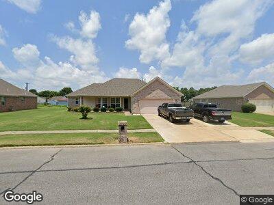
711 Auburn Ave West Memphis, AR 72301
Estimated Value: $136,000 - $205,000
3
Beds
2
Baths
1,454
Sq Ft
$111/Sq Ft
Est. Value
About This Home
This home is located at 711 Auburn Ave, West Memphis, AR 72301 and is currently estimated at $161,771, approximately $111 per square foot. 711 Auburn Ave is a home located in Crittenden County with nearby schools including Faulk Elementary School, Wonder Junior High School, and The Academies of West Memphis Charter School.
Ownership History
Date
Name
Owned For
Owner Type
Purchase Details
Closed on
Jan 10, 2022
Sold by
Louise Edmonson
Bought by
Louise Rucker Trust
Current Estimated Value
Purchase Details
Closed on
Dec 16, 2021
Sold by
Rucker Louise and Rucker Jessie
Bought by
Rucker Louise and Louise Rucker Living Trust
Purchase Details
Closed on
Mar 5, 2013
Bought by
Rucker Jessie
Purchase Details
Closed on
Mar 30, 2007
Sold by
Not Provided
Bought by
Sibbitt Camille
Create a Home Valuation Report for This Property
The Home Valuation Report is an in-depth analysis detailing your home's value as well as a comparison with similar homes in the area
Home Values in the Area
Average Home Value in this Area
Purchase History
| Date | Buyer | Sale Price | Title Company |
|---|---|---|---|
| Louise Rucker Trust | -- | None Listed On Document | |
| Rucker Louise | -- | None Available | |
| Rucker Jessie | $84,000 | -- | |
| Sibbitt Camille | $123,000 | -- |
Source: Public Records
Tax History Compared to Growth
Tax History
| Year | Tax Paid | Tax Assessment Tax Assessment Total Assessment is a certain percentage of the fair market value that is determined by local assessors to be the total taxable value of land and additions on the property. | Land | Improvement |
|---|---|---|---|---|
| 2024 | $734 | $24,090 | $3,200 | $20,890 |
| 2023 | $734 | $24,090 | $3,200 | $20,890 |
| 2022 | $784 | $24,090 | $3,200 | $20,890 |
| 2021 | $784 | $24,090 | $3,200 | $20,890 |
| 2020 | $1,091 | $24,090 | $3,200 | $20,890 |
| 2019 | $1,112 | $29,430 | $3,200 | $26,230 |
| 2018 | $844 | $29,430 | $3,200 | $26,230 |
| 2017 | $844 | $29,430 | $3,200 | $26,230 |
| 2016 | $1,116 | $29,430 | $3,200 | $26,230 |
| 2015 | $847 | $29,430 | $3,200 | $26,230 |
| 2014 | $791 | $27,930 | $3,200 | $24,730 |
Source: Public Records
Map
Nearby Homes
- 101 N Stonebridge Cove
- 506 Princeton St
- 503 Tulane Dr
- 402 Oxford St
- 400 Oxford St
- 815 Maple Dr
- 1005 Normandy Dr
- 209 Kingsway Dr
- 406 W Bond Ave
- 300 Georgetown Dr
- 511 W Cooper Ave
- 501 W Cooper Ave
- 511 Roosevelt Ave
- 908 W Barton Ave
- 807 W Barton Ave
- 607 W Barton Ave
- 502 W Barton Ave
- 901 W Barton Ave
- 408 Brentwood Dr
- 907 Rosewood Dr