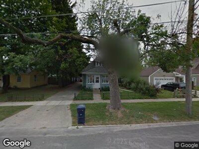
711 Bluff City Blvd Elgin, IL 60120
Southeast Elgin NeighborhoodEstimated Value: $213,846 - $241,000
3
Beds
1
Bath
880
Sq Ft
$262/Sq Ft
Est. Value
About This Home
This home is located at 711 Bluff City Blvd, Elgin, IL 60120 and is currently estimated at $230,962, approximately $262 per square foot. 711 Bluff City Blvd is a home located in Kane County with nearby schools including Nature Ridge Elementary School, Kenyon Woods Middle School, and South Elgin High School.
Ownership History
Date
Name
Owned For
Owner Type
Purchase Details
Closed on
Jan 3, 2003
Sold by
Ticknor Jon
Bought by
Reiman Steven W and Reiman Martha A
Current Estimated Value
Home Financials for this Owner
Home Financials are based on the most recent Mortgage that was taken out on this home.
Original Mortgage
$81,500
Interest Rate
6%
Mortgage Type
Purchase Money Mortgage
Create a Home Valuation Report for This Property
The Home Valuation Report is an in-depth analysis detailing your home's value as well as a comparison with similar homes in the area
Home Values in the Area
Average Home Value in this Area
Purchase History
| Date | Buyer | Sale Price | Title Company |
|---|---|---|---|
| Reiman Steven W | $83,000 | Chicago Title Insurance Co |
Source: Public Records
Mortgage History
| Date | Status | Borrower | Loan Amount |
|---|---|---|---|
| Open | Reiman Steve W | $40,000 | |
| Closed | Reiman Steve W | $10,000 | |
| Previous Owner | Reiman Steven W | $81,500 |
Source: Public Records
Tax History Compared to Growth
Tax History
| Year | Tax Paid | Tax Assessment Tax Assessment Total Assessment is a certain percentage of the fair market value that is determined by local assessors to be the total taxable value of land and additions on the property. | Land | Improvement |
|---|---|---|---|---|
| 2023 | $2,663 | $47,234 | $11,412 | $35,822 |
| 2022 | $2,781 | $43,069 | $10,406 | $32,663 |
| 2021 | $2,611 | $40,267 | $9,729 | $30,538 |
| 2020 | $2,376 | $37,053 | $9,288 | $27,765 |
| 2019 | $2,269 | $35,295 | $8,847 | $26,448 |
| 2018 | $1,848 | $29,592 | $8,334 | $21,258 |
| 2017 | $1,746 | $27,975 | $7,879 | $20,096 |
| 2016 | $2,768 | $25,954 | $7,310 | $18,644 |
| 2015 | -- | $23,789 | $6,700 | $17,089 |
| 2014 | -- | $23,495 | $6,617 | $16,878 |
| 2013 | -- | $27,172 | $6,792 | $20,380 |
Source: Public Records
Map
Nearby Homes
- 470 Dixon Ave
- 414 Dwight St
- 637 Grace St
- 360 Hastings St
- 539 Cleveland Ave
- 616 Kirk Ave
- 638 Virgil Ave
- 364 Bent St
- 440 Raymond St
- 618 Hampton Cir
- 1609 Deer Pointe Dr
- 301 Illinois Ave
- 662 Dover Dr
- 306 S Liberty St
- 155 Lord St
- 851 Mackey Ln
- 422 Ryerson Ave
- 1023 Berkshire Ct Unit D
- 50 S State St
- 0 Riverview Dr
- 711 Bluff City Blvd
- 703 Bluff City Blvd
- 863 Lavoie Ave
- 860 Cookane Ave
- 862 Cookane Ave
- 867 Lavoie Ave
- 725 Bluff City Blvd
- 866 Cookane Ave
- 873 Lavoie Ave
- 675 Bluff City Blvd
- 870 Cookane Ave
- 714 Bluff City Blvd
- 708 Bluff City Blvd
- 877 Lavoie Ave
- 720 Bluff City Blvd Unit 22
- 702 Bluff City Blvd
- 874 Cookane Ave
- 671 Bluff City Blvd
- 854 Lavoie Ave
- 726 Bluff City Blvd