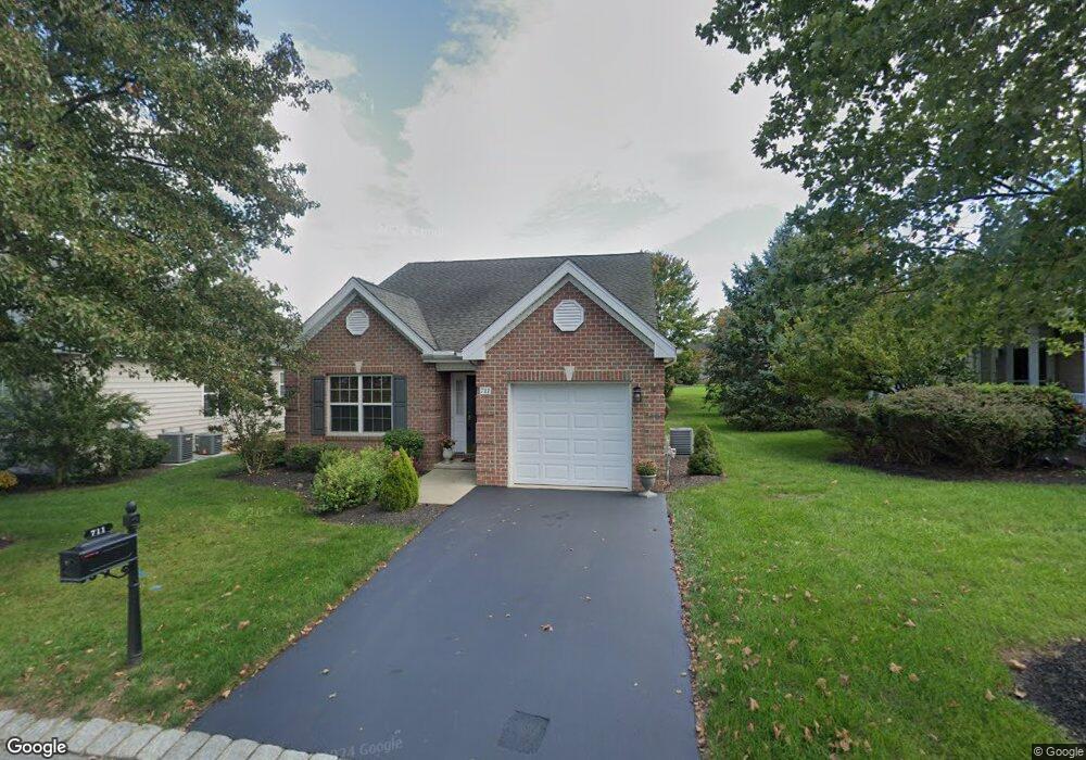
711 Hawthorne Ln Unit 121 Mount Joy, PA 17552
Estimated Value: $378,000 - $388,000
2
Beds
2
Baths
1,527
Sq Ft
$250/Sq Ft
Est. Value
About This Home
This home is located at 711 Hawthorne Ln Unit 121, Mount Joy, PA 17552 and is currently estimated at $381,381, approximately $249 per square foot. 711 Hawthorne Ln Unit 121 is a home located in Lancaster County with nearby schools including Manheim Central Senior High School and Sporting Hill Christian School.
Ownership History
Date
Name
Owned For
Owner Type
Purchase Details
Closed on
Feb 26, 2025
Sold by
Legath Vicki L and Miller Jerry M
Bought by
Mccauley Wendy
Current Estimated Value
Purchase Details
Closed on
Jan 26, 2024
Sold by
Parker Shirley A
Bought by
Legath Vicki L and Binford Lesli M
Purchase Details
Closed on
Jun 22, 2010
Sold by
Kessler Barbara
Bought by
Parker Shirley A
Purchase Details
Closed on
Mar 31, 2009
Sold by
K Hovnanian At Rapho Llc
Bought by
Kessler Barbara
Home Financials for this Owner
Home Financials are based on the most recent Mortgage that was taken out on this home.
Original Mortgage
$120,000
Interest Rate
5.02%
Mortgage Type
Purchase Money Mortgage
Create a Home Valuation Report for This Property
The Home Valuation Report is an in-depth analysis detailing your home's value as well as a comparison with similar homes in the area
Home Values in the Area
Average Home Value in this Area
Purchase History
| Date | Buyer | Sale Price | Title Company |
|---|---|---|---|
| Mccauley Wendy | $375,000 | None Listed On Document | |
| Legath Vicki L | -- | None Listed On Document | |
| Parker Shirley A | $219,000 | None Available | |
| Kessler Barbara | $217,908 | Eastern Title Agency Inc |
Source: Public Records
Mortgage History
| Date | Status | Borrower | Loan Amount |
|---|---|---|---|
| Previous Owner | Kessler Barbara | $120,000 |
Source: Public Records
Tax History Compared to Growth
Tax History
| Year | Tax Paid | Tax Assessment Tax Assessment Total Assessment is a certain percentage of the fair market value that is determined by local assessors to be the total taxable value of land and additions on the property. | Land | Improvement |
|---|---|---|---|---|
| 2025 | $4,189 | $202,300 | -- | $202,300 |
| 2024 | $4,189 | $202,300 | -- | $202,300 |
| 2023 | $4,102 | $202,300 | $0 | $202,300 |
| 2022 | $3,947 | $202,300 | $0 | $202,300 |
| 2021 | $3,832 | $202,300 | $0 | $202,300 |
| 2020 | $3,832 | $202,300 | $0 | $202,300 |
| 2019 | $3,765 | $202,300 | $0 | $202,300 |
| 2018 | $2,783 | $202,300 | $0 | $202,300 |
| 2017 | $4,014 | $172,600 | $0 | $172,600 |
| 2016 | $4,014 | $172,600 | $0 | $172,600 |
| 2015 | $947 | $172,600 | $0 | $172,600 |
| 2014 | $2,845 | $172,600 | $0 | $172,600 |
Source: Public Records
Map
Nearby Homes
- 631 Thoreau Dr
- 1393 James Way
- 5315 Oak Leaf Dr
- 1400 Fieldstone Dr
- 1334 Woodcrest Ct
- 5179 Oak Leaf Dr
- 102 Lancaster Estate
- 1227 Cantebury Dr
- 0 N Strickler Rd Unit PALA2071458
- 0 N Strickler Rd Unit PALA2071460
- 114 Ridgewood Manor
- 133 Ridgewood Manor
- 216 Park Ave
- 400 E Main St
- 201 S Barbara St
- 101 & 103 W Main St
- 65 W Donegal St
- 0 Back Run Rd
- 325 Deerfield Dr
- 146 New Haven St
- 715 Hawthorne Ln
- 707 Hawthorne Ln
- 703 Hawthorne Ln
- 1645 Emerson Dr
- 1651 Emerson Dr
- 1641 Emerson Dr
- 688 Thoreau Dr Unit 130
- 692 Thoreau Dr
- 685 Alcott Dr Unit 118
- 698 Thoreau Dr
- 684 Thoreau Dr Unit 131
- 706 Thoreau Dr
- 677 Alcott Dr
- 678 Thoreau Dr Unit 132
- 710 Thoreau Dr
- 690 Hawthorne Ln Unit 67
- 674 Thoreau Dr Unit 133
- 673 Alcott Dr Unit 116
- 687 Hawthorne Ln
- 684 Alcott Dr Unit 96