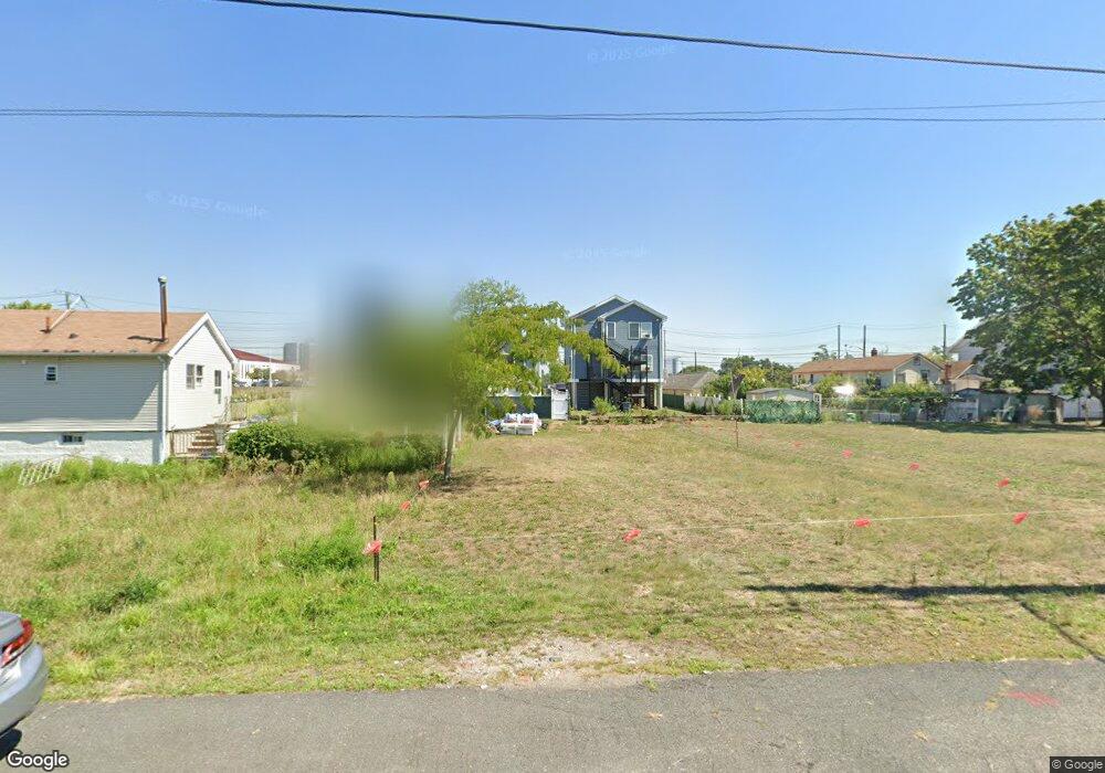
711 Liberty Ave Staten Island, NY 10305
Ocean Breeze NeighborhoodEstimated Value: $52,000 - $129,000
--
Bed
4
Baths
812
Sq Ft
$111/Sq Ft
Est. Value
About This Home
This home is located at 711 Liberty Ave, Staten Island, NY 10305 and is currently estimated at $90,500, approximately $111 per square foot. 711 Liberty Ave is a home located in Richmond County with nearby schools including P.S. 052 John C. Thompson, Is 2 George L Egbert, and New Dorp High School.
Ownership History
Date
Name
Owned For
Owner Type
Purchase Details
Closed on
May 24, 2022
Sold by
Housing Trust Fund Corporation
Bought by
Nikijeva Liliya and Nikijeva Musa
Current Estimated Value
Purchase Details
Closed on
Nov 18, 2014
Sold by
Carrotozzolo Doris
Bought by
Housing Trust Fund Corporation
Purchase Details
Closed on
Nov 11, 2003
Sold by
Carrotozzolo Vincent
Bought by
Carrotozzolo Doris
Purchase Details
Closed on
May 31, 1954
Sold by
The City Of New York
Bought by
Carrotozzolo Vincent
Create a Home Valuation Report for This Property
The Home Valuation Report is an in-depth analysis detailing your home's value as well as a comparison with similar homes in the area
Home Values in the Area
Average Home Value in this Area
Purchase History
| Date | Buyer | Sale Price | Title Company |
|---|---|---|---|
| Nikijeva Liliya | $18,000 | Chicago Title | |
| Housing Trust Fund Corporation | -- | Fidelity Natl Title Ins Co | |
| Carrotozzolo Doris | -- | Washington Title Ins Co | |
| Carrotozzolo Vincent | $650 | None Available |
Source: Public Records
Tax History Compared to Growth
Tax History
| Year | Tax Paid | Tax Assessment Tax Assessment Total Assessment is a certain percentage of the fair market value that is determined by local assessors to be the total taxable value of land and additions on the property. | Land | Improvement |
|---|---|---|---|---|
| 2025 | $1,839 | $12,000 | $9,707 | $2,293 |
| 2024 | $1,839 | $10,980 | $9,158 | $1,822 |
| 2023 | $1,755 | $8,640 | $8,640 | $0 |
| 2022 | $0 | $11,640 | $11,640 | $0 |
| 2021 | $0 | $10,140 | $10,140 | $0 |
| 2020 | $0 | $8,820 | $8,820 | $0 |
| 2019 | $0 | $7,680 | $7,680 | $0 |
| 2018 | $1,468 | $7,200 | $7,200 | $0 |
| 2017 | $0 | $7,695 | $5,665 | $2,030 |
| 2016 | -- | $7,260 | $7,200 | $60 |
| 2015 | $549 | $14,230 | $6,675 | $7,555 |
| 2014 | $549 | $12,873 | $8,220 | $4,653 |
Source: Public Records
Map
Nearby Homes
- 762 Seaview Ave
- 0 Quincy Ave
- 000 Quincy Ave
- 431 Patterson Ave
- 602 Seaview Ave
- 795 Father Capodanno Blvd
- 797 Father Capodanno Blvd
- 799 Father Capodanno Blvd
- 498 Dongan Hills Ave
- 521 Buel Ave
- 517 Buel Ave
- 473 Dongan Hills Ave
- 467 Dongan Hills Ave
- 9 Iroquois St
- 197 Slater Blvd
- 929 Father Capodanno Blvd
- 00 Baden Place
- 0 Baden Place Unit 2503276
- 188 Graham Blvd Unit B
- 428 Cromwell Ave
- 715 Liberty Ave
- 578 Quincy Ave
- 717 Liberty Ave
- 719 Liberty Ave
- 572 Quincy Ave
- 622 Quincy Ave
- 622 Quincy Ave
- 721 Liberty Ave
- 568 Quincy Ave
- 742 Seaview Ave Unit 2
- 742 Seaview Ave
- 576 Quincy Ave
- 738 Seaview Ave
- 723 Liberty Ave
- 736 Seaview Ave
- 748 Seaview Ave
- 725 Liberty Ave
- 750 Seaview Ave
- 750 Seaview Ave Unit 1
- 730 Seaview Ave Unit 732