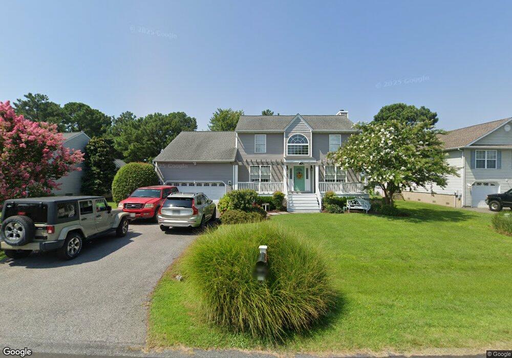
711 Long Point Rd Grasonville, MD 21638
Kent Narrows NeighborhoodEstimated Value: $691,926 - $892,000
Studio
3
Baths
2,494
Sq Ft
$329/Sq Ft
Est. Value
About This Home
This home is located at 711 Long Point Rd, Grasonville, MD 21638 and is currently estimated at $821,482, approximately $329 per square foot. 711 Long Point Rd is a home located in Queen Anne's County with nearby schools including Grasonville Elementary School, Stevensville Middle School, and Kent Island High School.
Ownership History
Date
Name
Owned For
Owner Type
Purchase Details
Closed on
Apr 18, 1996
Sold by
Butler Sheila A Diane M
Bought by
Goldsborough N Randolph
Current Estimated Value
Purchase Details
Closed on
Feb 9, 1996
Sold by
Bay Country Land Company
Bought by
Womack Douglas M F and Womack Penny C
Purchase Details
Closed on
Jan 25, 1996
Sold by
Bridge Pointe General Partnership
Bought by
Wolf Ruth Helen
Purchase Details
Closed on
Aug 3, 1995
Sold by
Long Point Partnership
Bought by
Bay Country Land Company
Create a Home Valuation Report for This Property
The Home Valuation Report is an in-depth analysis detailing your home's value as well as a comparison with similar homes in the area
Home Values in the Area
Average Home Value in this Area
Purchase History
| Date | Buyer | Sale Price | Title Company |
|---|---|---|---|
| Goldsborough N Randolph | $4,400 | -- | |
| Womack Douglas M F | $227,550 | -- | |
| Wolf Ruth Helen | $136,790 | -- | |
| Bay Country Land Company | $72,900 | -- |
Source: Public Records
Mortgage History
| Date | Status | Borrower | Loan Amount |
|---|---|---|---|
| Closed | Bay Country Land Company | -- |
Source: Public Records
Tax History
| Year | Tax Paid | Tax Assessment Tax Assessment Total Assessment is a certain percentage of the fair market value that is determined by local assessors to be the total taxable value of land and additions on the property. | Land | Improvement |
|---|---|---|---|---|
| 2025 | $4,208 | $563,033 | $0 | $0 |
| 2024 | $4,039 | $537,000 | $294,500 | $242,500 |
| 2023 | $4,660 | $507,067 | $0 | $0 |
| 2022 | $4,432 | $477,133 | $0 | $0 |
| 2021 | $4,289 | $447,200 | $201,200 | $246,000 |
| 2020 | $4,289 | $447,200 | $201,200 | $246,000 |
| 2019 | $4,289 | $447,200 | $201,200 | $246,000 |
| 2018 | $4,306 | $449,000 | $201,200 | $247,800 |
| 2017 | $4,194 | $437,267 | $0 | $0 |
| 2016 | -- | $425,533 | $0 | $0 |
| 2015 | $2,102 | $413,800 | $0 | $0 |
| 2014 | $2,102 | $413,800 | $0 | $0 |
Source: Public Records
Map
Nearby Homes
- 902 Long Point Rd
- 111 Bay View
- 1017 Long Point Rd
- 3729 Main St
- 111 Beach Harbor Rd
- 959 Chester River Dr
- 436 Oyster Cove Dr
- 110 Channel Marker Way Unit 203
- 111 Saddler Way Unit 46F
- 346 Narrows Pointe Dr
- 426 Narrows Pointe Dr
- 522 Narrows Pointe Dr
- 715 Winchester Creek Rd
- 648 Chester River Beach Rd
- 0 Vfw Ave Unit MDQA2014970
- 0 Vfw Ave Unit MDQA2014774
- 213 Clevenger Rd
- 4604 Main St
- 5H Piney Narrows Rd
- 105 Port Ct
- 713 Long Point Rd
- 709 Long Point Rd
- 715 Long Point Rd
- 707 Long Point Rd
- 608 Long Point Rd
- 606 Long Point Rd
- 717 Long Point Rd
- 700 Long Point Rd
- 705 Long Point Rd
- 801 Long Point Rd
- 604 Long Point Rd
- 703 Long Point Rd
- 702 Long Point Rd
- 803 Long Point Rd
- 602 Long Point Rd
- 701 Long Point Rd
- 704 Long Point Rd
- 600 Long Point Rd
- 805 Long Point Rd
- 520 Long Point Rd
Your Personal Tour Guide
Ask me questions while you tour the home.