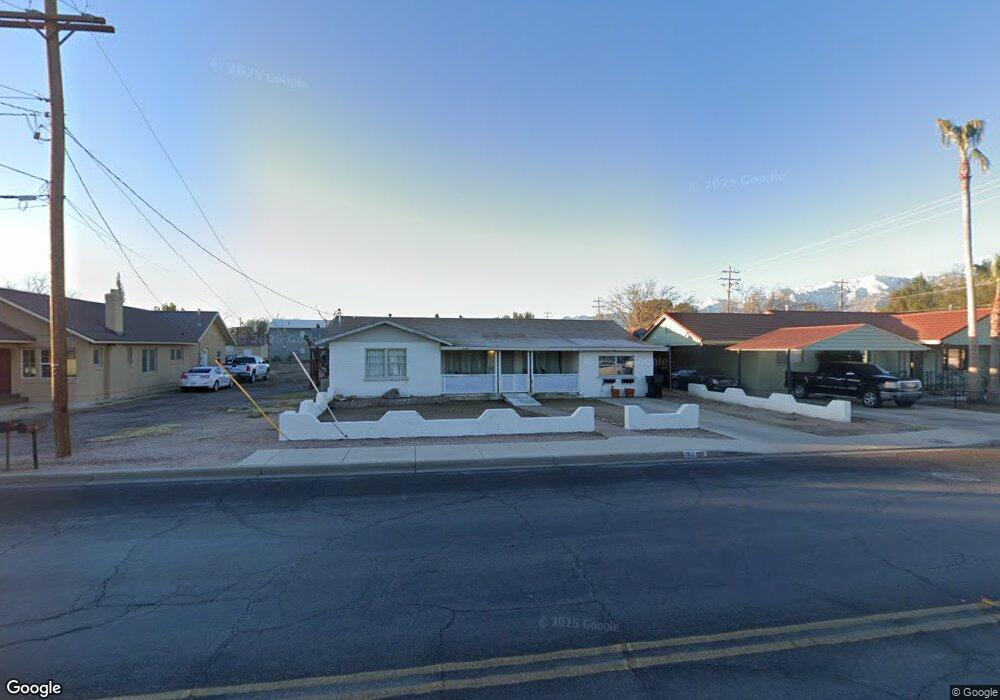
711 W Relation St Safford, AZ 85546
Estimated Value: $254,000 - $272,000
Studio
--
Bath
1,756
Sq Ft
$150/Sq Ft
Est. Value
About This Home
This home is located at 711 W Relation St, Safford, AZ 85546 and is currently estimated at $263,095, approximately $149 per square foot. 711 W Relation St is a home located in Graham County with nearby schools including Dorothy Stinson School, Ruth Powell Elementary School, and Lafe Nelson School.
Ownership History
Date
Name
Owned For
Owner Type
Purchase Details
Closed on
Mar 20, 2025
Sold by
Hanson Amber C and Diaz Terry Lynn
Bought by
Hanson Amber C
Current Estimated Value
Purchase Details
Closed on
Aug 13, 2010
Sold by
Suntrust Mortgage Inc
Bought by
Federal National Mortgage Association
Purchase Details
Closed on
Dec 18, 2007
Sold by
John Benjamin Kyle
Bought by
John Benjamin Kyle and John Tara Lynne
Home Financials for this Owner
Home Financials are based on the most recent Mortgage that was taken out on this home.
Original Mortgage
$120,000
Interest Rate
6.2%
Mortgage Type
New Conventional
Create a Home Valuation Report for This Property
The Home Valuation Report is an in-depth analysis detailing your home's value as well as a comparison with similar homes in the area
Purchase History
| Date | Buyer | Sale Price | Title Company |
|---|---|---|---|
| Hanson Amber C | -- | None Listed On Document | |
| Federal National Mortgage Association | -- | Service Link | |
| Suntrust Mortgage Inc | $80,900 | Servicelink | |
| John Benjamin Kyle | -- | Safford Title Agency |
Source: Public Records
Mortgage History
| Date | Status | Borrower | Loan Amount |
|---|---|---|---|
| Previous Owner | John Benjamin Kyle | $120,000 |
Source: Public Records
Tax History
| Year | Tax Paid | Tax Assessment Tax Assessment Total Assessment is a certain percentage of the fair market value that is determined by local assessors to be the total taxable value of land and additions on the property. | Land | Improvement |
|---|---|---|---|---|
| 2026 | $752 | -- | -- | -- |
| 2025 | $752 | $17,537 | $2,103 | $15,434 |
| 2024 | $782 | $16,491 | $2,103 | $14,388 |
| 2023 | $782 | $13,923 | $1,939 | $11,984 |
| 2022 | $767 | $12,171 | $1,939 | $10,232 |
| 2021 | $847 | $0 | $0 | $0 |
| 2020 | $815 | $0 | $0 | $0 |
| 2019 | $857 | $0 | $0 | $0 |
| 2018 | $816 | $0 | $0 | $0 |
| 2017 | $731 | $0 | $0 | $0 |
| 2016 | $671 | $0 | $0 | $0 |
| 2015 | $613 | $0 | $0 | $0 |
Source: Public Records
Map
Nearby Homes
- 1227 S 7th Ave
- 828 W Navajo Ln
- 1120 S 8th Ave
- 702 W 16th St
- 1108 S 9th Ave
- 1204 S Central Ave Unit A
- 1204 S Central Ave Unit B
- 1227 S Central Ave
- 1225 S Central Ave
- 1104 S Central Ave
- 1115 W Relation St
- 1017 S 5th Ave
- 1292 W Relation St
- 295 Geronimo Rd
- 1305 W Crimson Canyon Dr
- 419 W 7th St
- 1835 S 1st Ave
- 515 Highway 70 E
- 2250 S Lamonica Way
- 1601 W 14th Dr
- 707 W Relation St
- 727 W Relation St
- 1403 S 8th Ave
- 629 W Relation St
- 702 W Relation St
- 708 W Relation St
- 710 W Relation St
- 804 W Kimball Ln
- 718 W 15th St
- 712 W Relation St
- 716 W 15th St
- 720 W 15th St
- 615 W Relation St
- 1318 S 8th Ave
- 1312 S 7th Ave
- 1400 S 8th Ave
- 628 W Relation St
- 803 W Kimball Ln
- 702 W 15th St
- 1320 S 8th Ave
Your Personal Tour Guide
Ask me questions while you tour the home.