Estimated Value: $252,781 - $277,000
3
Beds
2
Baths
1,196
Sq Ft
$224/Sq Ft
Est. Value
About This Home
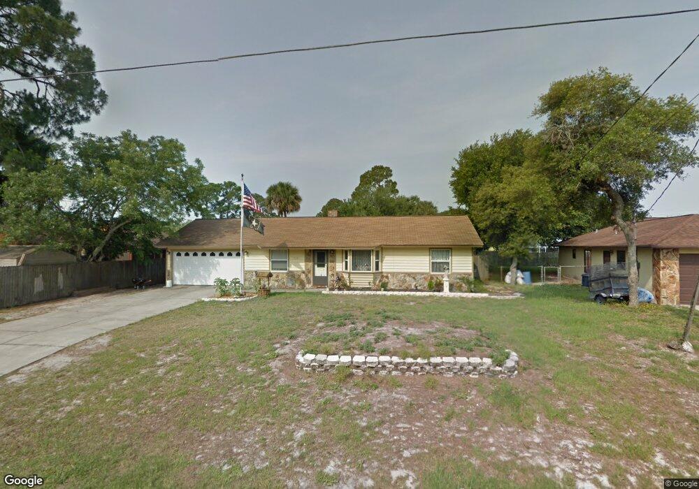
This home is located at 7110 Carlowe Ave, Cocoa, FL 32927 and is currently estimated at $267,945, approximately $224 per square foot. 7110 Carlowe Ave is a home located in Brevard County with nearby schools including Atlantis Elementary School, Space Coast Junior/Senior High School, and Sculptor Charter School.
Ownership History
Date
Name
Owned For
Owner Type
Purchase Details
Closed on
May 6, 2003
Sold by
Floyd Gerard Patrick
Bought by
Richards Robert and Richards Susan
Current Estimated Value
Home Financials for this Owner
Home Financials are based on the most recent Mortgage that was taken out on this home.
Original Mortgage
$71,400
Outstanding Balance
$34,189
Interest Rate
7.2%
Estimated Equity
$233,756
Create a Home Valuation Report for This Property
The Home Valuation Report is an in-depth analysis detailing your home's value as well as a comparison with similar homes in the area
Home Values in the Area
Average Home Value in this Area
Purchase History
| Date | Buyer | Sale Price | Title Company |
|---|---|---|---|
| Richards Robert | $84,000 | Great American Title & Abstr |
Source: Public Records
Mortgage History
| Date | Status | Borrower | Loan Amount |
|---|---|---|---|
| Open | Richards Robert | $71,400 |
Source: Public Records
Tax History Compared to Growth
Tax History
| Year | Tax Paid | Tax Assessment Tax Assessment Total Assessment is a certain percentage of the fair market value that is determined by local assessors to be the total taxable value of land and additions on the property. | Land | Improvement |
|---|---|---|---|---|
| 2025 | $973 | $77,410 | -- | -- |
| 2024 | $951 | $74,390 | -- | -- |
| 2023 | $951 | $72,230 | $0 | $0 |
| 2022 | $952 | $70,130 | $0 | $0 |
| 2021 | $954 | $68,090 | $0 | $0 |
| 2020 | $915 | $67,150 | $0 | $0 |
| 2019 | $862 | $65,650 | $0 | $0 |
| 2018 | $863 | $64,430 | $0 | $0 |
| 2017 | $864 | $63,110 | $0 | $0 |
| 2016 | $872 | $61,820 | $18,000 | $43,820 |
| 2015 | $879 | $61,400 | $15,000 | $46,400 |
| 2014 | $883 | $60,920 | $11,000 | $49,920 |
Source: Public Records
Map
Nearby Homes
- 7160 Carlowe Ave
- 7065 Bright Ave
- 7020 Ackerman Ave
- 7035 Jasmine Ave
- 7155 Ackerman Ave
- 7081 Bayfront Rd
- 4390 Everglades St
- 4550 Flood St
- 6839 Ackerman Ave
- 4760 Ivan St
- 7315 Darien Rd
- 4859 Horton St
- 4200 Lee Hall Place
- 7070 Bismarck Rd
- 3970 Curtis Blvd
- 6840 Anecia Ave
- 7155 Export Ave
- 4635 Alfred St
- 00 Kings Hwy
- 0000 Birch Dr
- 4510 Curtis Blvd
- 7120 Carlowe Ave
- 7115 Briggs Ave
- 4530 Curtis Blvd
- 7125 Briggs Ave
- 7113 Carlowe Ave
- 7125 Carlowe Ave
- 7135 Briggs Ave
- 4480 Curtis Blvd
- 7140 Carlowe Ave
- 7145 Briggs Ave
- 0 Briggs Ave
- None Curtis Blvd
- 7137 Carlowe Ave
- 7044 Carlowe Ave
- 4550 Curtis Blvd
- 7110 Briggs Ave
- 7112 Bright Ave
- 7150 Carlowe Ave
- 7155 Briggs Ave