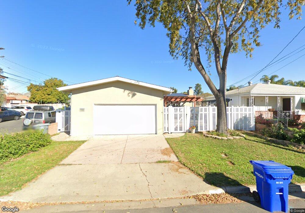
7110 Colony Rd La Mesa, CA 91942
Estimated Value: $695,000 - $838,000
3
Beds
1
Bath
1,155
Sq Ft
$670/Sq Ft
Est. Value
About This Home
This home is located at 7110 Colony Rd, La Mesa, CA 91942 and is currently estimated at $774,309, approximately $670 per square foot. 7110 Colony Rd is a home located in San Diego County with nearby schools including Rolando Elementary School, La Mesa Arts Academy, and Mount Miguel High School.
Ownership History
Date
Name
Owned For
Owner Type
Purchase Details
Closed on
Aug 4, 2014
Sold by
Etland Caroline Spencer and Etland Caroline S
Bought by
Etland Caroline Spencer and The Caroline Spencer Etland Re
Current Estimated Value
Purchase Details
Closed on
Jan 17, 2001
Sold by
Quinn Edwin L and Quinn Carole A
Bought by
Etland Caroline S
Home Financials for this Owner
Home Financials are based on the most recent Mortgage that was taken out on this home.
Original Mortgage
$221,865
Outstanding Balance
$79,423
Interest Rate
7.13%
Estimated Equity
$694,886
Purchase Details
Closed on
Jul 7, 1999
Sold by
Quinn Edwin L and Quinn Carole A
Bought by
Quinn Edwin L and Quinn Carole A
Purchase Details
Closed on
Jul 31, 1986
Create a Home Valuation Report for This Property
The Home Valuation Report is an in-depth analysis detailing your home's value as well as a comparison with similar homes in the area
Purchase History
| Date | Buyer | Sale Price | Title Company |
|---|---|---|---|
| Etland Caroline Spencer | -- | None Available | |
| Etland Caroline S | $225,000 | California Title Company | |
| Quinn Edwin L | -- | -- | |
| -- | $104,000 | -- |
Source: Public Records
Mortgage History
| Date | Status | Borrower | Loan Amount |
|---|---|---|---|
| Open | Etland Caroline S | $221,865 |
Source: Public Records
Tax History
| Year | Tax Paid | Tax Assessment Tax Assessment Total Assessment is a certain percentage of the fair market value that is determined by local assessors to be the total taxable value of land and additions on the property. | Land | Improvement |
|---|---|---|---|---|
| 2025 | $4,439 | $339,014 | $143,884 | $195,130 |
| 2024 | $4,439 | $332,367 | $141,063 | $191,304 |
| 2023 | $4,283 | $325,851 | $138,298 | $187,553 |
| 2022 | $4,232 | $319,463 | $135,587 | $183,876 |
| 2021 | $4,157 | $313,200 | $132,929 | $180,271 |
| 2020 | $4,018 | $309,989 | $131,566 | $178,423 |
| 2019 | $3,972 | $303,912 | $128,987 | $174,925 |
| 2018 | $3,904 | $297,954 | $126,458 | $171,496 |
| 2017 | $3,829 | $292,113 | $123,979 | $168,134 |
| 2016 | $3,712 | $286,387 | $121,549 | $164,838 |
| 2015 | $3,688 | $282,086 | $119,724 | $162,362 |
| 2014 | $3,624 | $276,561 | $117,379 | $159,182 |
Source: Public Records
Map
Nearby Homes
- 7105 Amherst St
- 4862 70th St
- 6979-81 Amherst St
- 4594 Normandie Place
- 6927 Amherst St Unit 1
- 6927 Amherst St Unit 8
- 4625 73rd St
- 7003 Saranac St Unit 203
- 4501 Normandie Place
- 4626 Terry Ln
- 7446 Ohio Place
- 7175 Stanford Ave
- 4605 Pomona Ave
- 7365 Cornell Ave
- 4591 68th St
- 4800 Williamsburg Ln Unit 227
- 6735 Amherst St Unit 1E
- 6673-75 Amherst St
- 7098 Neri Dr
- 4349 Yale Ave
- 4815 71st St
- 7146 Colony Rd
- 4817 71st St Unit 19
- 00000 Colony Rd
- 0000 Colony Rd
- 0000 Colony Rd Unit 1
- 7101 Colony Rd
- 7070 Colony Rd
- 7050 Colony Rd
- 7148 Colony Rd
- 4814 71st St
- 4814 71st St
- 7131 Colony Rd
- 4812 71st St
- 4821 71st St
- 4814 71st St Unit 16
- 7156 Colony Rd
- 7060 Colony Rd Unit U7060
- 4779 71st St
- 4790 71st St