Estimated Value: $378,000 - $462,000
3
Beds
2
Baths
1,758
Sq Ft
$239/Sq Ft
Est. Value
About This Home
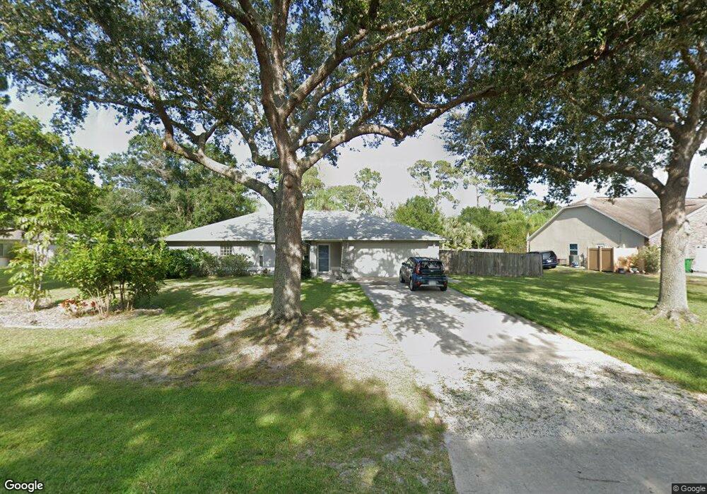
This home is located at 7115 Hundred Acre Dr, Cocoa, FL 32927 and is currently estimated at $420,799, approximately $239 per square foot. 7115 Hundred Acre Dr is a home located in Brevard County with nearby schools including Enterprise Elementary School, Space Coast Junior/Senior High School, and Sculptor Charter School.
Ownership History
Date
Name
Owned For
Owner Type
Purchase Details
Closed on
Jun 9, 2010
Sold by
Southwell Scott L
Bought by
Southwell Sandra Ann
Current Estimated Value
Purchase Details
Closed on
May 29, 1997
Sold by
Lampert Daryl A and Lampert Dianna C
Bought by
Southwell Scott L and Southwell Sandra An
Home Financials for this Owner
Home Financials are based on the most recent Mortgage that was taken out on this home.
Original Mortgage
$118,750
Interest Rate
8.13%
Create a Home Valuation Report for This Property
The Home Valuation Report is an in-depth analysis detailing your home's value as well as a comparison with similar homes in the area
Home Values in the Area
Average Home Value in this Area
Purchase History
| Date | Buyer | Sale Price | Title Company |
|---|---|---|---|
| Southwell Sandra Ann | -- | Attorney | |
| Southwell Scott L | $125,000 | -- |
Source: Public Records
Mortgage History
| Date | Status | Borrower | Loan Amount |
|---|---|---|---|
| Previous Owner | Southwell Scott L | $118,750 |
Source: Public Records
Tax History
| Year | Tax Paid | Tax Assessment Tax Assessment Total Assessment is a certain percentage of the fair market value that is determined by local assessors to be the total taxable value of land and additions on the property. | Land | Improvement |
|---|---|---|---|---|
| 2025 | $2,076 | $158,980 | -- | -- |
| 2024 | $2,036 | $154,500 | -- | -- |
| 2023 | $2,036 | $150,000 | $0 | $0 |
| 2022 | $1,903 | $145,640 | $0 | $0 |
| 2021 | $1,928 | $141,400 | $0 | $0 |
| 2020 | $1,873 | $139,450 | $0 | $0 |
| 2019 | $1,815 | $136,320 | $0 | $0 |
| 2018 | $1,815 | $133,780 | $0 | $0 |
| 2017 | $1,824 | $131,030 | $0 | $0 |
| 2016 | $1,840 | $128,340 | $32,000 | $96,340 |
| 2015 | $1,881 | $127,450 | $32,000 | $95,450 |
| 2014 | $1,889 | $126,440 | $32,000 | $94,440 |
Source: Public Records
Map
Nearby Homes
- 6990 Bryant Rd
- 7065 Hundred Acre Dr
- 5555 Brandon St
- 7230 Venus Ave
- 5165 Patricia St
- 6815 Bryant Rd
- 5155 Mayflower St
- 7200 Oakwood Ave
- 7635 Fringe Place
- 6760 Cairo Rd
- 5080 Mayflower St
- 5075 Carter St
- 5200 Frisco St
- 7545 Fringe Place
- 5150 Melody St
- 6615 Dock Ave
- 7419 Hackberry Rd
- TBD Freeport Rd
- 7155 Export Ave
- 5740 Friendly St
- 7125 Hundred Acre Dr
- 7105 Hundred Acre Dr
- 7135 Hundred Acre Dr
- 6980 Kaylor Ave
- 7110 Hundred Acre Dr
- 7040 Kaylor Ave
- 7120 Hundred Acre Dr
- 7100 Hundred Acre Dr
- 6970 Kaylor Ave
- 7060 Kaylor Ave
- 7130 Hundred Acre Dr
- 7090 Hundred Acre Dr
- 7085 Hundred Acre Dr
- 7145 Hundred Acre Dr
- 6960 Kaylor Ave
- 7045 Pluto Ave
- 7035 Pluto Ave
- 7025 Pluto Ave
- 7055 Pluto Ave
- 7025 Kaylor Ave
Your Personal Tour Guide
Ask me questions while you tour the home.