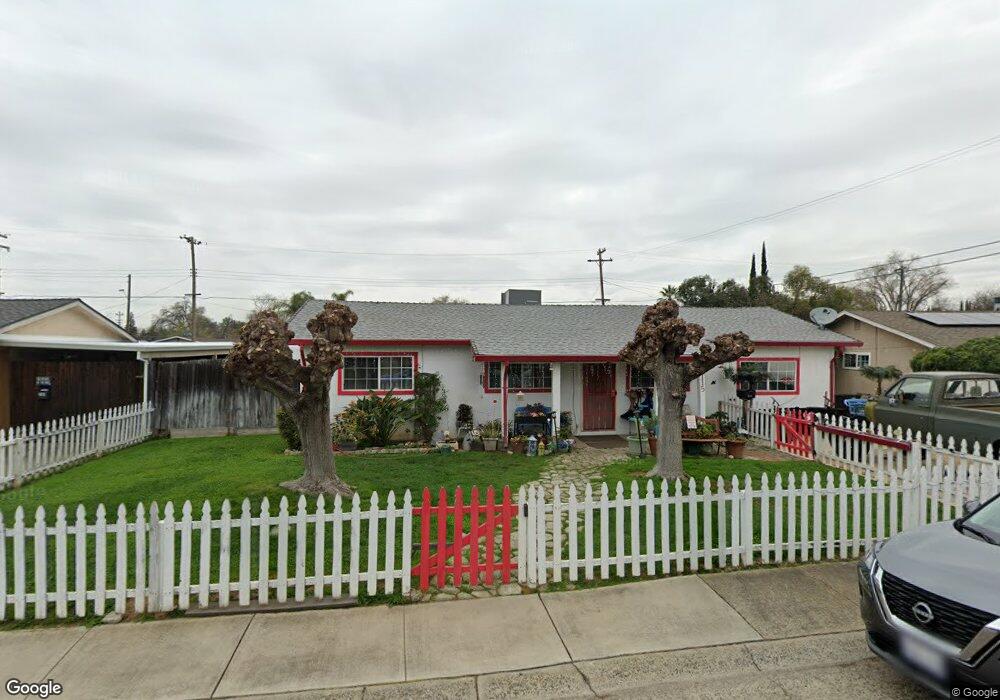
7115 Parish Way Citrus Heights, CA 95621
Estimated Value: $299,000 - $431,000
3
Beds
1
Bath
1,200
Sq Ft
$321/Sq Ft
Est. Value
About This Home
This home is located at 7115 Parish Way, Citrus Heights, CA 95621 and is currently estimated at $384,965, approximately $320 per square foot. 7115 Parish Way is a home located in Sacramento County with nearby schools including Grand Oaks Elementary School, Sylvan Middle School, and Mesa Verde High School.
Ownership History
Date
Name
Owned For
Owner Type
Purchase Details
Closed on
Nov 16, 2016
Sold by
Redman Steven C and Redman Steven
Bought by
Redman Steven C and Redman Tina
Current Estimated Value
Home Financials for this Owner
Home Financials are based on the most recent Mortgage that was taken out on this home.
Original Mortgage
$75,000
Outstanding Balance
$35,667
Interest Rate
3.52%
Mortgage Type
New Conventional
Estimated Equity
$349,298
Purchase Details
Closed on
Dec 12, 2014
Sold by
Redman Ken and Redman Steven C
Bought by
Redman Steven C and Redman Steven
Purchase Details
Closed on
Feb 27, 2006
Sold by
Redman Janice Claire
Bought by
Redman Steven C and Redman Ken
Create a Home Valuation Report for This Property
The Home Valuation Report is an in-depth analysis detailing your home's value as well as a comparison with similar homes in the area
Home Values in the Area
Average Home Value in this Area
Purchase History
| Date | Buyer | Sale Price | Title Company |
|---|---|---|---|
| Redman Steven C | -- | Placer Title Company | |
| Redman Steven C | -- | None Available | |
| Redman Steven C | -- | None Available |
Source: Public Records
Mortgage History
| Date | Status | Borrower | Loan Amount |
|---|---|---|---|
| Open | Redman Steven C | $75,000 |
Source: Public Records
Tax History Compared to Growth
Tax History
| Year | Tax Paid | Tax Assessment Tax Assessment Total Assessment is a certain percentage of the fair market value that is determined by local assessors to be the total taxable value of land and additions on the property. | Land | Improvement |
|---|---|---|---|---|
| 2025 | $1,611 | $143,096 | $38,041 | $105,055 |
| 2024 | $1,611 | $140,292 | $37,296 | $102,996 |
| 2023 | $1,569 | $137,542 | $36,565 | $100,977 |
| 2022 | $1,559 | $134,847 | $35,849 | $98,998 |
| 2021 | $1,532 | $132,204 | $35,147 | $97,057 |
| 2020 | $1,503 | $130,849 | $34,787 | $96,062 |
| 2019 | $1,471 | $128,284 | $34,105 | $94,179 |
| 2018 | $1,452 | $125,770 | $33,437 | $92,333 |
| 2017 | $1,452 | $123,305 | $32,782 | $90,523 |
| 2016 | $1,356 | $120,889 | $32,140 | $88,749 |
| 2015 | $1,332 | $119,074 | $31,658 | $87,416 |
| 2014 | $382 | $37,459 | $8,178 | $29,281 |
Source: Public Records
Map
Nearby Homes
- 7128 Parish Way
- 7783 Live Oak Way
- 8001 Lichen Dr
- 7542 Pomerol Ln
- 8031 Lichen Dr
- 6633 Briartree Way
- 6611 Branchwater Way
- 77012 Lauppe Ln
- 77020 Lauppe Ln
- 6600 Branchwater Way
- 77094 Lauppe Ln
- 0 Muth Ln Unit 225125594
- 7325 Little Oaks Way
- 8016 Lesser Way
- 77066 Lauppe Ln
- 7058 Enright Dr
- 6721 Navion Dr
- 8206 Lichen Dr
- 7448 Grand Oaks Blvd
- 7006 Enright Dr
- 7119 Parish Way
- 7111 Parish Way
- 7123 Parish Way
- 7116 Parish Way
- 7124 Parish Way
- 7112 Parish Way
- 7017 Rollingwood Blvd
- 7127 Parish Way
- 7013 Rollingwood Blvd
- 7100 Parish Way
- 7104 Parish Way
- 7009 Rollingwood Blvd
- 7008 Oak Spring Way
- 7800 Tabare Ct
- 7013 Oak Spring Way
- 7131 Parish Way
- 7005 Rollingwood Blvd
- 6900 Gumwood Cir
- 7804 Tabare Ct
- 7825 Tabare Ct