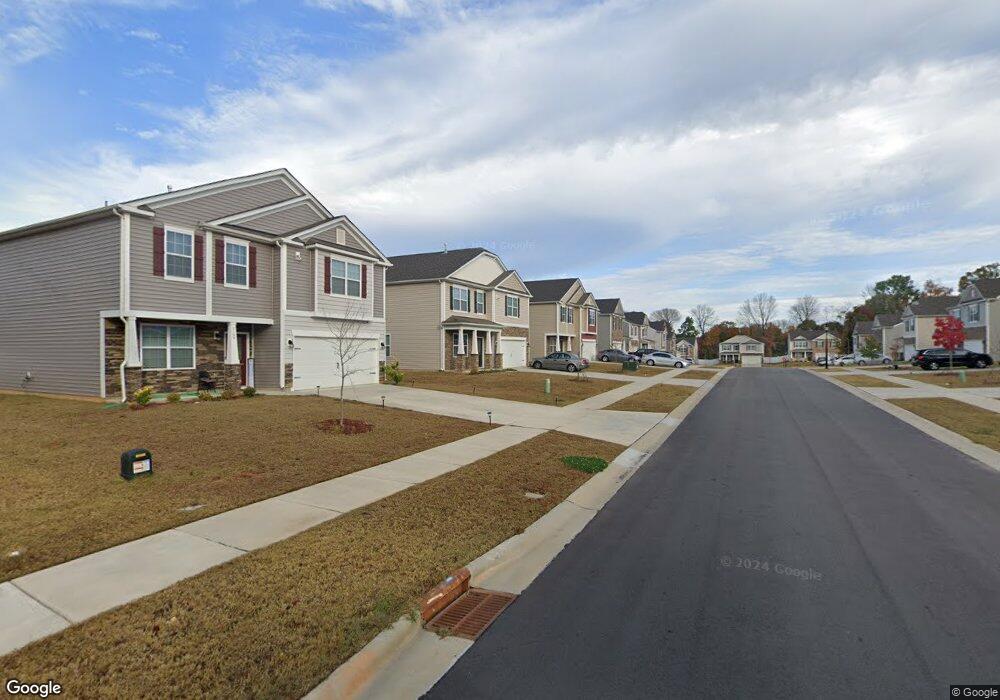
7117 Branch Fork Rd Charlotte, NC 28215
Silverwood NeighborhoodEstimated Value: $391,120 - $440,000
3
Beds
3
Baths
2,207
Sq Ft
$189/Sq Ft
Est. Value
About This Home
This home is located at 7117 Branch Fork Rd, Charlotte, NC 28215 and is currently estimated at $417,280, approximately $189 per square foot. 7117 Branch Fork Rd is a home located in Mecklenburg County with nearby schools including Reedy Creek Elementary School, Northridge Middle School, and Rocky River High School.
Ownership History
Date
Name
Owned For
Owner Type
Purchase Details
Closed on
May 15, 2020
Sold by
D R Horton Inc
Bought by
Reid Turkessa and Reid Turkessa L
Current Estimated Value
Home Financials for this Owner
Home Financials are based on the most recent Mortgage that was taken out on this home.
Original Mortgage
$258,236
Outstanding Balance
$228,833
Interest Rate
3.3%
Mortgage Type
FHA
Estimated Equity
$188,447
Purchase Details
Closed on
Aug 8, 2019
Sold by
Forestar Real Estate Group Inc
Bought by
D R Horton Inc
Create a Home Valuation Report for This Property
The Home Valuation Report is an in-depth analysis detailing your home's value as well as a comparison with similar homes in the area
Home Values in the Area
Average Home Value in this Area
Purchase History
| Date | Buyer | Sale Price | Title Company |
|---|---|---|---|
| Reid Turkessa | $263,000 | None Available | |
| D R Horton Inc | $2,363,500 | None Available |
Source: Public Records
Mortgage History
| Date | Status | Borrower | Loan Amount |
|---|---|---|---|
| Open | Reid Turkessa | $258,236 |
Source: Public Records
Tax History Compared to Growth
Tax History
| Year | Tax Paid | Tax Assessment Tax Assessment Total Assessment is a certain percentage of the fair market value that is determined by local assessors to be the total taxable value of land and additions on the property. | Land | Improvement |
|---|---|---|---|---|
| 2025 | $2,995 | $375,300 | $85,000 | $290,300 |
| 2024 | $2,995 | $375,300 | $85,000 | $290,300 |
| 2023 | $2,892 | $375,300 | $85,000 | $290,300 |
| 2022 | $2,384 | $234,000 | $30,000 | $204,000 |
| 2021 | $1,358 | $132,900 | $30,000 | $102,900 |
Source: Public Records
Map
Nearby Homes
- 10630 Bradstreet Commons Way
- 7415 Foxgate Cir
- 8224 Teeter Dr
- 8601 Findon Place
- 8412 Bristol Ford Place
- 8904 Daventry Place
- 8112 Cambridge Commons Dr
- 8502 Mansell Ct
- 10610 Coulport Ln
- 0 Cambridge Commons Dr Unit 3770354
- 8731 Woodhill Manor Ct
- 5436 Hughesdale Dr
- 11121 Nolet Ct
- Aspire Plan at Stewarts Landing
- Mitchell Plan at Stewarts Landing
- Hampton Plan at Stewarts Landing
- 9832 Harrisburg Rd
- 5711 Stewarts Landing Rd
- 5746 Stewarts Landing Rd Unit 123
- 5750 Stewarts Landing Rd Unit 122
- 7121 Branch Fork Rd
- 7113 Branch Fork Rd
- 7125 Branch Fork Rd
- 7109 Branch Fork Rd
- 7118 Branch Fork Rd
- 7122 Branch Fork Rd
- 7114 Branch Fork Rd
- 7129 Branch Fork Rd
- 7105 Branch Fork Rd
- 7126 Branch Fork Rd
- 7110 Branch Fork Rd
- 7130 Branch Fork Rd
- 7101 Branch Fork Rd
- 7106 Branch Fork Rd
- 7133 Branch Fork Rd
- 9835 Oak Barrel Ln
- 7134 Branch Fork Rd
- 7035 Branch Fork Rd
- 9839 Oak Barrel Ln
- 10615 Bradstreet Commons Way