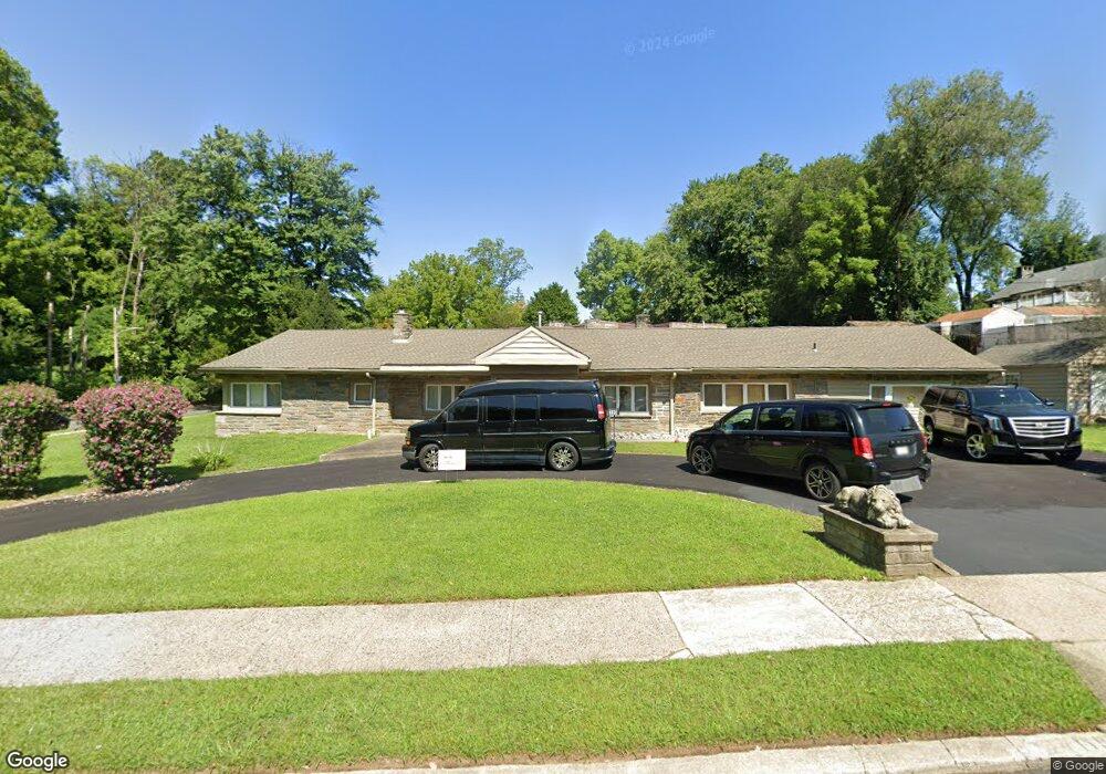
7119 Sherwood Rd Philadelphia, PA 19151
Overbrook NeighborhoodEstimated Value: $598,000 - $644,000
--
Bed
--
Bath
2,795
Sq Ft
$222/Sq Ft
Est. Value
About This Home
This home is located at 7119 Sherwood Rd, Philadelphia, PA 19151 and is currently estimated at $619,936, approximately $221 per square foot. 7119 Sherwood Rd is a home located in Philadelphia County with nearby schools including Union Mill Elementary School, Lamberton Robert E School, and Overbrook High School.
Ownership History
Date
Name
Owned For
Owner Type
Purchase Details
Closed on
Jan 5, 2024
Sold by
Wells Fargo Bank Na
Bought by
Univest Bank And Trust Co
Current Estimated Value
Purchase Details
Closed on
Aug 7, 2008
Sold by
Moore Nicole Mclaughlin and Scott Ann
Bought by
Wachovia Bank Na and Estate Of Nikkimah Mclaughlin
Purchase Details
Closed on
Feb 5, 2007
Sold by
Webster Nichole M
Bought by
Moore Nicole Mclaughlin and Scott Ann
Purchase Details
Closed on
Apr 30, 2004
Sold by
Shaw Ennis Joan H and Ennis David P
Bought by
Webster Nichole M
Home Financials for this Owner
Home Financials are based on the most recent Mortgage that was taken out on this home.
Original Mortgage
$306,000
Interest Rate
8.9%
Mortgage Type
Purchase Money Mortgage
Purchase Details
Closed on
Nov 16, 1998
Sold by
Warren Repsie M
Bought by
Shaw Ennis Joan H and Ennis David P
Create a Home Valuation Report for This Property
The Home Valuation Report is an in-depth analysis detailing your home's value as well as a comparison with similar homes in the area
Home Values in the Area
Average Home Value in this Area
Purchase History
| Date | Buyer | Sale Price | Title Company |
|---|---|---|---|
| Univest Bank And Trust Co | -- | None Listed On Document | |
| Wachovia Bank Na | -- | None Available | |
| Moore Nicole Mclaughlin | $383,000 | Lawyers Title Insurance Co | |
| Webster Nichole M | $360,000 | -- | |
| Shaw Ennis Joan H | $190,000 | -- |
Source: Public Records
Mortgage History
| Date | Status | Borrower | Loan Amount |
|---|---|---|---|
| Previous Owner | Webster Nichole M | $306,000 |
Source: Public Records
Tax History Compared to Growth
Tax History
| Year | Tax Paid | Tax Assessment Tax Assessment Total Assessment is a certain percentage of the fair market value that is determined by local assessors to be the total taxable value of land and additions on the property. | Land | Improvement |
|---|---|---|---|---|
| 2026 | $5,521 | $542,800 | $108,560 | $434,240 |
| 2025 | $5,521 | $542,800 | $108,560 | $434,240 |
| 2024 | $5,521 | $542,800 | $108,560 | $434,240 |
| 2023 | $5,521 | $394,400 | $78,880 | $315,520 |
| 2022 | $5,521 | $394,400 | $78,880 | $315,520 |
| 2021 | $5,521 | $0 | $0 | $0 |
| 2020 | $5,521 | $0 | $0 | $0 |
| 2019 | $6,053 | $0 | $0 | $0 |
| 2018 | $5,720 | $0 | $0 | $0 |
| 2017 | $5,720 | $0 | $0 | $0 |
| 2016 | $5,720 | $0 | $0 | $0 |
| 2015 | $5,352 | $0 | $0 | $0 |
| 2014 | -- | $408,600 | $241,969 | $166,631 |
| 2012 | -- | $49,984 | $19,562 | $30,422 |
Source: Public Records
Map
Nearby Homes
- 1721 N 72nd St
- 1843-45 N 72nd St
- 7102 City Ave
- 7322 Drexel Rd
- 7517 Brookhaven Rd
- 7519 Brookhaven Rd
- 7322 Ruskin Rd
- 1001 City Ave Unit EE1026
- 1001 City Ave Unit W-811
- 1001 City Ave Unit EE-927
- 1001 City Ave Unit W-617
- 1001 City Ave Unit EC206
- 1001 City Ave Unit W-801
- 1001 City Ave Unit E-1107
- 1001 City Ave Unit EC107
- 1001 City Ave Unit W-1004
- 1001 City Ave Unit E-223
- 1001 City Ave Unit E-726
- 1001 City Ave Unit W-106
- 1001 City Ave Unit W-405
- 1815 N 72nd St
- 7101 Sherwood Rd Unit 7
- 1729 N 72nd St
- 1810 N 71st St
- 7110 Sherwood Rd
- 1825 N 72nd St
- 7100 Sherwood Rd
- 1830 N 71st St
- 1725 N 72nd St
- 1738 N 71st St
- 1840 N 71st St
- 7045 Sherwood Rd
- 1734 N 71st St
- 7117 Brentwood Rd
- 7060 Greenhill Rd
- 1850 N 71st St
- 7111 Brentwood Rd
- 7041 Sherwood Rd
- 7054 Sherwood Rd
- 1839 N 72nd St