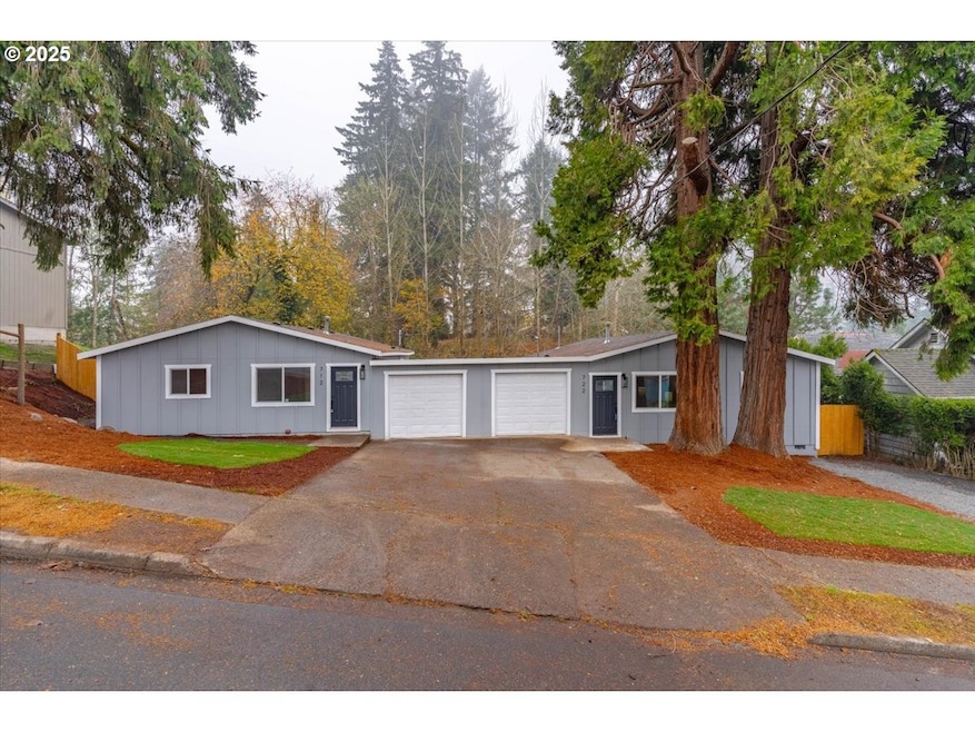

712 12th Ave Sweet Home, OR 97386
Estimated payment $2,696/month
Highlights
- Territorial View
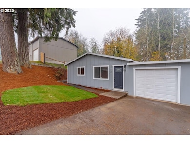
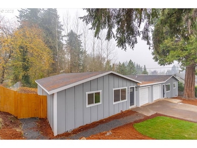
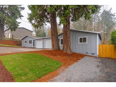
- Board and Batten Siding
- 1-Story Property
- 2 Car Attached Garage
- Forced Air Heating System
- 4-minute walk to Sankey Park
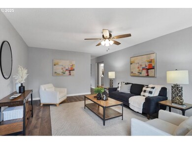
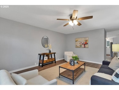
About This Home
DUPLEX!!! - This beautifully updated duplex presents a fantastic opportunity for investors or owner occupants. Each unit includes 3 beds and 1 bath with washer/dryer hookups in separate utility rooms. 2025 updates include new roof, siding, windows as well as fully renovated kitchens and bathrooms. New interior/exterior paint, appliances, doors, millwork as well as plumbing and light fixtures. Each unit has its own garage, and deck for outdoor entertaining. This turnkey property is fully fenced, landscaped and ready to generate profit for its new owner.
Listing Agent
Realty One Group Willamette Valley License #201221849 Listed on: 11/14/2025

Property Details
Home Type
- Multi-Family
Est. Annual Taxes
- $3,405
Year Built
- Built in 1973
Lot Details
- 9,583 Sq Ft Lot
Parking
- 2 Car Attached Garage
Home Design
- Shingle Roof
- Composition Roof
- Board and Batten Siding
- Cement Siding
Interior Spaces
- 1-Story Property
- Territorial Views
Bedrooms and Bathrooms
- 6 Bedrooms
- 2 Bathrooms
Schools
- Oak Heights Elementary School
- Sweet Home Middle School
- Sweet Home High School
Utilities
- No Cooling
- Forced Air Heating System
- Heating System Uses Gas
- Gas Water Heater
Community Details
- 2 Units
Listing and Financial Details
- Assessor Parcel Number 0253951
Map
Home Values in the Area
Average Home Value in this Area
Tax History
| Year | Tax Paid | Tax Assessment Tax Assessment Total Assessment is a certain percentage of the fair market value that is determined by local assessors to be the total taxable value of land and additions on the property. | Land | Improvement |
|---|---|---|---|---|
| 2025 | $3,405 | $137,770 | -- | -- |
| 2024 | $3,310 | $133,760 | -- | -- |
| 2023 | $2,964 | $129,870 | $0 | $0 |
| 2022 | $2,902 | $126,090 | $0 | $0 |
| 2021 | $2,986 | $122,420 | $0 | $0 |
| 2020 | $2,917 | $118,860 | $0 | $0 |
| 2019 | $2,847 | $115,400 | $0 | $0 |
| 2018 | $2,768 | $112,040 | $0 | $0 |
| 2017 | $2,225 | $108,780 | $0 | $0 |
| 2016 | $2,153 | $105,620 | $0 | $0 |
| 2015 | $1,987 | $102,550 | $0 | $0 |
| 2014 | $2,039 | $99,570 | $0 | $0 |
Property History
| Date | Event | Price | List to Sale | Price per Sq Ft |
|---|---|---|---|---|
| 11/14/2025 11/14/25 | For Sale | $459,900 | -- | -- |
Purchase History
| Date | Type | Sale Price | Title Company |
|---|---|---|---|
| Warranty Deed | $266,000 | Amerititle | |
| Warranty Deed | $105,000 | Amerititle |
Mortgage History
| Date | Status | Loan Amount | Loan Type |
|---|---|---|---|
| Closed | $266,000 | Construction |
Source: Regional Multiple Listing Service (RMLS)
MLS Number: 728790466
APN: 0253951
Disclaimer: Certain information contained herein is derived from information provided by parties other than Homes.com. All information provided is deemed reliable, but is not guaranteed to be accurate and should be independently verified.
![]() The content relating to real estate for sale on this web site comes in part from the IDX program of the RMLS™ of Portland, Oregon. Real estate listings held by brokerage firms other than Ten-X are marked with the RMLS™ logo, and detailed information about these properties includes the names of the listing brokers. Listing content is copyright © 2025 RMLS™, Portland, Oregon. Some properties which appear for sale on this web site may subsequently have sold or may no longer be available. All information provided is deemed reliable but is not guaranteed and should be independently verified.
The content relating to real estate for sale on this web site comes in part from the IDX program of the RMLS™ of Portland, Oregon. Real estate listings held by brokerage firms other than Ten-X are marked with the RMLS™ logo, and detailed information about these properties includes the names of the listing brokers. Listing content is copyright © 2025 RMLS™, Portland, Oregon. Some properties which appear for sale on this web site may subsequently have sold or may no longer be available. All information provided is deemed reliable but is not guaranteed and should be independently verified.
- 1330 Hawthorne St
- 1354 Grape St
- TL2500 Grape St
- 1607 Elm St
- 951 Dogwood St Unit 2JAN
- 1774 Grape Ct
- 1780 Grape Ct
- 1730 Cedar St
- 1756 Elm St
- 6343 Lake Pointe Way
- 6335 Lake Pointe Way
- 6331 Lake Pointe Way
- 6332 Lake Pointe Way
- 6339 Lake Pointe Way
- 0 13th Ave
- 775 Long St
- Parcel 2 - 1400 Nandina St
- 985 Pinetop St
- 913 6th Ave
- 615 5th Ave
- 4840 48th Loop Unit B
- 300 Sand Ridge Ct
- 2211 Mckinney Ln
- 305 E Airport Rd
- 2622 S 7th St
- 1956 S 2nd St
- 911 E Grant St
- 142 Elmore St
- 2010 Cypress Ct Unit 2010
- 311 E Dodge St
- 91351 Donna Rd
- 4140 Furlong Ave SE
- 225 Timber Ridge St NE
- 3517 Hill St SE
- 150 Timber Ridge St NE
- 6208-6293 SE Wilford Ct
- 1915 21st Ave SE
- 350 Timber Ridge St NE
- 3835 Knox Butte Rd E
- 1755 Geary St SE