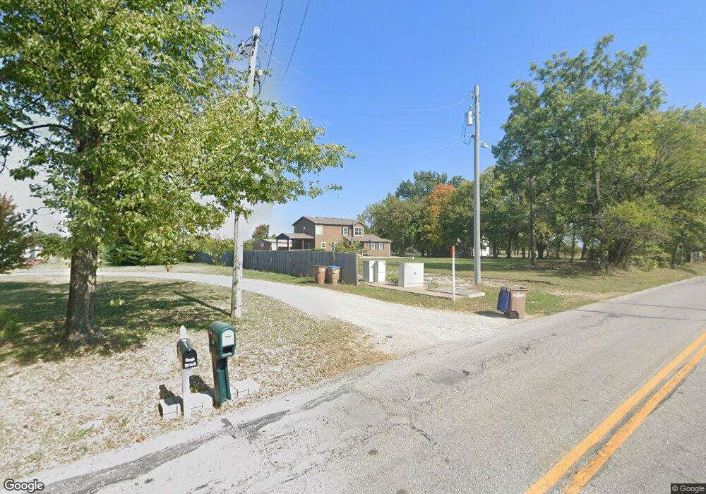
712 Gore Rd Raymore, MO 64083
Estimated Value: $620,000 - $763,000
5
Beds
5
Baths
4,300
Sq Ft
$160/Sq Ft
Est. Value
About This Home
This home is located at 712 Gore Rd, Raymore, MO 64083 and is currently estimated at $687,512, approximately $159 per square foot. 712 Gore Rd is a home located in Cass County with nearby schools including Timber Creek Elementary School, Raymore-Peculiar East Middle School, and Raymore-Peculiar Senior High School.
Ownership History
Date
Name
Owned For
Owner Type
Purchase Details
Closed on
Apr 29, 2024
Sold by
Tullis Joshua Daniel and Tullis Abbigail Christin
Bought by
Clough Dustin T and Clough Paige
Current Estimated Value
Home Financials for this Owner
Home Financials are based on the most recent Mortgage that was taken out on this home.
Original Mortgage
$54,000
Outstanding Balance
$53,142
Interest Rate
6.87%
Mortgage Type
New Conventional
Estimated Equity
$634,370
Purchase Details
Closed on
Sep 21, 2020
Sold by
Burns Robert L and Burns Kelly L
Bought by
Tullis Joshua Daniel and Tullis Abbigail Christine
Home Financials for this Owner
Home Financials are based on the most recent Mortgage that was taken out on this home.
Original Mortgage
$375,000
Interest Rate
2.9%
Mortgage Type
New Conventional
Purchase Details
Closed on
Nov 15, 2010
Sold by
Halliburton David L and Halliburton Anh
Bought by
Burns Robert L and Burns Kelly L
Home Financials for this Owner
Home Financials are based on the most recent Mortgage that was taken out on this home.
Original Mortgage
$319,900
Interest Rate
4.27%
Mortgage Type
New Conventional
Create a Home Valuation Report for This Property
The Home Valuation Report is an in-depth analysis detailing your home's value as well as a comparison with similar homes in the area
Home Values in the Area
Average Home Value in this Area
Purchase History
| Date | Buyer | Sale Price | Title Company |
|---|---|---|---|
| Clough Dustin T | -- | Continental Title | |
| Tullis Joshua Daniel | -- | Kansas City Title Inc | |
| Burns Robert L | -- | -- |
Source: Public Records
Mortgage History
| Date | Status | Borrower | Loan Amount |
|---|---|---|---|
| Open | Clough Dustin T | $54,000 | |
| Previous Owner | Tullis Joshua Daniel | $375,000 | |
| Previous Owner | Burns Robert L | $319,900 |
Source: Public Records
Tax History
| Year | Tax Paid | Tax Assessment Tax Assessment Total Assessment is a certain percentage of the fair market value that is determined by local assessors to be the total taxable value of land and additions on the property. | Land | Improvement |
|---|---|---|---|---|
| 2025 | $4,661 | $65,130 | $7,170 | $57,960 |
| 2024 | $4,661 | $57,280 | $6,520 | $50,760 |
| 2023 | $4,655 | $57,280 | $6,520 | $50,760 |
| 2022 | $4,123 | $50,390 | $6,520 | $43,870 |
| 2021 | $4,123 | $50,390 | $6,520 | $43,870 |
| 2020 | $4,087 | $49,070 | $6,520 | $42,550 |
| 2019 | $3,946 | $49,070 | $6,520 | $42,550 |
| 2018 | $3,674 | $44,120 | $5,220 | $38,900 |
| 2017 | $3,393 | $44,120 | $5,220 | $38,900 |
| 2016 | $3,393 | $42,290 | $5,220 | $37,070 |
| 2015 | $3,395 | $42,290 | $5,220 | $37,070 |
| 2014 | $3,397 | $42,290 | $5,220 | $37,070 |
| 2013 | -- | $42,290 | $5,220 | $37,070 |
Source: Public Records
Map
Nearby Homes
- 307 E Gore Rd
- East E Gore Rd
- 1312 SE Windbreak Dr
- 1433 SE Vantage Point Dr
- 1429 SE Vantage Point Dr
- 205 W Laredo Trail
- 304 W Calico Dr
- 1401 Kintyre Ct
- 101 N Franklin St
- 100 N Franklin St
- 1400 Upton Ct
- 600 Mayfair Ct
- 0 Madison Creek Dr
- 1014 Branchwood Ln
- 602 Mayfair Ct
- 603 Mayfair Ct
- 1406 Upton Ct
- 605 Hampstead Dr
- 408 N Washington St
- 1624 Hanover Ln
- 712 Gore Rd
- 700 Gore Rd
- 806 Gore Rd
- 1202 N Kurzweil Rd
- 805 Gore Rd
- 1208 N Kurzweil Rd
- 907 Gore Rd
- 1308 N Kurzweil Rd
- 812 N Kurzweil Rd
- 1007 Gore Rd
- 1307 N Kurzweil Rd
- 720 N Kurzweil Rd
- 1400 N Kurzweil Rd
- 1500 N Kurzweil Rd
- 303 Gore Rd
- 1510 N Kurzweil Rd
- 1512 N Kurzweil Rd
- 1015 N Washington St
- 1105 N Washington St
- 1009 N Washington St
Your Personal Tour Guide
Ask me questions while you tour the home.
