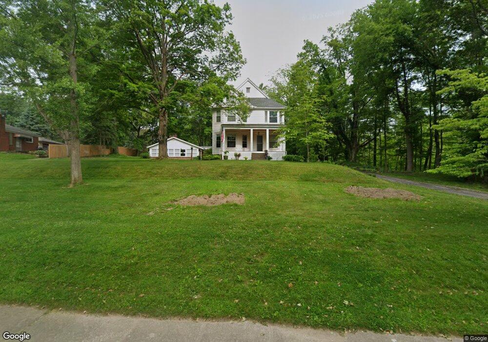
712 S Main St Amherst, OH 44001
Estimated Value: $289,000 - $461,000
5
Beds
4
Baths
3,081
Sq Ft
$118/Sq Ft
Est. Value
About This Home
This home is located at 712 S Main St, Amherst, OH 44001 and is currently estimated at $363,468, approximately $117 per square foot. 712 S Main St is a home located in Lorain County with nearby schools including Powers Elementary School, Walter G. Nord Middle School, and Amherst Junior High School.
Ownership History
Date
Name
Owned For
Owner Type
Purchase Details
Closed on
Apr 29, 2005
Sold by
Seng Jeffrey D and Seng Dawn A
Bought by
Seng Jeffrey D and Seng Dawn A
Current Estimated Value
Create a Home Valuation Report for This Property
The Home Valuation Report is an in-depth analysis detailing your home's value as well as a comparison with similar homes in the area
Home Values in the Area
Average Home Value in this Area
Purchase History
| Date | Buyer | Sale Price | Title Company |
|---|---|---|---|
| Seng Jeffrey D | -- | Multiple |
Source: Public Records
Tax History Compared to Growth
Tax History
| Year | Tax Paid | Tax Assessment Tax Assessment Total Assessment is a certain percentage of the fair market value that is determined by local assessors to be the total taxable value of land and additions on the property. | Land | Improvement |
|---|---|---|---|---|
| 2024 | $4,572 | $112,462 | $25,172 | $87,290 |
| 2023 | $3,730 | $77,256 | $19,530 | $57,726 |
| 2022 | $3,578 | $77,256 | $19,530 | $57,726 |
| 2021 | $3,587 | $77,256 | $19,530 | $57,726 |
| 2020 | $3,517 | $67,240 | $17,000 | $50,240 |
| 2019 | $3,447 | $67,240 | $17,000 | $50,240 |
| 2018 | $3,465 | $67,240 | $17,000 | $50,240 |
| 2017 | $3,557 | $65,250 | $16,020 | $49,230 |
| 2016 | $3,586 | $65,250 | $16,020 | $49,230 |
| 2015 | $3,566 | $65,250 | $16,020 | $49,230 |
| 2014 | $3,348 | $60,980 | $14,970 | $46,010 |
| 2013 | $3,359 | $60,980 | $14,970 | $46,010 |
Source: Public Records
Map
Nearby Homes
- 621 Van Oaks Dr
- 2176 Myla Way
- 2180 Myla Way
- 0 Stonebridge Dr
- 394 Long St
- 748 Tarry Ln
- 133 Ambleside Way
- 281 English Lakes Blvd Unit 67281
- V/L Middle Ridge Rd
- 653 Brennan Dr
- 335 Copper Creek
- 891 Park Ave
- 483 N Main St
- 825 Cleveland Ave
- 168 Orchard Hill Dr
- 814 Valley Dr
- 658 Nicole Dr
- 1140 Woodside Dr
- 923 Longitude Ln
- 0 Middle Ridge Rd Unit 5102632