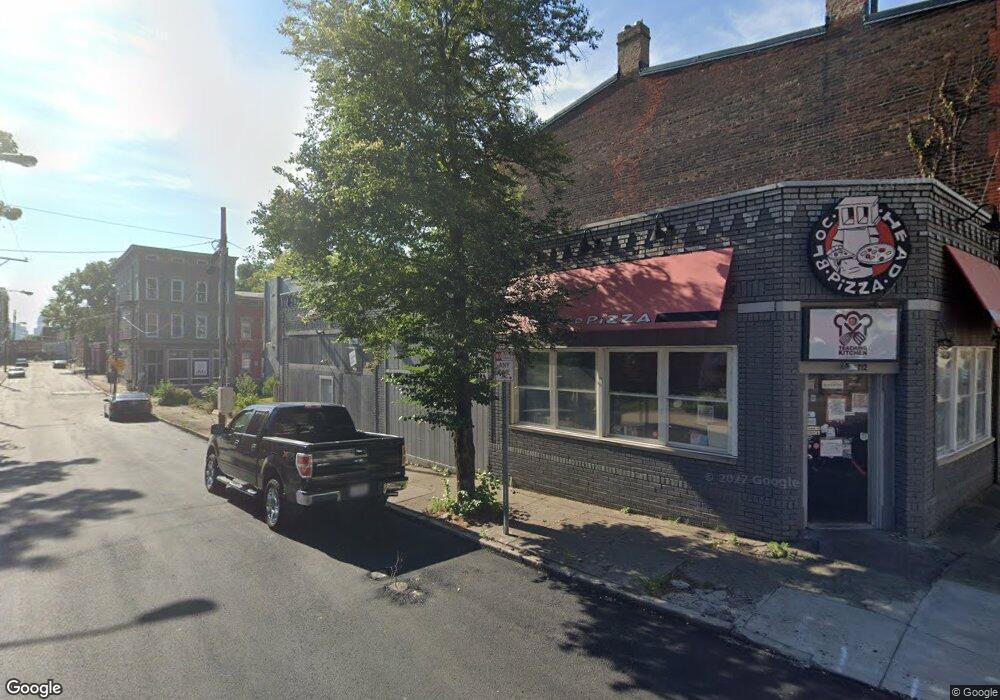
712 State Ave Cincinnati, OH 45204
East Price Hill Neighborhood
Studio
--
Bath
1,162
Sq Ft
871
Sq Ft Lot
About This Home
This home is located at 712 State Ave, Cincinnati, OH 45204. 712 State Ave is a home located in Hamilton County with nearby schools including Oyler School, Robert A. Taft Information Technology High School, and Gilbert A. Dater High School.
Ownership History
Date
Name
Owned For
Owner Type
Purchase Details
Closed on
Jan 30, 2017
Sold by
Blochead Pizza Llc
Bought by
Bloc Industries Llc
Purchase Details
Closed on
Aug 15, 2014
Sold by
Bloc Ministries Inc
Bought by
Blochead Pizza Llc
Purchase Details
Closed on
Sep 6, 2013
Sold by
Dkmc Llc
Bought by
Bloc Ministries Inc
Purchase Details
Closed on
Dec 28, 2012
Sold by
Clarke Martin
Bought by
Dkmc Llc
Purchase Details
Closed on
Mar 28, 2008
Sold by
Brown Clive and Brown Vicki D
Bought by
Clarke Martin
Purchase Details
Closed on
Jun 30, 2004
Sold by
West Eighth & State Tenant Cooperative O
Bought by
Brown Clive
Home Financials for this Owner
Home Financials are based on the most recent Mortgage that was taken out on this home.
Original Mortgage
$125,000
Interest Rate
6.37%
Mortgage Type
Credit Line Revolving
Create a Home Valuation Report for This Property
The Home Valuation Report is an in-depth analysis detailing your home's value as well as a comparison with similar homes in the area
Home Values in the Area
Average Home Value in this Area
Purchase History
| Date | Buyer | Sale Price | Title Company |
|---|---|---|---|
| Bloc Industries Llc | -- | -- | |
| Blochead Pizza Llc | -- | Northern Kentucky Title Inc | |
| Bloc Ministries Inc | $10,000 | Attorney | |
| Dkmc Llc | -- | Attorney | |
| Clarke Martin | $18,700 | None Available | |
| Brown Clive | $23,500 | -- |
Source: Public Records
Mortgage History
| Date | Status | Borrower | Loan Amount |
|---|---|---|---|
| Previous Owner | Brown Clive | $125,000 |
Source: Public Records
Tax History
| Year | Tax Paid | Tax Assessment Tax Assessment Total Assessment is a certain percentage of the fair market value that is determined by local assessors to be the total taxable value of land and additions on the property. | Land | Improvement |
|---|---|---|---|---|
| 2025 | $652 | $7,575 | $2,671 | $4,904 |
| 2024 | $648 | $7,575 | $2,671 | $4,904 |
| 2023 | $647 | $7,575 | $2,671 | $4,904 |
| 2022 | $719 | $7,669 | $2,265 | $5,404 |
| 2021 | $699 | $7,669 | $2,265 | $5,404 |
| 2020 | $700 | $7,669 | $2,265 | $5,404 |
| 2019 | $716 | $7,235 | $2,135 | $5,100 |
| 2018 | $716 | $7,235 | $2,135 | $5,100 |
| 2017 | $692 | $7,235 | $2,135 | $5,100 |
| 2016 | $612 | $6,251 | $2,128 | $4,123 |
| 2015 | $563 | $6,251 | $2,128 | $4,123 |
| 2014 | $565 | $6,251 | $2,128 | $4,123 |
| 2013 | $589 | $6,511 | $2,216 | $4,295 |
Source: Public Records
Map
Nearby Homes
- 2152 Staebler St
- 2430 Maryland Ave
- 2358 Glenway Ave
- 752 Mount Hope Ave
- 2360 Wilder Ave
- 309 Mount Hope Ave
- 2485 Warsaw Ave
- 2425 Glenway Ave
- 2414 River Rd
- 2814 Bodley Ave
- 2403 Elberon Ave
- 922 Summit Ave
- 2500 Warsaw Ave
- 2519 Warsaw Ave
- 720 Grand Ave
- 2462 River Rd
- 540 Grand Ave
- 538 Grand Ave
- 552 Grand Ave
- 658 Hawthorne Ave
Your Personal Tour Guide
Ask me questions while you tour the home.