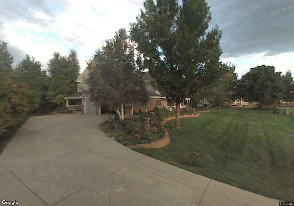
7120 Stable Dr Niwot, CO 80503
Niwot NeighborhoodEstimated Value: $1,618,559 - $1,871,000
5
Beds
4
Baths
3,440
Sq Ft
$519/Sq Ft
Est. Value
About This Home
This home is located at 7120 Stable Dr, Niwot, CO 80503 and is currently estimated at $1,786,390, approximately $519 per square foot. 7120 Stable Dr is a home located in Boulder County with nearby schools including Niwot Elementary School, Sunset Middle School, and Niwot High School.
Ownership History
Date
Name
Owned For
Owner Type
Purchase Details
Closed on
Oct 19, 2015
Sold by
Bromwell Matthew S and Digiallonardo Lisa Ann
Bought by
The Matthew Scott Bromwell Iii Family Tr
Current Estimated Value
Purchase Details
Closed on
Aug 30, 1993
Bought by
Bromwell Matthew Scott Iii Family Tr Tru
Purchase Details
Closed on
Apr 10, 1992
Bought by
Bromwell Matthew Scott Iii Family Tr Tru
Purchase Details
Closed on
Apr 27, 1990
Bought by
Bromwell Matthew Scott Iii Family Tr Tru
Create a Home Valuation Report for This Property
The Home Valuation Report is an in-depth analysis detailing your home's value as well as a comparison with similar homes in the area
Home Values in the Area
Average Home Value in this Area
Purchase History
| Date | Buyer | Sale Price | Title Company |
|---|---|---|---|
| The Matthew Scott Bromwell Iii Family Tr | -- | None Available | |
| Bromwell Matthew Scott Iii Family Tr Tru | $345,000 | -- | |
| Bromwell Matthew Scott Iii Family Tr Tru | $72,900 | -- | |
| Bromwell Matthew Scott Iii Family Tr Tru | -- | -- | |
| Bromwell Matthew Scott Iii Family Tr Tru | -- | -- |
Source: Public Records
Tax History Compared to Growth
Tax History
| Year | Tax Paid | Tax Assessment Tax Assessment Total Assessment is a certain percentage of the fair market value that is determined by local assessors to be the total taxable value of land and additions on the property. | Land | Improvement |
|---|---|---|---|---|
| 2025 | $10,640 | $101,737 | $29,156 | $72,581 |
| 2024 | $10,640 | $101,737 | $29,156 | $72,581 |
| 2023 | $10,499 | $107,703 | $26,988 | $84,400 |
| 2022 | $8,209 | $80,328 | $24,290 | $56,038 |
| 2021 | $8,318 | $82,639 | $24,989 | $57,650 |
| 2020 | $7,457 | $74,267 | $21,021 | $53,246 |
| 2019 | $7,340 | $74,267 | $21,021 | $53,246 |
| 2018 | $6,979 | $71,042 | $21,168 | $49,874 |
| 2017 | $6,568 | $78,541 | $23,402 | $55,139 |
| 2016 | $7,024 | $74,466 | $18,388 | $56,078 |
| 2015 | $6,689 | $61,650 | $12,577 | $49,073 |
| 2014 | $5,666 | $61,650 | $12,577 | $49,073 |
Source: Public Records
Map
Nearby Homes
- 8576 Niwot Meadow Farm Rd
- 8461 Pawnee Ln
- 8392 Niwot Meadow Farm Rd
- 8568 Foxhaven Dr
- 8536 Foxhaven Ct
- 7196 Christopher Ct
- 6851 Goldbranch Dr
- 8400 Sawtooth Ln
- 7284 Dry Creek Rd
- 6816 Goldbranch Dr
- 8180 Dry Creek Cir
- 7204 Spring Creek Cir
- 7220 Spring Creek Cir
- 8840 Niwot Rd
- 8896 Niwot Rd
- 8060 Niwot Rd Unit 34
- 8009 James Ct
- 8836 Marathon Rd
- 8748 Skyland Dr
- 7970 James Ct
- 7136 Stable Dr
- 8440 Brittany Place
- 7152 Stable Dr
- 8432 Brittany Place
- 8435 Brittany Place
- 7101 Longview Dr
- 7145 Waterford Ct
- 8427 Brittany Place
- 8424 Brittany Place
- 7157 Waterford Ct
- 7133 Waterford Ct
- 8416 Brittany Place
- 8520 Waterford Way
- 8419 Brittany Place
- 8408 Brittany Place
- 8525 Waterford Way
- 7169 Waterford Ct
- 8528 Waterford Way
- 8400 Brittany Place
- 7000 Longview Dr