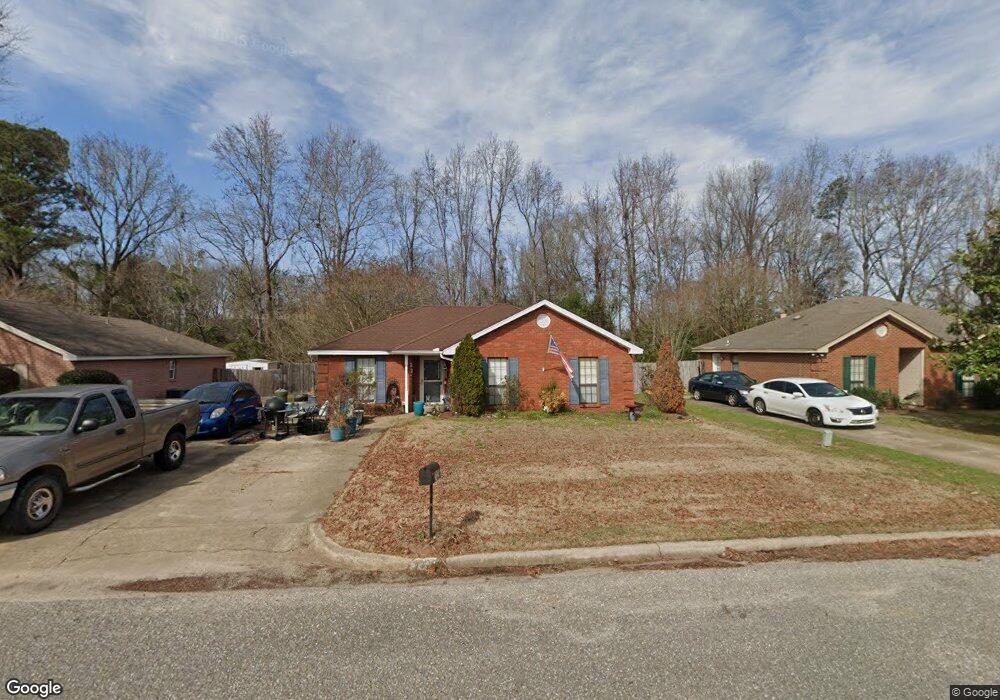
7125 Buckram Oak Dr Montgomery, AL 36117
East Montgomery NeighborhoodEstimated Value: $177,000 - $189,531
--
Bed
--
Bath
1,403
Sq Ft
$131/Sq Ft
Est. Value
About This Home
This home is located at 7125 Buckram Oak Dr, Montgomery, AL 36117 and is currently estimated at $183,383, approximately $130 per square foot. 7125 Buckram Oak Dr is a home located in Montgomery County with nearby schools including William Silas Garrett Elementary School, Johnnie R. Carr Middle School, and Park Crossing High School.
Ownership History
Date
Name
Owned For
Owner Type
Purchase Details
Closed on
Apr 28, 2009
Sold by
Lenn Katherine L
Bought by
Lenn Ii Robert A
Current Estimated Value
Purchase Details
Closed on
Apr 30, 1999
Sold by
Glover David E
Bought by
Lenn Robert A and Lenn Katherine L
Home Financials for this Owner
Home Financials are based on the most recent Mortgage that was taken out on this home.
Original Mortgage
$86,700
Interest Rate
7.06%
Mortgage Type
FHA
Create a Home Valuation Report for This Property
The Home Valuation Report is an in-depth analysis detailing your home's value as well as a comparison with similar homes in the area
Home Values in the Area
Average Home Value in this Area
Purchase History
| Date | Buyer | Sale Price | Title Company |
|---|---|---|---|
| Lenn Ii Robert A | -- | None Available | |
| Lenn Robert A | $87,700 | -- |
Source: Public Records
Mortgage History
| Date | Status | Borrower | Loan Amount |
|---|---|---|---|
| Previous Owner | Lenn Robert A | $86,700 |
Source: Public Records
Tax History Compared to Growth
Tax History
| Year | Tax Paid | Tax Assessment Tax Assessment Total Assessment is a certain percentage of the fair market value that is determined by local assessors to be the total taxable value of land and additions on the property. | Land | Improvement |
|---|---|---|---|---|
| 2025 | $871 | $19,200 | $2,500 | $16,700 |
| 2024 | $822 | $17,580 | $2,500 | $15,080 |
| 2023 | $822 | $16,530 | $2,500 | $14,030 |
| 2022 | $477 | $14,200 | $2,500 | $11,700 |
| 2021 | $428 | $12,840 | $0 | $0 |
| 2020 | $412 | $12,410 | $2,500 | $9,910 |
| 2019 | $403 | $12,150 | $2,500 | $9,650 |
| 2018 | $403 | $11,040 | $2,500 | $8,540 |
| 2017 | $339 | $20,780 | $5,000 | $15,780 |
| 2014 | -- | $11,300 | $2,500 | $8,800 |
| 2013 | -- | $12,050 | $2,500 | $9,550 |
Source: Public Records
Map
Nearby Homes
- 148 Blushing Groom St
- 6916 Buffalo Trace
- 6924 Buffalo Trace
- 6917 Buffalo Trace
- 6897 Brownwood Ln
- 50 Seaboard Dr
- 804 Overview Cir
- 7383 Orange Blossom Way
- 62 Seaboard Dr
- 7386 Orange Blossom Way
- 58 Seaboard Dr
- CALI Plan at McLemore Spur
- LAKESIDE Plan at McLemore Spur
- ARIA Plan at McLemore Spur
- MAZIE Plan at McLemore Spur
- PENWELL Plan at McLemore Spur
- 6800 Sandfield Dr
- 6812 Overview Ct
- 436 Tree Line Dr
- 7437 Old Pump Rd
- 7119 Buckram Oak Dr
- 7131 Buckram Oak Dr
- 7137 Buckram Oak Dr
- 7113 Buckram Oak Dr
- 7124 Buckram Oak Dr
- 7201 Buckram Oak Dr
- 7107 Buckram Oak Dr
- 7130 Buckram Oak Dr
- 7118 Buckram Oak Dr
- 7101 Buckram Oak Dr
- 7207 Buckram Oak Dr
- 7106 Buckram Oak Dr
- 266 Preakness Path
- 7091 Runnymede Dr
- 7097 Runnymede Dr
- 7085 Runnymede Dr
- 7100 Buckram Oak Dr
- 260 Preakness Path
- 7091 Buckram Oak Dr
- 7079 Runnymede Dr