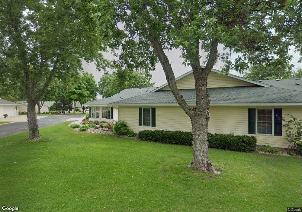
713 Paine Dr Paynesville, MN 56362
Estimated Value: $231,374 - $264,000
2
Beds
2
Baths
1,514
Sq Ft
$165/Sq Ft
Est. Value
About This Home
This home is located at 713 Paine Dr, Paynesville, MN 56362 and is currently estimated at $250,344, approximately $165 per square foot. 713 Paine Dr is a home located in Stearns County with nearby schools including Paynesville Elementary School, Paynesville Middle School, and Paynesville Area High School.
Ownership History
Date
Name
Owned For
Owner Type
Purchase Details
Closed on
Aug 26, 2025
Sold by
Jacobson Lynne K
Bought by
Rappa Laurie K and Jacobson Michael J
Current Estimated Value
Purchase Details
Closed on
May 23, 2025
Sold by
Setterberg Carol
Bought by
Jacobson Lynne
Purchase Details
Closed on
Sep 7, 2000
Sold by
Mor & Mor Inc
Bought by
Setterberg Carol
Create a Home Valuation Report for This Property
The Home Valuation Report is an in-depth analysis detailing your home's value as well as a comparison with similar homes in the area
Home Values in the Area
Average Home Value in this Area
Purchase History
| Date | Buyer | Sale Price | Title Company |
|---|---|---|---|
| Rappa Laurie K | $500 | None Listed On Document | |
| Jacobson Lynne | $259,000 | -- | |
| Jacobson Lynne K | $259,000 | None Listed On Document | |
| Setterberg Carol | $112,300 | -- |
Source: Public Records
Tax History Compared to Growth
Tax History
| Year | Tax Paid | Tax Assessment Tax Assessment Total Assessment is a certain percentage of the fair market value that is determined by local assessors to be the total taxable value of land and additions on the property. | Land | Improvement |
|---|---|---|---|---|
| 2025 | $2,194 | $215,100 | $15,400 | $199,700 |
| 2024 | $2,222 | $194,600 | $15,400 | $179,200 |
| 2023 | $2,266 | $193,600 | $16,500 | $177,100 |
| 2022 | $2,102 | $173,400 | $15,000 | $158,400 |
| 2021 | $2,090 | $173,400 | $15,000 | $158,400 |
| 2020 | $2,124 | $174,500 | $15,000 | $159,500 |
| 2019 | $1,876 | $176,300 | $20,000 | $156,300 |
| 2018 | $1,718 | $150,200 | $20,000 | $130,200 |
| 2017 | $1,650 | $144,800 | $20,000 | $124,800 |
| 2016 | $1,618 | $0 | $0 | $0 |
| 2015 | $1,538 | $0 | $0 | $0 |
| 2014 | -- | $0 | $0 | $0 |
Source: Public Records
Map
Nearby Homes
- 622 Spruce St
- 381 Spruce St
- 369 W Mill St
- 523 W Mill St
- 27677 Highway 55
- 309 Wendell St
- 416 South St
- 421 South St
- 511 Morningside Ave
- 750 South St
- 701 South St
- 790 South St
- 440 N Grande St
- 400 N Grande St
- 28726 Clarence Ct
- 28780 Clarence Ct
- 28642 Clarence Ct
- 28707 Clarence Ct
- 28630 Clarence Ct
- 28653 Clarence Ct
- 715 Paine Dr
- 717 Paine Dr
- 719 Paine Dr
- 725 Paine Dr
- 707 Paine Dr
- 722 Alldon Park Dr
- 709 Paine Dr
- 729 Paine Dr
- 720 Alldon Park Dr
- 708 Alldon Park Dr
- 703 Paine Dr
- 705 Paine Dr
- 732 Alldon Park Dr
- 704 Alldon Park Dr
- 735 Paine Dr
- 706 Alldon Park Dr
- 702 Alldon Park Dr
- 408 2nd St S
- 730 Alldon Park Dr
- 739 Paine Dr