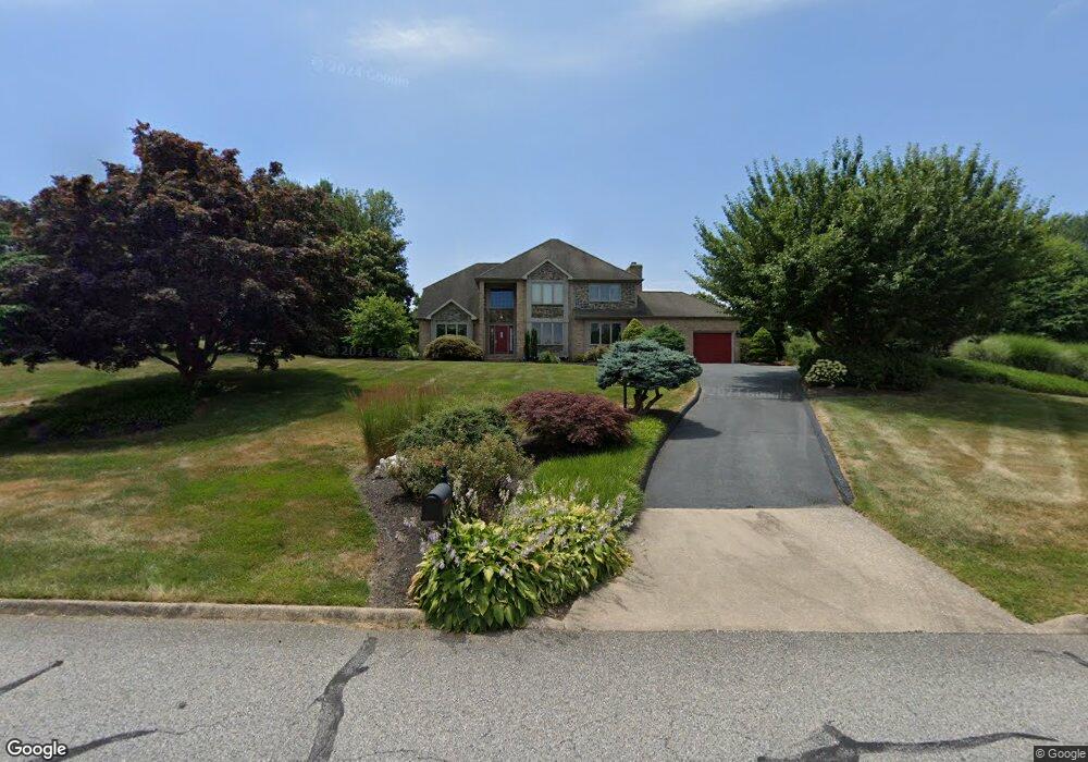
713 Pheasant Dr Forest Hill, MD 21050
Estimated Value: $691,053 - $837,000
Studio
3
Baths
2,974
Sq Ft
$261/Sq Ft
Est. Value
About This Home
This home is located at 713 Pheasant Dr, Forest Hill, MD 21050 and is currently estimated at $774,763, approximately $260 per square foot. 713 Pheasant Dr is a home located in Harford County with nearby schools including Forest Hill Elementary School, North Harford Middle School, and North Harford High School.
Ownership History
Date
Name
Owned For
Owner Type
Purchase Details
Closed on
Aug 1, 2008
Sold by
Childress Robin Alonzo
Bought by
Robel Danny W and Rubicz Patricia L
Current Estimated Value
Home Financials for this Owner
Home Financials are based on the most recent Mortgage that was taken out on this home.
Original Mortgage
$545,664
Outstanding Balance
$354,599
Interest Rate
6.13%
Mortgage Type
Purchase Money Mortgage
Estimated Equity
$420,164
Purchase Details
Closed on
Jun 3, 1991
Sold by
Diversified Homes Master
Bought by
Childress Robin Alonzo
Purchase Details
Closed on
Jan 10, 1989
Sold by
Meadowlark Corporation
Bought by
Diversified Homes Master
Create a Home Valuation Report for This Property
The Home Valuation Report is an in-depth analysis detailing your home's value as well as a comparison with similar homes in the area
Purchase History
| Date | Buyer | Sale Price | Title Company |
|---|---|---|---|
| Robel Danny W | $550,000 | -- | |
| Childress Robin Alonzo | $63,000 | -- | |
| Diversified Homes Master | $70,000 | -- |
Source: Public Records
Mortgage History
| Date | Status | Borrower | Loan Amount |
|---|---|---|---|
| Open | Robel Danny W | $545,664 |
Source: Public Records
Tax History
| Year | Tax Paid | Tax Assessment Tax Assessment Total Assessment is a certain percentage of the fair market value that is determined by local assessors to be the total taxable value of land and additions on the property. | Land | Improvement |
|---|---|---|---|---|
| 2025 | $5,461 | $531,900 | $135,200 | $396,700 |
| 2024 | $5,461 | $504,133 | $0 | $0 |
| 2023 | $5,200 | $476,367 | $0 | $0 |
| 2022 | $4,949 | $448,600 | $135,200 | $313,400 |
| 2021 | $4,926 | $435,133 | $0 | $0 |
| 2020 | $4,926 | $421,667 | $0 | $0 |
| 2019 | $4,771 | $408,200 | $140,200 | $268,000 |
| 2018 | $4,603 | $397,267 | $0 | $0 |
| 2017 | $4,478 | $408,200 | $0 | $0 |
| 2016 | -- | $375,400 | $0 | $0 |
| 2015 | $4,702 | $375,400 | $0 | $0 |
| 2014 | $4,702 | $375,400 | $0 | $0 |
Source: Public Records
Map
Nearby Homes
- 2948 Grier Nursery Rd
- 520 Walters Mill Rd
- 106 Bower Ln
- 209 Christopher Rd
- 2433 Maxa Meadows Ln
- 2804 Rocks Rd
- 2419 Edwards Manor Dr
- 2605 Ady Rd
- 2322 Rock Spring Rd
- 332 Ponfield Rd E
- 2229-A Ady Rd
- 407 Shellbark Ct
- 408 Cherry Hill Rd
- 1986 Esther Ct
- 2033 Mardic Dr
- 2027 Mardic Dr
- 305 Esther Dr
- 310 Willrich Cir
- 313 Willrich Cir Unit E
- 311 Willrich Cir Unit G
- 711 Pheasant Dr
- 715 Pheasant Dr
- 710 Pheasant Dr
- 720 Pheasant Dr
- 708 Pheasant Dr
- 707 Pheasant Dr
- 709 Pheasant Dr
- 717 Pheasant Dr
- 722 Pheasant Dr
- 706 Pheasant Dr
- 721 Pheasant Dr
- 719 Pheasant Dr
- 704 Pheasant Dr
- 718 Pheasant Dr
- 716 Pheasant Dr
- 724 Pheasant Dr
- 712 Pheasant Dr
- 702 Pheasant Dr
- 714 Pheasant Dr
- 332 Chestnut Hill Rd
Your Personal Tour Guide
Ask me questions while you tour the home.