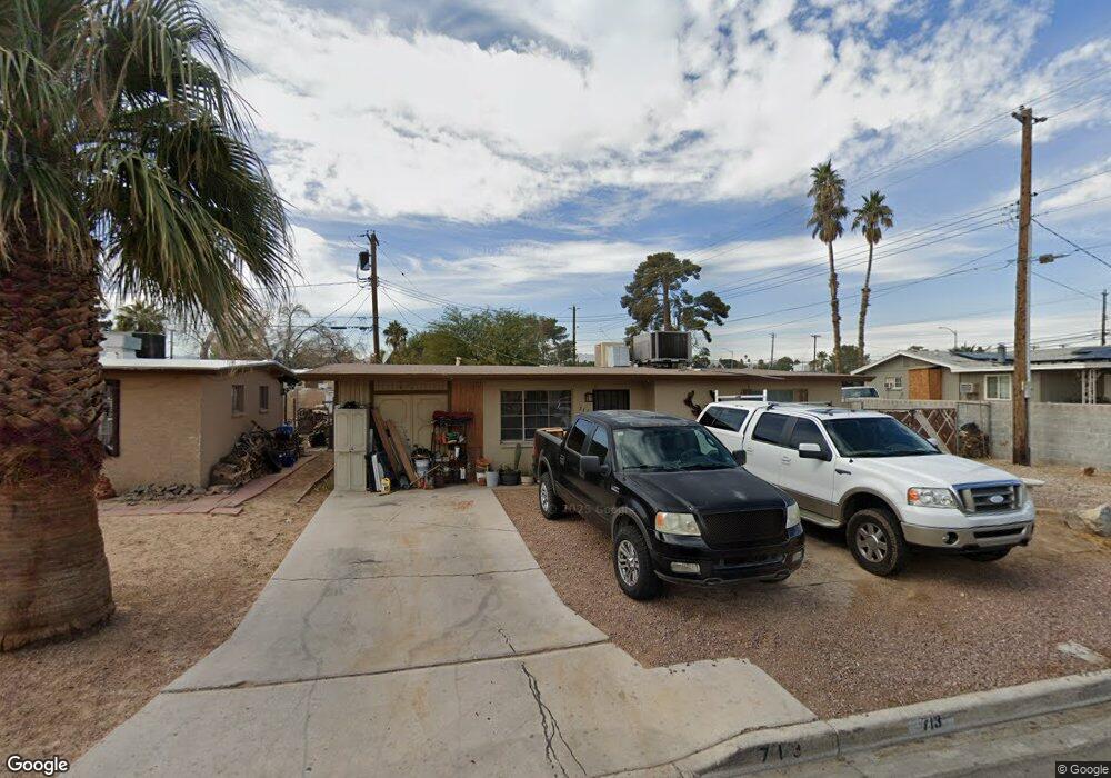
713 Stanford St Las Vegas, NV 89107
Michael Way NeighborhoodEstimated Value: $234,000 - $280,000
2
Beds
1
Bath
718
Sq Ft
$357/Sq Ft
Est. Value
About This Home
This home is located at 713 Stanford St, Las Vegas, NV 89107 and is currently estimated at $256,199, approximately $356 per square foot. 713 Stanford St is a home located in Clark County with nearby schools including J.T. McWlliams Elementary School, Robert O Gibson Middle School, and Western High School.
Ownership History
Date
Name
Owned For
Owner Type
Purchase Details
Closed on
Sep 17, 1998
Sold by
Buettner John A
Bought by
Alley Michael and Alley Janet
Current Estimated Value
Home Financials for this Owner
Home Financials are based on the most recent Mortgage that was taken out on this home.
Original Mortgage
$63,050
Outstanding Balance
$13,445
Interest Rate
6.88%
Estimated Equity
$242,754
Create a Home Valuation Report for This Property
The Home Valuation Report is an in-depth analysis detailing your home's value as well as a comparison with similar homes in the area
Home Values in the Area
Average Home Value in this Area
Purchase History
| Date | Buyer | Sale Price | Title Company |
|---|---|---|---|
| Alley Michael | $66,000 | Fidelity National Title |
Source: Public Records
Mortgage History
| Date | Status | Borrower | Loan Amount |
|---|---|---|---|
| Open | Alley Michael | $63,050 |
Source: Public Records
Tax History Compared to Growth
Tax History
| Year | Tax Paid | Tax Assessment Tax Assessment Total Assessment is a certain percentage of the fair market value that is determined by local assessors to be the total taxable value of land and additions on the property. | Land | Improvement |
|---|---|---|---|---|
| 2025 | $597 | $36,463 | $25,200 | $11,263 |
| 2024 | $554 | $36,463 | $25,200 | $11,263 |
| 2023 | $554 | $36,050 | $25,900 | $10,150 |
| 2022 | $513 | $30,113 | $21,000 | $9,113 |
| 2021 | $475 | $26,660 | $18,200 | $8,460 |
| 2020 | $438 | $23,280 | $15,050 | $8,230 |
| 2019 | $411 | $22,989 | $15,050 | $7,939 |
| 2018 | $392 | $17,966 | $10,500 | $7,466 |
| 2017 | $564 | $17,196 | $9,800 | $7,396 |
| 2016 | $369 | $14,172 | $7,000 | $7,172 |
| 2015 | $366 | $12,209 | $5,250 | $6,959 |
| 2014 | $356 | $10,617 | $3,780 | $6,837 |
Source: Public Records
Map
Nearby Homes
- 604 N Minnesota St
- 5004 Cannon Blvd
- 704 McDermit St
- 504 N Minnesota St
- 609 Harvard St
- 424 Stanford St
- 605 N Yale St
- 601 Huntington St
- 324 Princeton St
- 304 N Minnesota St
- 1124 Nassau Dr Unit 4
- 5305 Sugarfoot Ave
- 5400 Maddox Ave
- 116 Princeton St
- 5420 Moonstruck Ave
- 104 Stanford St
- 600 Woodmount Dr
- 5612 Pearldrop Ave
- 5128 Forrest Hills Ln
- 5705 Pearldrop Ave
- 709 Stanford St
- 5001 W Washington Ave
- 712 N Minnesota St
- 705 Stanford St
- 708 N Minnesota St
- 712 Stanford St
- 5025 W Washington Ave
- 704 N Minnesota St
- 708 Stanford St
- 701 Stanford St
- 4953 W Washington Ave
- 621 Stanford St
- 700 Stanford St
- 4937 W Washington Ave
- 4937 W Washington Ave
- 620 N Minnesota St
- 5101 W Washington Ave
- 713 Princeton St
- 709 Princeton St
- 620 Stanford St