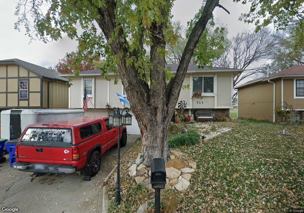
713 Trant St Kansas City, KS 66111
Estimated Value: $238,000 - $249,000
3
Beds
2
Baths
1,024
Sq Ft
$236/Sq Ft
Est. Value
About This Home
This home is located at 713 Trant St, Kansas City, KS 66111 and is currently estimated at $242,098, approximately $236 per square foot. 713 Trant St is a home located in Wyandotte County with nearby schools including Robert E Clark Middle School and Bonner Springs High School.
Ownership History
Date
Name
Owned For
Owner Type
Purchase Details
Closed on
May 23, 2003
Sold by
Miller Gerry R and Miller Maureen E
Bought by
Fasani Luis G
Current Estimated Value
Home Financials for this Owner
Home Financials are based on the most recent Mortgage that was taken out on this home.
Original Mortgage
$90,286
Outstanding Balance
$39,240
Interest Rate
5.79%
Mortgage Type
FHA
Estimated Equity
$202,858
Create a Home Valuation Report for This Property
The Home Valuation Report is an in-depth analysis detailing your home's value as well as a comparison with similar homes in the area
Home Values in the Area
Average Home Value in this Area
Purchase History
| Date | Buyer | Sale Price | Title Company |
|---|---|---|---|
| Fasani Luis G | -- | Guarantee Title Of Wyandotte |
Source: Public Records
Mortgage History
| Date | Status | Borrower | Loan Amount |
|---|---|---|---|
| Open | Fasani Luis G | $90,286 |
Source: Public Records
Tax History Compared to Growth
Tax History
| Year | Tax Paid | Tax Assessment Tax Assessment Total Assessment is a certain percentage of the fair market value that is determined by local assessors to be the total taxable value of land and additions on the property. | Land | Improvement |
|---|---|---|---|---|
| 2024 | $3,539 | $23,691 | $4,106 | $19,585 |
| 2023 | $3,507 | $21,862 | $3,317 | $18,545 |
| 2022 | $3,019 | $18,722 | $3,075 | $15,647 |
| 2021 | $2,729 | $15,966 | $2,847 | $13,119 |
| 2020 | $2,594 | $14,784 | $2,723 | $12,061 |
| 2019 | $2,526 | $14,080 | $2,723 | $11,357 |
| 2018 | $2,907 | $13,670 | $2,322 | $11,348 |
| 2017 | $2,640 | $13,145 | $2,322 | $10,823 |
| 2016 | $2,589 | $13,231 | $2,322 | $10,909 |
| 2015 | $2,650 | $13,231 | $2,322 | $10,909 |
| 2014 | $2,312 | $12,971 | $2,322 | $10,649 |
Source: Public Records
Map
Nearby Homes
- 738 S 9th St
- 507 Newton St
- 240 White St Unit LOT 240
- 603 Newton St
- 507 High St
- 781 Highland Dr
- 824 Highland Dr
- 828 Highland Dr
- 789 Highland Dr
- 800 Highland Dr
- 20823 W 45th Terrace
- 4531 Woodstock St
- 1803 S 98th St
- 10506 Shelton Ave
- 1630 S 105th Terrace
- 1548 S 105th Ct
- 98th Metropolitan Ave
- 9687 Metropolitan Ave
- 21222 W 48th St
- 4817 Marion St