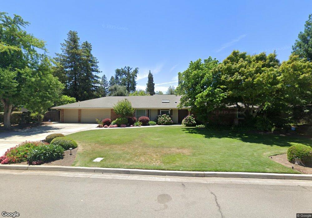
713 W San Madele Ave Fresno, CA 93704
Bullard NeighborhoodEstimated Value: $622,000 - $724,862
4
Beds
4
Baths
3,095
Sq Ft
$215/Sq Ft
Est. Value
About This Home
This home is located at 713 W San Madele Ave, Fresno, CA 93704 and is currently estimated at $664,466, approximately $214 per square foot. 713 W San Madele Ave is a home located in Fresno County with nearby schools including Kratt Elementary School, Tenaya Middle School, and Bullard High School.
Ownership History
Date
Name
Owned For
Owner Type
Purchase Details
Closed on
Apr 29, 2009
Sold by
Demera Howard J
Bought by
The Desmond Family Real Estate Limited P
Current Estimated Value
Purchase Details
Closed on
Jan 31, 2006
Sold by
The Desmond Family Real Estate Lp and Desmond Joseph F
Bought by
Desmond Joseph F and Desmond Family Living Trust
Purchase Details
Closed on
Aug 18, 1995
Sold by
Mccaffrey Development
Bought by
Mccaffrey Development Lp
Purchase Details
Closed on
Aug 14, 1995
Sold by
Mccaffrey Development Lp
Bought by
Beal Properties Inc
Create a Home Valuation Report for This Property
The Home Valuation Report is an in-depth analysis detailing your home's value as well as a comparison with similar homes in the area
Home Values in the Area
Average Home Value in this Area
Purchase History
| Date | Buyer | Sale Price | Title Company |
|---|---|---|---|
| The Desmond Family Real Estate Limited P | $911,000 | None Available | |
| Desmond Joseph F | -- | None Available | |
| Mccaffrey Development Lp | -- | Chicago Title Co | |
| Beal Properties Inc | $500,000 | Chicago Title Co |
Source: Public Records
Tax History Compared to Growth
Tax History
| Year | Tax Paid | Tax Assessment Tax Assessment Total Assessment is a certain percentage of the fair market value that is determined by local assessors to be the total taxable value of land and additions on the property. | Land | Improvement |
|---|---|---|---|---|
| 2025 | $5,574 | $458,426 | $64,380 | $394,046 |
| 2023 | $5,467 | $440,627 | $61,881 | $378,746 |
| 2022 | $5,393 | $431,988 | $60,668 | $371,320 |
| 2021 | $5,244 | $423,519 | $59,479 | $364,040 |
| 2020 | $5,222 | $419,178 | $58,870 | $360,308 |
| 2019 | $5,018 | $410,960 | $57,716 | $353,244 |
| 2018 | $4,908 | $402,903 | $56,585 | $346,318 |
| 2017 | $4,823 | $394,900 | $55,400 | $339,500 |
| 2016 | $4,599 | $381,936 | $53,605 | $328,331 |
| 2015 | $4,528 | $376,200 | $52,800 | $323,400 |
| 2014 | $4,245 | $352,400 | $49,500 | $302,900 |
Source: Public Records
Map
Nearby Homes
- 548 W San Jose Ave
- 5180 N Wishon Ave Unit 201
- 5180 N Wishon Ave Unit 103
- 1159 W San Madele Ave
- 520 W Barstow Ave
- 5090 N Roosevelt Ave Unit 11
- 715 W Browning Ave
- 5076 N Wishon Ave Unit A
- 5048 N Wishon Ave Unit E
- 5370 N Maroa Ave
- 5672 N Ferger Ave
- 696 W Celeste Ave
- 5082 N Maroa Ave
- 4915 N Wishon Ct
- 5386 N Fruit Ave
- 5075 N College Ave
- 4843 N Palm Ave
- 116 E Alamos Ave
- 4834 N Wishon Ave
- 4822 N Safford Ave
- 697 W San Madele Ave
- 729 W San Madele Ave
- 714 W San Ramon Ave
- 698 W San Ramon Ave
- 730 W San Ramon Ave
- 710 W San Madele Ave
- 726 W San Madele Ave
- 681 W San Madele Ave
- 684 W San Ramon Ave
- 747 W San Madele Ave
- 694 W San Madele Ave
- 740 W San Madele Ave
- 748 W San Ramon Ave
- 5319 N Roosevelt Ave
- 678 W San Madele Ave
- 713 W Barstow Ave
- 5331 N Roosevelt Ave
- 761 W San Madele Ave
- 756 W San Madele Ave
- 735 W Barstow Ave