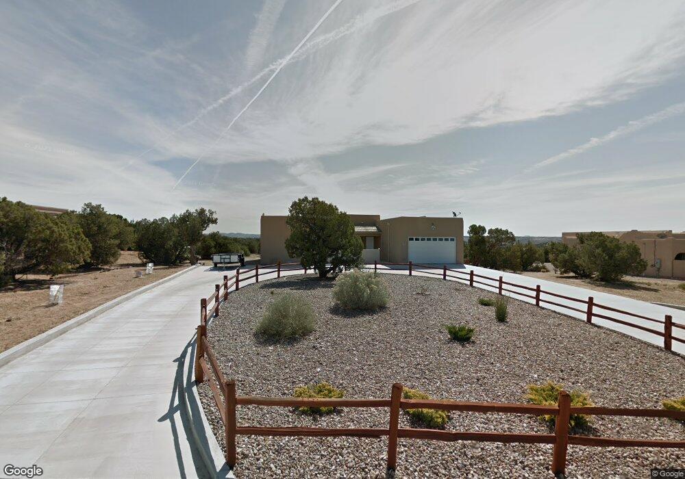
7130 Dellwood Ct Farmington, NM 87402
Estimated Value: $523,000 - $614,000
--
Bed
--
Bath
2,617
Sq Ft
$210/Sq Ft
Est. Value
About This Home
This home is located at 7130 Dellwood Ct, Farmington, NM 87402 and is currently estimated at $549,735, approximately $210 per square foot. 7130 Dellwood Ct is a home located in San Juan County with nearby schools including Country Club Elementary School, Heights Middle School, and Piedra Vista High School.
Ownership History
Date
Name
Owned For
Owner Type
Purchase Details
Closed on
Jul 2, 2009
Sold by
Frie Scott and Frie Judy
Bought by
Frie Scott A and Frie Judy A
Current Estimated Value
Purchase Details
Closed on
Apr 29, 2009
Sold by
High Point Development Inc
Bought by
Frie Scott and Frie Judy
Home Financials for this Owner
Home Financials are based on the most recent Mortgage that was taken out on this home.
Original Mortgage
$320,000
Outstanding Balance
$204,135
Interest Rate
5.03%
Mortgage Type
New Conventional
Estimated Equity
$345,600
Create a Home Valuation Report for This Property
The Home Valuation Report is an in-depth analysis detailing your home's value as well as a comparison with similar homes in the area
Home Values in the Area
Average Home Value in this Area
Purchase History
| Date | Buyer | Sale Price | Title Company |
|---|---|---|---|
| Frie Scott A | -- | None Available | |
| Frie Scott | -- | None Available |
Source: Public Records
Mortgage History
| Date | Status | Borrower | Loan Amount |
|---|---|---|---|
| Open | Frie Scott | $320,000 |
Source: Public Records
Tax History Compared to Growth
Tax History
| Year | Tax Paid | Tax Assessment Tax Assessment Total Assessment is a certain percentage of the fair market value that is determined by local assessors to be the total taxable value of land and additions on the property. | Land | Improvement |
|---|---|---|---|---|
| 2024 | $2,906 | $121,616 | $0 | $0 |
| 2023 | $2,844 | $118,074 | $0 | $0 |
| 2022 | $2,708 | $114,634 | $0 | $0 |
| 2021 | $2,607 | $111,296 | $0 | $0 |
| 2020 | $2,522 | $108,055 | $0 | $0 |
| 2019 | $2,435 | $104,907 | $0 | $0 |
| 2018 | $2,322 | $98,886 | $0 | $0 |
| 2017 | $2,222 | $95,115 | $0 | $0 |
| 2016 | $2,126 | $95,115 | $0 | $0 |
| 2015 | $2,091 | $95,115 | $0 | $0 |
| 2014 | $2,089 | $95,931 | $0 | $0 |
Source: Public Records
Map
Nearby Homes
- 7121 Dellwood Ct
- LOT 11 Silver Maple Ct
- LOT 13 Silver Maple Ct
- LOT 15 Silver Maple Ct
- 6735 Sandrock Ct
- 6730 Sandrock Ct
- 6726 Sandrock Ct
- 6734 Sandrock Ct
- 6731 Sandrock Ct
- 6722 Sandrock Ct
- 6727 Sandrock Ct
- 6723 Sandrock Ct
- 6718 Sandrock Ct
- 6715 Sandrock Ct
- 6711 Sandrock Ct
- 6707 Sandrock Ct
- 6719 Sandrock Ct
- 6250 Jack Rabbit Jct
- 7680 Tuscany Way
- 6600 Big Cedar Rd
- 7120 Dellwood Ct
- 7140 Dellwood Ct
- 7131 Dellwood Ct
- 7110 Dellwood Ct
- 7150 Dellwood Ct
- 7141 Dellwood Ct
- 7111 Dellwood Ct
- 7100 Dellwood Ct
- 7105 Dellwood Ct
- 7215 Dellwood Ct
- 7200 N Driftwood Ave
- 7130 Driftwood Dr
- 7120 Driftwood Dr
- 7222 Dellwood Ct
- 7210 Dellwood Ct
- 7110 Driftwood Dr
- 7110 N Driftwood Ave
- 7210 Driftwood Dr
- 6525 Lakewood Dr
- 7100 Driftwood Dr