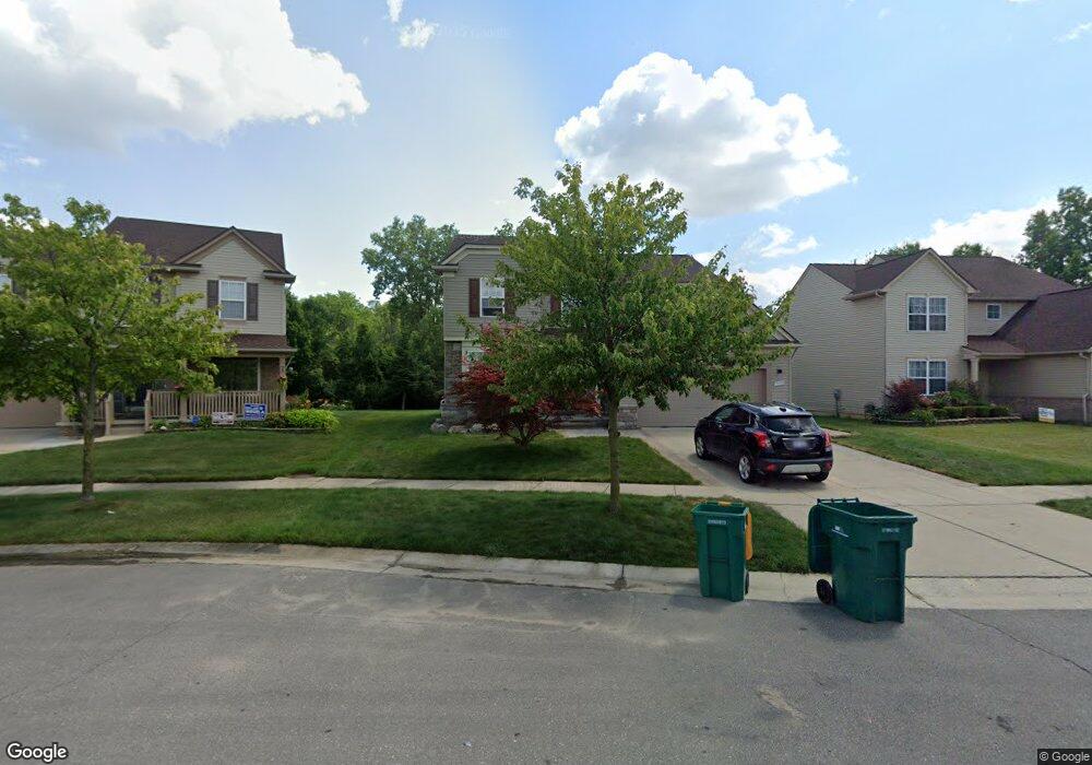
7135 Coral Dr Unit 19 Romulus, MI 48174
Estimated Value: $349,000 - $462,000
4
Beds
3
Baths
2,200
Sq Ft
$175/Sq Ft
Est. Value
About This Home
This home is located at 7135 Coral Dr Unit 19, Romulus, MI 48174 and is currently estimated at $385,406, approximately $175 per square foot. 7135 Coral Dr Unit 19 is a home located in Wayne County with nearby schools including Lodge Grass Elementary School, Romulus Elementary School, and Romulus Middle School.
Ownership History
Date
Name
Owned For
Owner Type
Purchase Details
Closed on
Feb 5, 2010
Sold by
Glenn Kevin L and Glenn Asha
Bought by
Buckley Elizabeth A
Current Estimated Value
Home Financials for this Owner
Home Financials are based on the most recent Mortgage that was taken out on this home.
Original Mortgage
$106,236
Interest Rate
3.58%
Mortgage Type
FHA
Purchase Details
Closed on
Mar 28, 2007
Sold by
E Rom Partners Llc
Bought by
Glenn Kevin L
Create a Home Valuation Report for This Property
The Home Valuation Report is an in-depth analysis detailing your home's value as well as a comparison with similar homes in the area
Home Values in the Area
Average Home Value in this Area
Purchase History
| Date | Buyer | Sale Price | Title Company |
|---|---|---|---|
| Buckley Elizabeth A | $109,000 | None Available | |
| Glenn Kevin L | $61,000 | Metropolitan Title Company |
Source: Public Records
Mortgage History
| Date | Status | Borrower | Loan Amount |
|---|---|---|---|
| Previous Owner | Buckley Elizabeth A | $106,236 |
Source: Public Records
Tax History Compared to Growth
Tax History
| Year | Tax Paid | Tax Assessment Tax Assessment Total Assessment is a certain percentage of the fair market value that is determined by local assessors to be the total taxable value of land and additions on the property. | Land | Improvement |
|---|---|---|---|---|
| 2025 | $2,742 | $166,600 | $0 | $0 |
| 2024 | $2,742 | $152,400 | $0 | $0 |
| 2023 | $2,629 | $146,500 | $0 | $0 |
| 2022 | $3,119 | $131,200 | $0 | $0 |
| 2021 | $3,019 | $110,300 | $0 | $0 |
| 2020 | $2,960 | $98,400 | $0 | $0 |
| 2019 | $2,807 | $86,000 | $0 | $0 |
| 2018 | $1,837 | $76,300 | $0 | $0 |
| 2017 | $1,383 | $75,500 | $0 | $0 |
| 2016 | $2,437 | $73,300 | $0 | $0 |
| 2015 | $4,785 | $51,700 | $0 | $0 |
| 2013 | $5,240 | $57,400 | $0 | $0 |
| 2012 | $1,571 | $55,300 | $3,600 | $51,700 |
Source: Public Records
Map
Nearby Homes
- 7063 Sargent St
- 35344 Ecorse Rd
- 0000 Park Place
- Lot 215 2nd St
- Lot 214 2nd St
- 6358 Dexter St
- 0 Hazel Ct
- 6291 Edmund St
- Lot 227 Dexter St
- 35431 Beverly Rd
- 7300 Canterbury Dr
- 000 Waynecorse
- 35901 Abbey Ct
- 35511 Beverly Rd
- 6029 Edmund St
- 000 Cincinnati St
- 35841 Vinewood St
- 9358 Karen St
- 9274 Chamberlain St
- 5932 Colorado St
- 7147 Coral Crt
- 7123 Coral Dr Unit 18
- 33212 Sienna Dr Unit 17
- 7136 Coral Dr Unit 61
- 7183 Coral Dr
- 7171 Coral Dr
- 7159 Coral Dr
- 7147 Coral Dr
- 7148 Coral Dr Unit 60
- 7160 Coral Dr Unit 59
- 7172 Coral Dr Unit 58
- 33995 Ecorse Rd
- 7184 Coral Dr Unit 57
- 7195 Coral Dr Unit Bldg-Unit
- 7195 Coral Dr Unit 24
- 3332 Tall Oak Lane Sienna Dr
- 7207 Coral Dr Unit 25
- 7196 Coral Dr Unit 56
- 7220 Coral Dr Unit 54
- 7208 Coral Dr Unit 55